We supply a selection of industry-leading scanners and software to industry professionals to create the most realistic digital environment for the most accurate planning. Focussing on energy efficient and safe construction, Leica Geosystems reality capture laser scanners and mobile mapping solutions.
The Leica BLK360 captures the world around you with full-colour panoramic images overlaid on a high-accuracy point cloud. Simple to use with just the single push of one button, the BLK360 is the smallest and lightest in the world.
The Leica RTC360 is a new ultra-fast medium-sized 3D laser scanner designed to quickly capture rich data while simplifying both in field and in office workflows. It captures scans, and High-Dynamic Range (HDR) imagery in less than two minutes while simultaneously recording the scanner’s movement from station to station to pre-register scans without manual intervention. Combined with Cyclone FIELD 360 software for automated registration in the field, the Leica RTC360 reality capture scanner offers outstanding precision that can be checked on-site.

  • Leica BLK360 Imaging Laser Scanner

    The smallest and lightest imaging laser scanner available

    The Leica BLK360 captures the world around you with full-colour panoramic images overlaid on a high-accuracy point cloud. Simple to use with just the single push of one button, the BLK360 is the smallest and lightest of its kind. Anyone who can operate an iPad can now capture the world around them with high resolution 3D panoramic images. Using the ReCap Pro mobile app, the BLK360 streams image and point cloud data to iPad. The app filters and registers scan data in real time. After capture, ReCap Pro enables point cloud data transfer to a number of CAD, BIM, VR and AR applications. The integration of BLK360 and Autodesk software dramatically streamlines the reality capture process thereby opening this technology to non-surveying individuals. Package includes:
    • Leica BLK360 Imaging Laser Scanner
    • GEB212 Lithium-Ion Battery for the BLK360
    • GKL311 Battery Charger
    • AC/DC adaptor
    • BLK360 Tripod
    • BLK360 Mission bag
  • Leica CloudWorx Ultimate

    One simple licence for all your favourite CAD systems

    Leica CloudWorx Ultimate delivers all the speed, scale and simplifying benefits of CloudWorx for all your favourite CAD systems with a single, simple license. Now you can access the power of CloudWorx for AutoCAD, MultiWorx for AutoCAD, CloudWorx for MicroStation, CloudWorx for PDMS, CloudWorx for Revit and CloudWorx for Navisworks to bring increased speed and efficiency to your multi-platform workflows. Speed Bring increased speed and efficiency to your multi-platform workflows and reach end deliverables faster. No longer waste time moving between file formats or worrying about the number of licenses for each of your CAD services—easily work between platforms, producing drawings and models, performing design verification, or conducting design with the same digital reality content. And gain the benefit of higher point cloud performance when combined with Leica JetStream Scale Unlimited in every sense. Handle projects and point clouds of any size, across all supported CAD systems to create deliverables more simply and deliver projects more efficiently to clients and stakeholders—all with a single, ultimate license. Simplicity No special installation required. CloudWorx Ultimate works with all your existing CloudWorx plug-ins to allow you to work with large data sets from Cyclone and JetStream point cloud sources to eliminate tedious export/import transfers. Easily communicate your results globally with translated software available in localised solutions.
  • Leica Cyclone Cloud

    Digital reality SaaS platform

    Leica Cyclone Cloud is an all-new, centralised, online administration portal for Leica Geosystems’ new cloud-based software services. These services are designed to bring speed, scale and simplicity to the digital reality capture market. Simply login to connect the field to the office or clients and stakeholders. Easily scale up your services by adding on packages to meet customer and project needs, all this with the simple use of a smart phone, tablet, or your desktop browser New subscription models offer the same enterprise-level solutions now with a Leica Geosystems-hosted and trusted environment with global access to enable users to collaborate intuitively and efficiently.
  • Leica Cyclone FIELD 360

    VIEW

    As part of the Leica Geosystems Reality Capture 360 solution, the high- performance Leica Cyclone FIELD 360 mobile-device app is the perfect field companion for the Leica RTC360 3D laser scanner. With its intuitive user interface, remote scanner control and on-site point cloud display, navigation is a breeze - even for novice users – with full imagery and point cloud data delivered directly to your tablet using edge computing technology.

    CHECK

    Direct data access and visualisation are the foundation for quality control in the field; with Cyclone FIELD 360, automatically pre-registered point cloud data enables users to quickly conduct on-site quality control checks, improves productivity and makes for better- informed decisions in the field.

    ADD

    For improved registration in Leica Cyclone REGISTER 360 post-processing, and to add extra value and information to 3D data, Cyclone FIELD 360 enables on-site tagging of measurements, videos, images, text or voice files to the point cloud geometry simply by using your tablet.  
  • Leica Cyclone REGISTER 360

    The power of Cyclone, simplified

    Leica Cyclone REGISTER 360 is the latest upgrade to the number one 3D laser scanning point cloud registration software, Cyclone REGISTER. This all-new product built from the ground-up brings with it all-new capabilities from simple, guided workflows to automated registration and client-ready deliverables with the click of a button. REGISTER 360 empowers users of any skill-level to work smarter, deliver results more accurately, visualise in more detail and collaborate more effectively—placing the user at the centre of their projects. Whether deployed as a stand-alone solution or as part of an end-to-end integrated laser scanning solution, Cyclone REGISTER 360 is your fastest and easiest option to get the job done right, the first time.
  • Leica RTC360 Laser Scanner

    Fast, agile and precise 3D reality capture solution

    FAST

    The Leica RTC360 laser scanner makes 3D reality capture faster than ever before. With a measuring rate of up to 2 million points per second and advanced HDR imaging system, the creation of colored 3D point clouds can be completed in under 2 minutes. Plus, automated targetless field registration (based on VIS technology) and the seamless, automated transfer of data from site to office reduce time spent in the field and further maximize productivity.

    Agile

    Small and lightweight, the Leica RTC360 scanner’s portable design and collapsible tripod mean it’s compact enough to fit into most backpacks, ready to be taken anywhere. Once on-site, easy-to-use one-button operation makes for fast, hassle-free scanning.

    Precise

    Low noise data allows for better images, resulting in crisp, high-quality scans that are rich in detail and ready for use in a range of applications. Combined with Cyclone FIELD 360 software for automated registration in the field, the Leica RTC360 scanner offers outstanding precision that can be checked on-site.
  • Leica ScanStation P30

    Accomplished scanning

    The Leica ScanStation P30 is a highly adaptable scanner appropriate for a range of classic scanning solutions. Its combination of range, speed and accuracy paired with matchless sturdiness it is the comprehensive solution for a broad range of applications. The correct choice Whether acquiring 3D geometry of civil infrastructure, generating an as-built illustration of an industry development or producing 3D data for Building Information Modelling (BIM), you will need a true long range scanning instrument for projects. The Leica ScanStation P30 and P40 laser scanners are the best choice. Extreme performance in tough environments The Leica P30 and P40 bring the highest quality HDR imaging and 3D data at a scan rate of 1 mio points p/second at distances of up to 270 meters. Supreme angular accuracy and range combined with survey-grade dual-axis compensation and low range noise form the basis for highly comprehensive 3D point clouds (colour) mapped in lifelike clarity. Decreased downtime The robust ScanStations function under the harsh working conditions, such as intense temperatures varying from – 20°C to + 50°C and conform to the IP54 rating for water and dust resistance. Comprehensive scanning solutions Leica ScanStation portfolio from Leica Geosystems comes as an integrated piece of a comprehensive scanning solution. Data can be processed in the foremost 3D point cloud software suite, consisting of Leica Cyclone, Leica CloudWorx and the free Leica TruView.
  • Leica ScanStation P40

    Accomplished scanning

    The ScanStation P40 offers uppermost adaptability including extended range abilities. Delivering exceptional speed, range and data quality wherever and wherever required. It is the ultimate solution for any 3D laser scanning task. The correct choice Whether acquiring 3D geometry of civil infrastructure, generating an as-built illustration of an industry development or producing 3D data for Building Information Modelling (BIM), you will need a true long range scanning instrument for projects. The Leica ScanStation P30 and P40 laser scanners are the best choice. Extreme performance in tough environments The Leica P30 and P40 bring the highest quality HDR imaging and 3D data at a scan rate of 1 mio points p/second at distances of up to 270 meters. Supreme angular accuracy and range combined with survey-grade dual-axis compensation and low range noise form the basis for highly comprehensive 3D point clouds (colour) mapped in lifelike clarity. Decreased downtime The robust ScanStations function under the harsh working conditions, such as intense temperatures varying from – 20°C to + 50°C and conform to the IP54 rating for water and dust resistance. Comprehensive scanning solutions Leica ScanStation portfolio from Leica Geosystems comes as an integrated piece of a comprehensive scanning solution. Data can be processed in the foremost 3D point cloud software suite, consisting of Leica Cyclone, Leica CloudWorx and the free Leica TruView.
  • Leica ScanStation P50

    Maximise productivity by scanning inaccessible places at a safe position on site, reducing time in the field with less setups.

    Every detail matters 
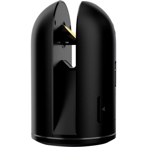
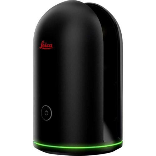
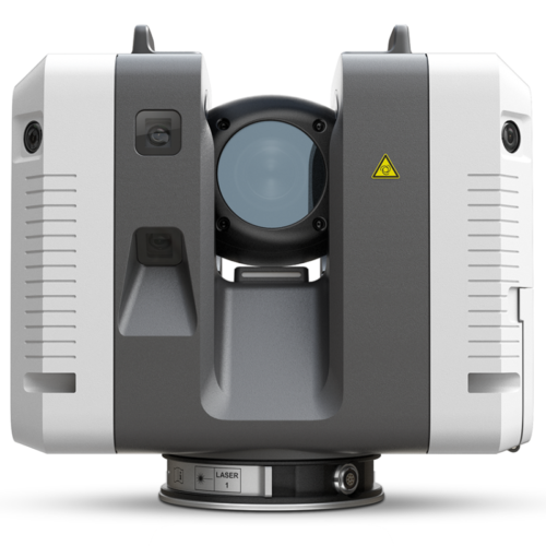
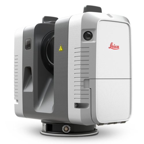
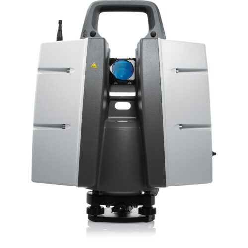
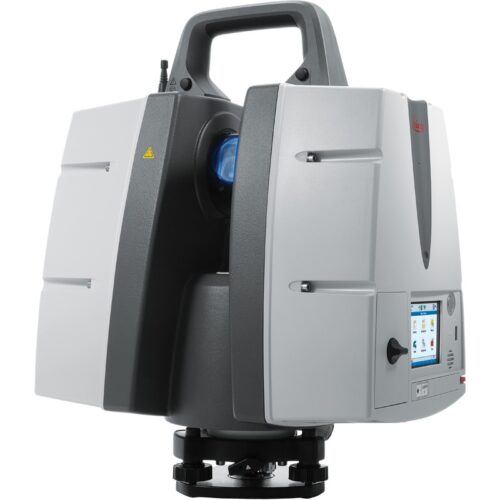
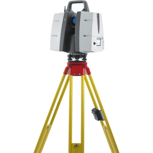
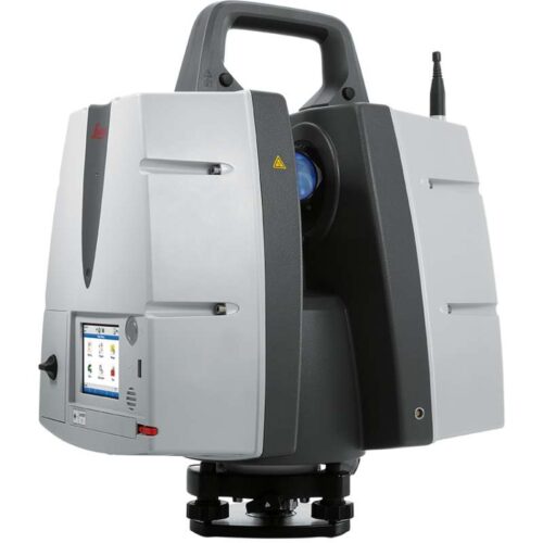
For professionals looking to scan inaccessible locations, the Leica ScanStation P50 is the most rapid and safest, long-range 3D laser scanner. Unlike other laser scanners, the P50 solution exploits productivity by scanning difficult to reach places in a safe position on site, saving time with fewer setups. Scan inaccessible locations The Leica ScanStation P50 delivers maximum quality HDR imaging and 3D data at an exceptionally fast scan rate of up to 1 mio points per second and ranges of more than 1 km. Unmatched distance and angular precision combined with survey-grade dual-axis compensation and low range noise form the basis for well detailed 3D colour point clouds mapped in clarity. Great performance in severe conditions The very durable ScanStation P50 delivers even under the harshest environmental conditions, such as temperatures ranging from -20°C to + 50°C and conforms to the IP54 rating for water and dust resistance. Complete scanning solution 
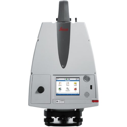
The new P50 ScanStation is provided as part of a comprehensive scanning solution including hardware, software, training, service and support. 3D laser scan data can be processed in the leading 3D point cloud software suite, which consists of Leica Cyclone, Leica CloudWorx, Leica JetStream and the cost-free Leica TruView.
    • Highest quality 3D data and HDR imaging
    • Extremely high-speed scan rate of 1 mio points per second
    • Ranges of up to 1 kilometre
    • Low range noise
    • Survey-grade dual-axis compensation
  • Leica TruView Cloud

    Digital reality data anywhere, anytime, any device

    TruView is the industry leader for easily and intuitively sharing point cloud data, design models, mark-ups and more. TruView Cloud is available via Leica Geosystems’ Cyclone Cloud portal for cloud-based software services. TruView Cloud removes the hurdles of deploying a TruView server solution on a local server or external cloud service. Instead, access the same enterprise-level project collaboration solution in a Leica Geosystems-trusted and managed cloud environment. Bring unparalleled speed, scale and simplicity to your TruView workflows. TruView Cloud is the perfect software to view, measure and annotate your digital reality data and it is now available anywhere, anytime and on any device. The intuitiveness of TruView has been married with an equally intuitive way to access your data. Simply log in to your Cyclone Cloud account, deploy the product and start sharing immediately. With excellent dependability and advanced admin and user controls, never worry about who has, or does not have access to your data.

Title

Go to Top