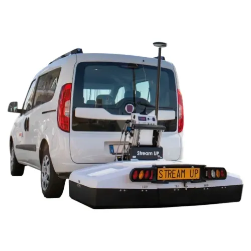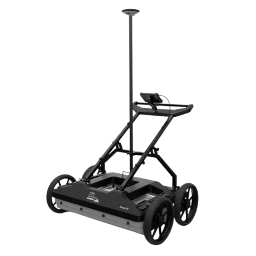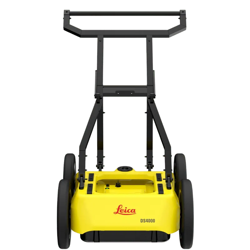
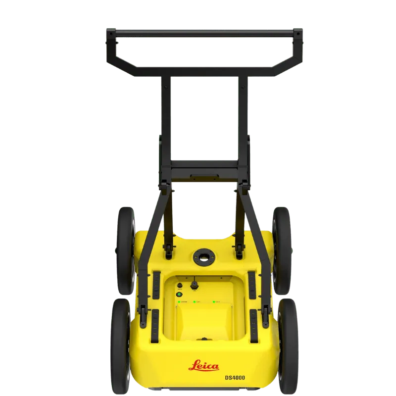
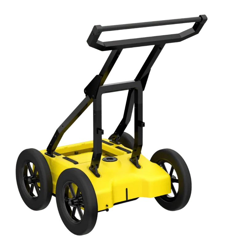
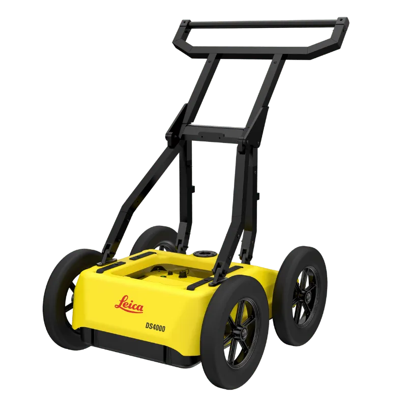
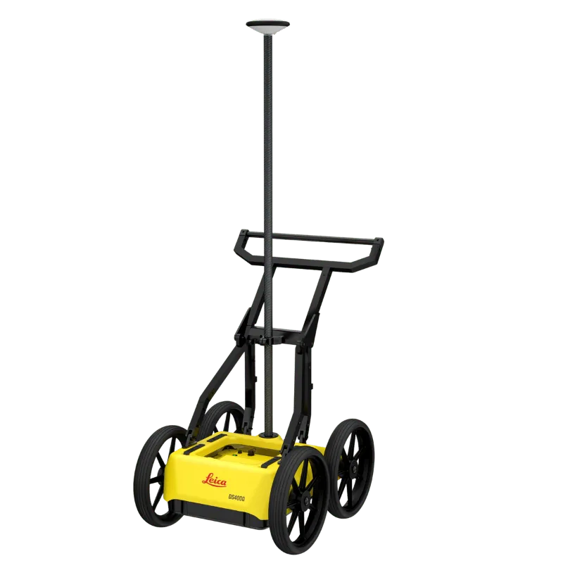
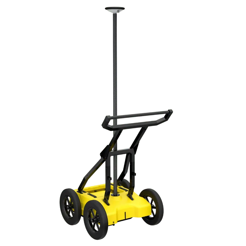
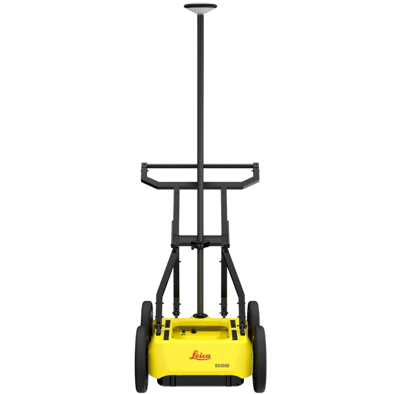
The Leica DS4000 Utility Detection Radar delivers precise subsurface mapping with advanced EsT technology, detecting underground utilities up to 60% deeper than conventional systems. Designed for construction, oil and gas, surveying, and government infrastructure projects, it combines high mobility with exceptional data clarity. Available in Saudi Arabia exclusively through SITML, the authorized Leica distributor, the DS4000 ensures reliable performance and local support for demanding field applications.
See more, Reach deeper

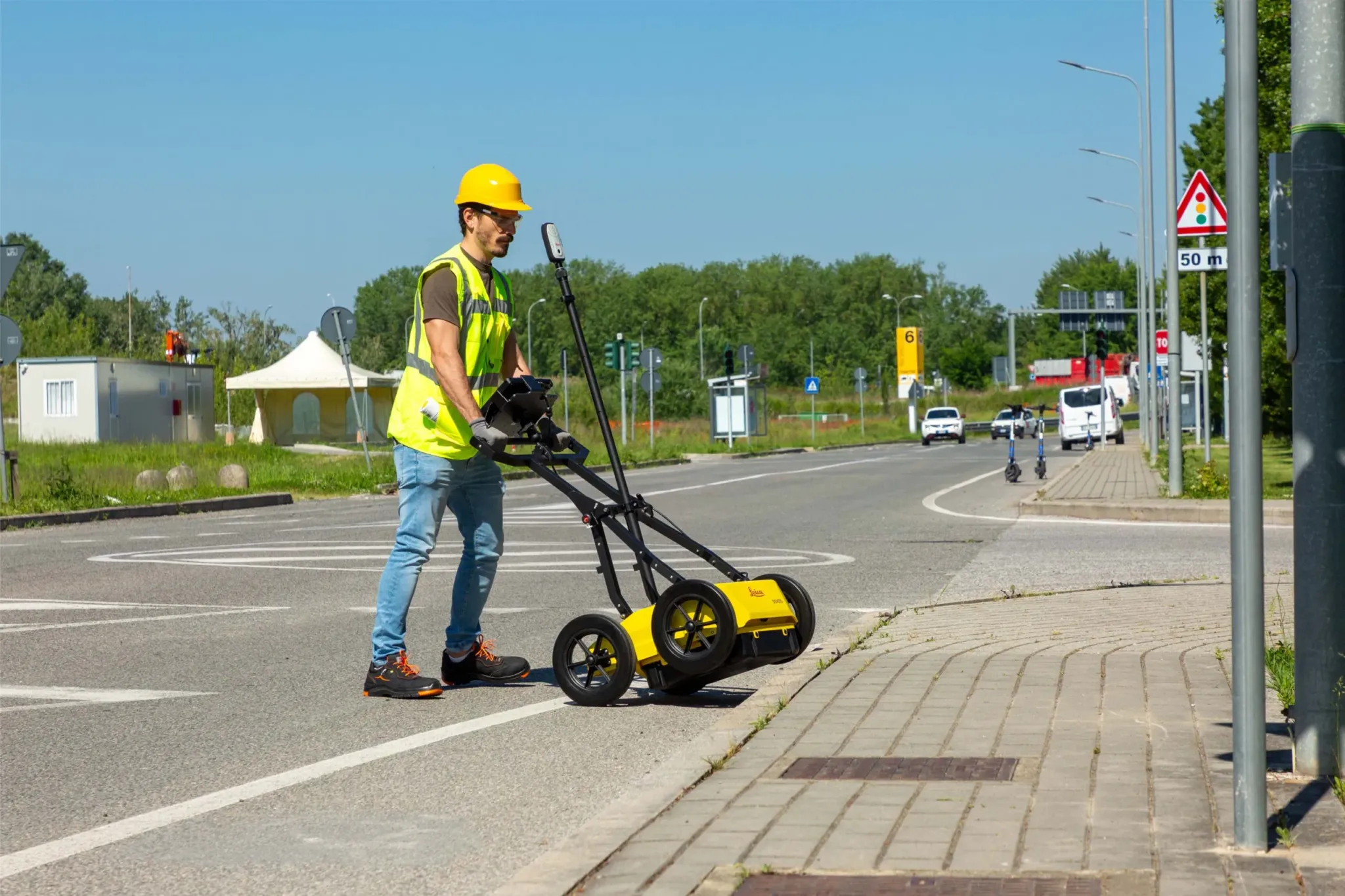
Advanced Utility Detection for Safer Groundworks in Saudi Arabia
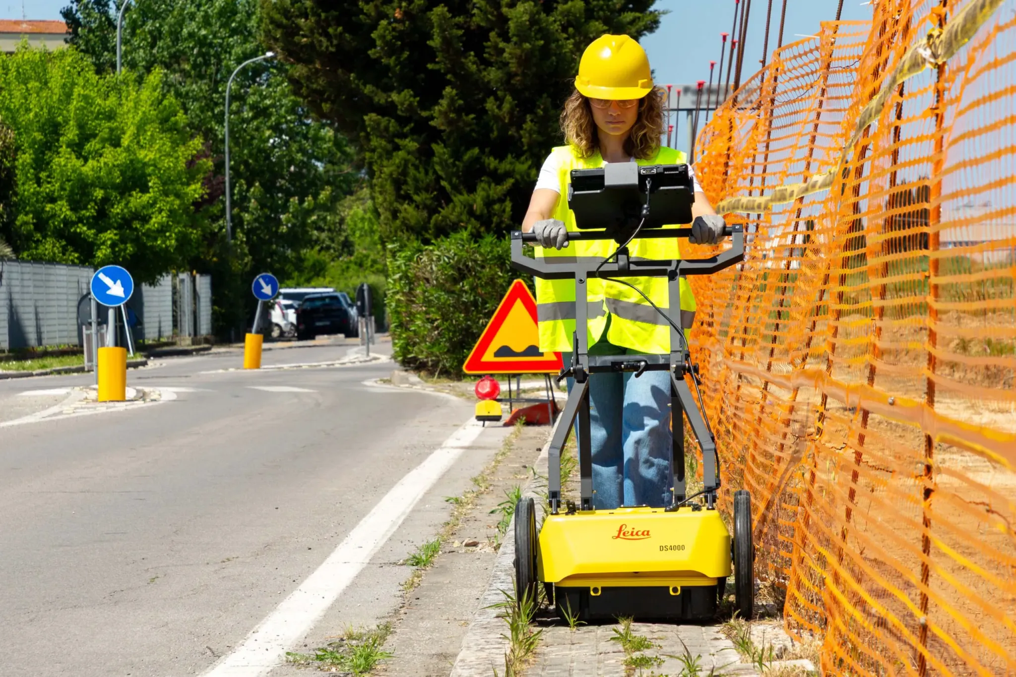
Urban environments continue to expand, and with them, the underground space becomes increasingly congested with cables, pipelines, and critical infrastructure. The Leica DS4000 Utility Detection Radar, available in KSA through SITML, provides contractors and surveyors with a reliable solution to reduce risks before excavation and construction.
Patented EsT Technology for Superior Clarity
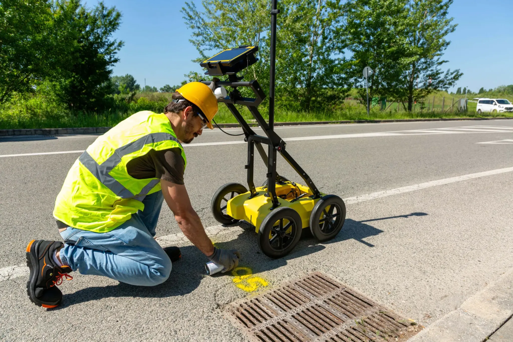
Equipped with Leica’s patented Equalised Scrambling Technology (EsT), the DS4000 delivers unmatched clarity in detecting underground utilities. It identifies both shallow and deep-lying assets, including hard-to-detect elements such as fibre optic cables, ensuring accurate results in complex urban settings.
See More, Reach Deeper
The Leica DS4000 penetrates up to 60% deeper than traditional utility detection systems, helping teams in Saudi Arabia work with greater confidence and efficiency. By providing clear, dependable data, it enables safer decision-making and minimizes costly project delays.
Accurate Data and Reduced Risk
The Leica DS4000 Utility Detection Radar provides surveyors in KSA with accurate subsurface data, even in complex ground conditions. Its patented EsT technology extends detection range and ensures reliable identification of underground assets.
For construction and utilities teams, this means fewer risks, minimized chances of costly delays, and improved safety during excavation. By integrating the DS4000 into their workflow, project teams can keep schedules on track while protecting both workers and underground infrastructure.
Unlimited Data Collection with Simplified Management
The Leica DS4000 Utility Detection Radar integrates seamlessly with advanced software to streamline fieldwork and data handling. Using uMap field software, teams can collect data quickly and manage information with ease directly on site.
For deeper analysis, the IQMaps post-processing software provides powerful tools to interpret results with greater precision, enabling professionals in Saudi Arabia to make informed decisions with confidence.
Simplified Detection Workflow
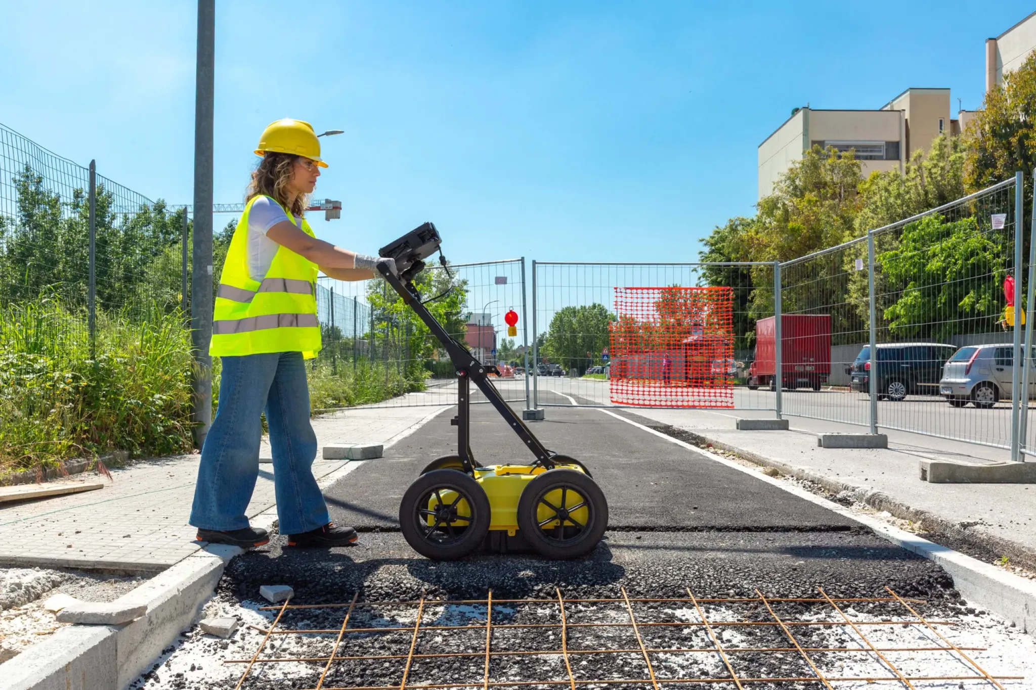
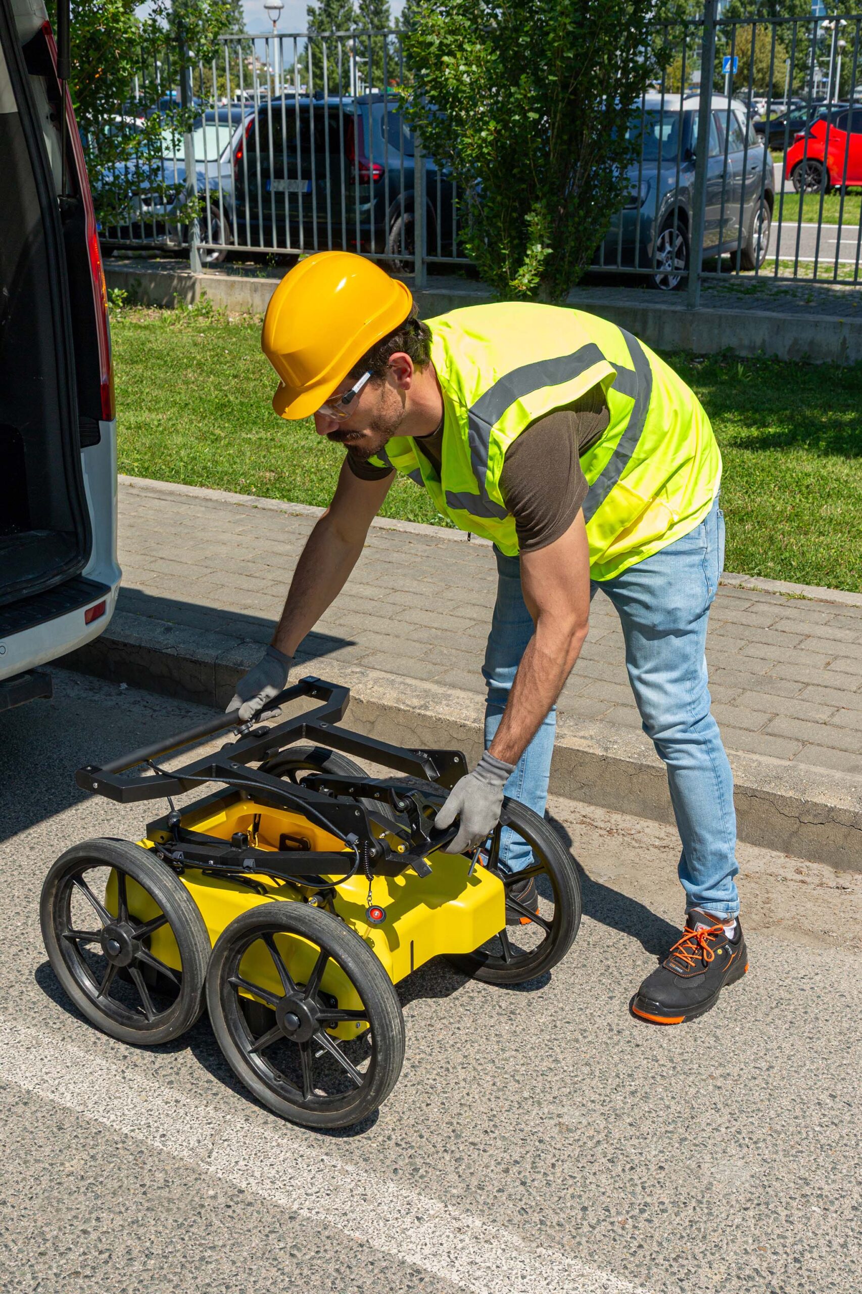
Engineered for efficiency, the Leica DS4000 Utility Detection Radar is designed to perform reliably across diverse urban environments in Saudi Arabia. Its compact and lightweight build enables easy, single-user operation without compromising performance.
With the innovative Quick Scan Mode, fieldwork becomes faster and more cost-effective, allowing teams to save valuable time while maintaining high accuracy in subsurface detection.
DS4000 Accessories
Enhance the performance and usability of the Leica DS4000 Utility Detection Radar with a range of dedicated accessories designed for demanding fieldwork in Saudi Arabia.
-
External positioning support for seamless integration with GPS, GNSS, or Total Station equipment
-
Off-road wheels engineered for reliable operation on rough and uneven terrain
-
Durable hard case for secure transport and protection during shipping
Designed to perform
Key Features of the Leica DS4000
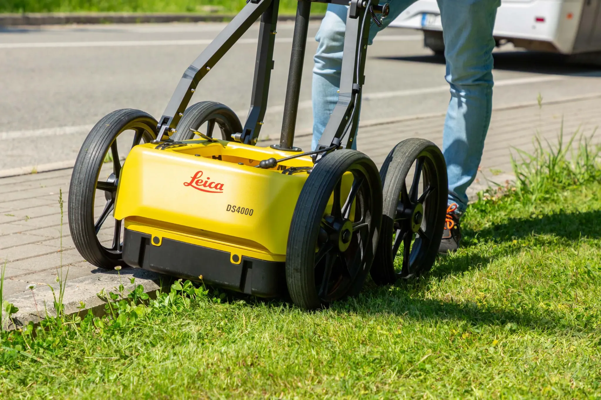
Built with practicality and performance in mind, the Leica DS4000 Utility Detection Radar offers a combination of advanced features to support efficient underground detection in Saudi Arabia.
-
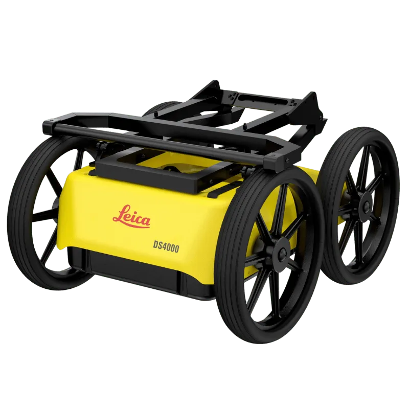
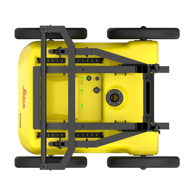
Lightweight, modular, and compact design (20 kg | 44 lb) for effortless mobility and data collection
-
Foldable handlebar for quick deployment and convenient storage
-
Height-adjustable antenna mount to overcome obstacles in challenging environments
-
Hot swap power supply for uninterrupted data acquisition in the field
Key Benefits of the Leica DS4000
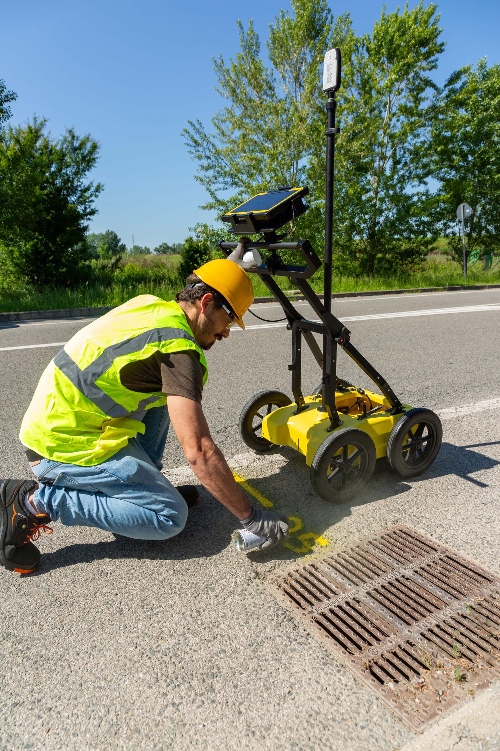
The Leica DS4000 Utility Detection Radar delivers a powerful combination of performance and usability, ensuring safer and more efficient subsurface detection across Saudi Arabia.
-
Extended detection range enables deeper visibility and greater accuracy in identifying underground assets
-
Simplified workflow with Quick Scan mode and instant on-site reporting
-
Real-time detection with on-site marking and digital recording of anomalies
-
Optimized field performance with easy polarization switching (HH and VV) and uninterrupted operation through hot swap power supply
Complete Detection and Mapping Solution
The Leica DS4000 Utility Detection Radar integrates seamlessly with the wider Leica Geosystems detection portfolio to deliver a comprehensive underground mapping solution. Paired with the rugged Leica CT1000 field tablet, the GG04 plus or GPS60 smart antenna, and the DD SMART Series cable locators and transmitters, it provides unmatched flexibility and efficiency for field operations in Saudi Arabia.
With IQMaps post-processing software, professionals can carry out advanced analysis, easily convert radar data into CAD files, and enhance project workflows from field to office.
Your Authorized Leica Partner in Saudi Arabia
SITML is the authorized Leica distributor in Saudi Arabia, delivering the DS4000 and the full range of Leica detection solutions. Our team provides local expertise and support to help contractors, surveyors, and infrastructure professionals work faster, safer, and more efficiently.
Leica Geosystems
Leica Geosystems Saudi Arabia – Precision Meets Innovation
Introduction
Leica Geosystems Saudi Arabia delivers unmatched precision, durability, and advanced geospatial performance for professionals across construction, infrastructure, mining, and agriculture. For over 200 years, Leica has pioneered surveying instruments, GNSS/GPS systems, laser scanners, and software platforms that empower projects worldwide.
Trusted Worldwide, Available Locally in Saudi Arabia
Founded in Switzerland, Leica Geosystems has built a legacy of engineering excellence. Now available in Saudi Arabia through authorized dealers, Leica Geosystems Saudi Arabia products are adapted for the region’s challenging environments—providing local support, training, and calibrated precision.
Innovation in Every Leica Geosystems Product
Ranging from sophisticated total stations and GNSS receivers to mobile mapping and high-definition laser scanners, Leica Geosystems Saudi Arabia offers real-time accuracy and seamless digital workflows that boost project efficiency and reduce field downtime.
Key Achievements & Milestones
-
Over 200 years of geomatics innovation
-
Inventor of the world’s first digital level and early laser distance meters
-
Reality capture systems deployed in 100+ countries
-
Trusted in major infrastructure, metro, and oil & gas surveying
-
Adopted by engineers, surveyors, and government agencies worldwide
Why Choose Leica Geosystems in Saudi Arabia?
-
Localized support: Technical assistance, training, and product availability through authorized dealers
-
Unmatched accuracy: Instruments deliver centimeter-level precision and durability
-
Comprehensive portfolio: Full range from DISTO distance meters to robotic total stations and reality capture systems
-
Smart integration: Compatible with Hexagon, Autodesk, and other industry-leading software platforms
Leica Product Range in KSA
-
Leica Total Stations – Manual and robotic total stations for construction and high-precision surveying.
-
Leica Mobile Mapping Systems – Pegasus TRK Neo, Pegasus:Backpack, BLK2GO for vehicle, wearable, and handheld 3D capture
-
Leica GPS & GNSS Equipment – GS18 I GNSS RTK rover, iCON GPS smart antennas offering tilt-compensated precision positioning
-
Ground Penetrating Radar (GPR) – Leica GPR solutions for accurate subsurface mapping
-
Leica Laser Scanners – ScanStation P‑Series, RTC360, BLK360, and BLK2FLY for HD 3D scanning and digital twin workflows
-
Leica DISTO & Leica Levels – Leica DISTO™ meter series and LINO/Rugby laser levels for point‑to‑point measurements and leveling
Leica Cyclone Software Portfolio
-
Cyclone REGISTER 360 PLUS – Guided workflows to register and visualize point cloud datasets with automation for efficient office workflows
-
Cyclone 3DR – End-to-end solution to analyze and model point clouds into actionable 3D deliverables
-
Cyclone Enterprise – On‑premise project and data management platform for centralized reality capture workflows
-
Cyclone Cloud – Subscription-based SaaS portal offering centralized license management and secure cloud-hosted service access
Get in Touch - Contact Us
Discover how Leica Geosystems Saudi Arabia solutions can elevate your next project. Reach out to your authorized local distributor to request demos, pricing, and expert consultation tailored to your requirements.
Official Website: www.leica-geosystems.com
Leica Geosystems is a world leader in precision surveying and geospatial solutions with over 200 years of expertise. From total stations and GNSS/GPS receivers to 3D laser scanning systems, Leica products deliver exceptional accuracy and reliability for construction, infrastructure, and mapping projects in Saudi Arabia and worldwide.