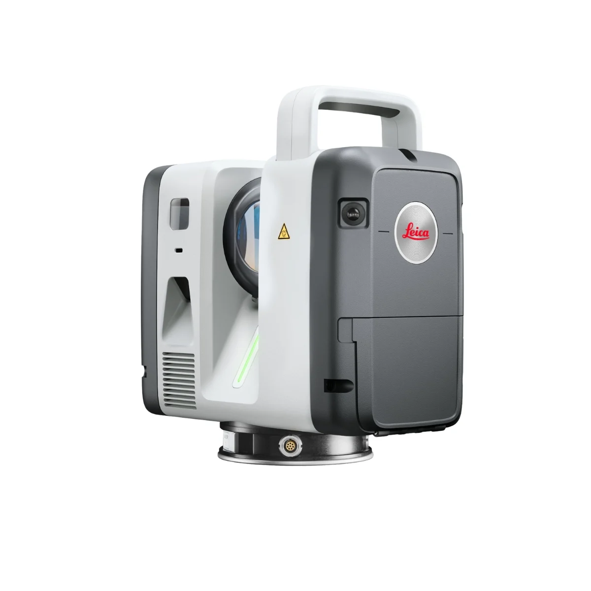

The Leica RTC Series is a next-generation 3D laser scanner platform designed for fast, accurate and intelligent reality capture. With RTC300, RTC500 and RTC700 models, it supports professional terrestrial scanning workflows for surveying, construction, infrastructure, industrial documentation and public safety applications.
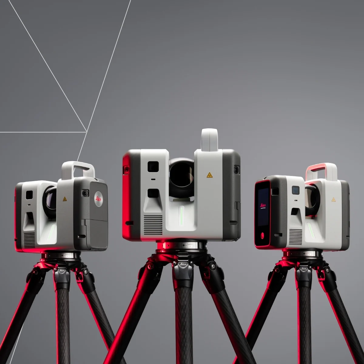
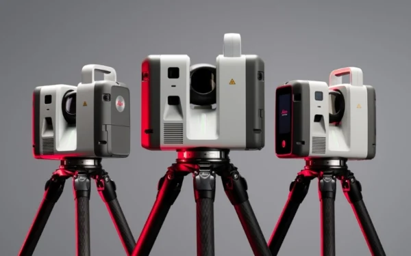
Welcome to a new dimension in reality capture. One trusted design. Three levels of performance.

The Leica RTC Series introduces a smarter and more connected approach to reality capture, helping professionals capture, manage and share 3D data with greater efficiency.
Developed from Leica Geosystems’ extensive expertise in 3D laser scanning, the Leica RTC Series combines advanced scanning technology, intelligent software integration and cloud-enabled collaboration within a unified workflow. Capture high-quality reality capture data, monitor project progress in real time and maintain seamless communication between field teams, cloud platforms and office users throughout every stage of a project.

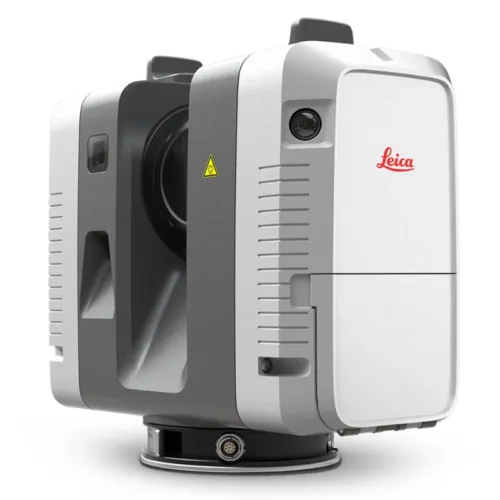
Leica RTC300
Agile reality capture for building construction and fast-moving project sites. The Leica RTC300 delivers trusted Leica RTC Series scanning performance in a practical solution designed for efficient single-scanner workflows and future-ready connected operations.

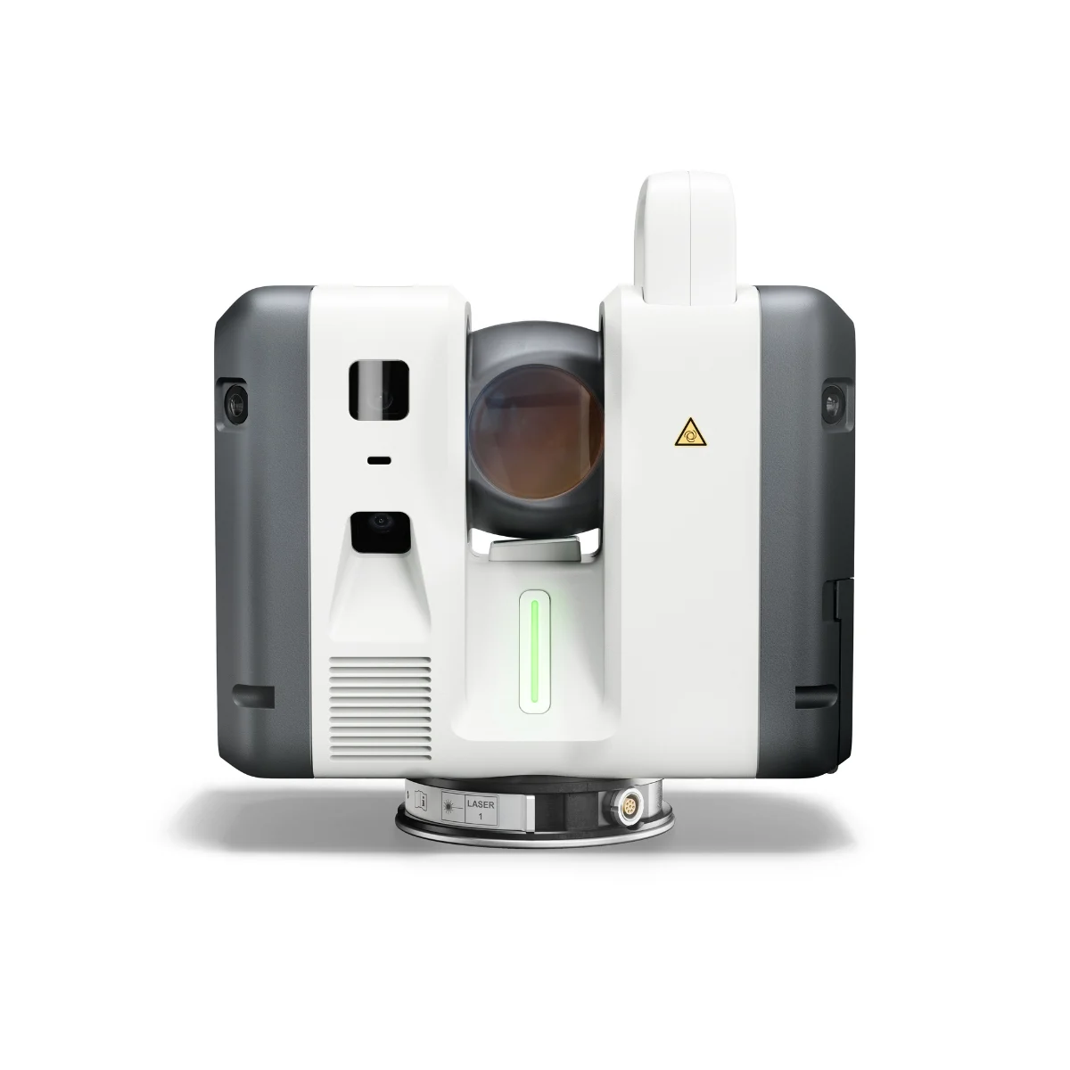
Leica RTC500
Balanced 3D laser scanning performance for surveying, construction, public safety and infrastructure projects. The Leica RTC500 provides the range, speed and flexibility needed to adapt to changing site conditions and evolving project requirements.

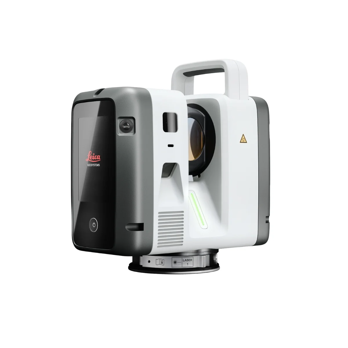
Leica RTC700
Advanced reality capture for large-scale infrastructure, industrial plant and complex surveying environments. The Leica RTC700 is designed for high-demand projects requiring extended range, high accuracy and scalable multi-scanner workflows.

How Leica RTC can transform your work
 The Leica RTC Series is designed for professionals who need fast reality capture with confidence in every scan. With three performance levels, RTC laser scanners support efficient capture of high-density 3D data across construction sites, infrastructure projects, and demanding field environments.
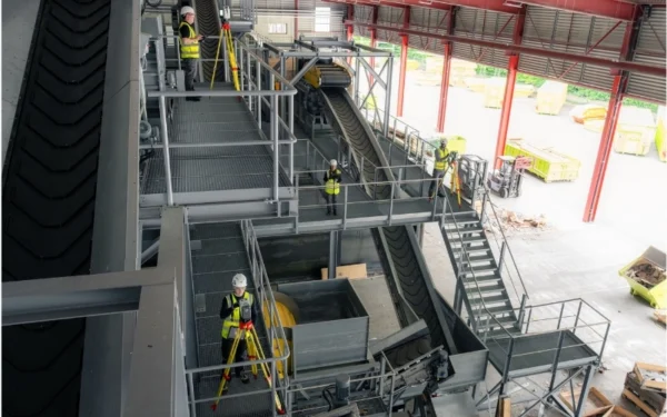
For construction teams, the RTC Series helps document existing conditions, verify progress, and keep site activity moving with clearer project visibility. For surveyors and infrastructure professionals, it delivers a dependable 3D laser scanning workflow that supports accurate site documentation even when conditions change. The result is stronger project control, reduced rework, and a smoother path from field capture to final deliverables.
 The Leica RTC Series is built to support reality capture workflows as project complexity increases. Whether teams are working with one scanner on a single site or coordinating multiple scanners across several locations, the RTC workflow helps keep field data organized, aligned, and easy to manage.
Connected software intelligence supports collaboration between field, office, and remote experts, allowing teams to review progress, guide scanning activity, and maintain control as data volume grows. Instead of slowing the project down, the expanded data environment helps improve clarity, coordination, and confidence across the full 3D laser scanning workflow.
 With LiveLink in Leica Cyclone FIELD 360, field teams can create real-time collaborative projects where scan data becomes accessible beyond the jobsite as capture is taking place. Through Hexagon GeoCloud, field and office users can work within the same connected project environment, helping teams review progress, validate data, and stay aligned during active scanning.
This connected workflow supports registration, quality checks, quality control, and progress monitoring while the project is still in motion. Teams can identify issues earlier, reduce the risk of rework, and make faster decisions before field activity is complete. After data capture, Leica Cyclone REGISTER 360 PLUS supports final registration, validation, and post-processing for accurate project deliverables.
What makes the new RTC Series different.
Higher performance scanning
The Leica RTC Series combines fast, high-density 3D laser scanning with onboard data storage and a rugged IP55-rated design. Built for active job sites and demanding field conditions, it helps teams capture reliable scan data with the speed, durability, and consistency needed for modern reality capture workflows.
Field-to-office collaboration
LiveLink in Leica Cyclone FIELD 360 connects field teams, office users, and remote experts through Hexagon GeoCloud while scanning is still in progress. This real-time collaboration helps teams review scan data earlier, monitor progress, identify issues on time, and reduce the need for unnecessary site revisits.
Faster data visualisation
VIS technology helps register scans directly in the field, turning captured site conditions into complete, usable 3D datasets faster. This gives teams a clearer view of the project while work is still progressing, with data ready to support BIM, CAD, and the visualisation platforms already used in their workflow.
Built for the way you already work
The Leica RTC Series is designed to fit into the software environment your teams already use. With connectivity to Hexagon GeoCloud, Leica Cyclone software, Autodesk Revit, and other CAD/BIM platforms, RTC helps move captured data into existing project workflows without forcing teams to change the way they work.
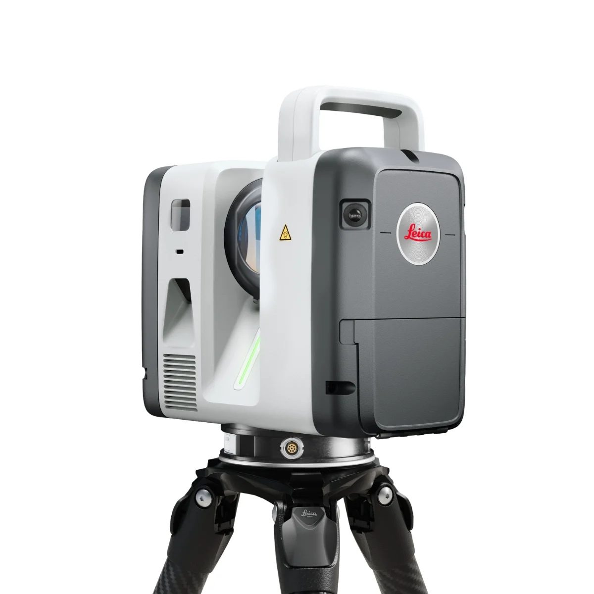
One trusted design.
Three levels of performance.
Choose the Leica RTC scanner that fits your project scale, working conditions, and performance requirements.
Leica RTC300
Agile reality capture for evolving projects.

Leica RTC500
High-performance scanning with operational flexibility.
Leica RTC700
Maximum range and accuracy for the most demanding work.
From field capture to final deliverable, without fragmentation.
CAPTURE
Superior scanning performance for real project demands
The Leica RTC Series brings trusted laser scanning performance to demanding field environments. Built for speed, precision, range, and rugged operation, it helps teams capture high-density 3D data with confidence across construction, infrastructure, and industrial sites.
With VIS auto-registration and reliable field performance, the RTC Series supports faster data capture, clearer site documentation, and dependable results when accuracy matters from the first scan to the final deliverable.
Collaborate
Bring field data into a connected project environment.
The Leica RTC Series helps teams move beyond isolated field capture by connecting scan data with the wider project workflow. With LiveLink in Leica Cyclone FIELD 360, users can start a real-time collaborative project and share captured data with colleagues on site and in the office through Hexagon GeoCloud.
This connected environment allows teams to coordinate while scanning is still in progress, supporting earlier quality checks, progress tracking, and better decision-making before field work is complete.
Deliver
From storage to analysis to streaming, work the way you already do.
The Leica RTC Series supports a connected software ecosystem that helps teams manage scan data beyond field capture. Through Hexagon GeoCloud, users can store, share, visualise, and analyse RTC data within a collaborative project environment.
For more advanced processing, Leica Cyclone 3DR supports deeper analysis and deliverable creation, while data can also be streamed into Autodesk Revit and other CAD/BIM platforms. This gives teams the flexibility to keep working with the tools already used across design, construction, and project documentation workflows.
Built for specialised reality capture workflows.
Leica RTC supports professionals across industries where accurate, connected 3D data helps teams make better decisions faster.
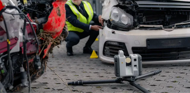
Public safety and forensics
Capture incident scenes quickly, accurately, and without disturbing critical evidence. The Leica RTC Series supports reliable 3D documentation for public safety, forensic investigation, and scene reconstruction workflows, helping teams preserve details, review conditions, and share clear visual records for further analysis.
Surveying
Capture accurate site conditions, manage large scan datasets, and coordinate complex survey projects with greater confidence from field to office. The Leica RTC Series helps survey professionals create registered 3D scan data that supports BIM, VDC, and CAD workflows, making it easier for teams to model, verify, and deliver against real site conditions.
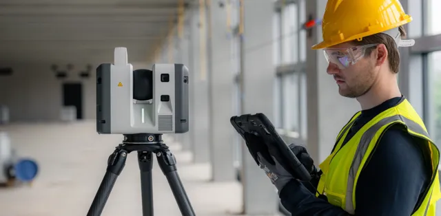
Building construction
Document existing site conditions, verify construction progress, and support Scan to BIM workflows with reliable 3D reality capture. The Leica RTC Series helps project teams reduce uncertainty, compare work against design intent, and make decisions based on accurate, up-to-date site information.
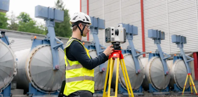
Plant and industrial
Capture complex industrial facilities where accuracy, access time, and coordination are critical. The Leica RTC Series supports reliable 3D documentation for plant environments, helping teams plan safer work, reduce site uncertainty, and make better engineering decisions from accurate as-built data.
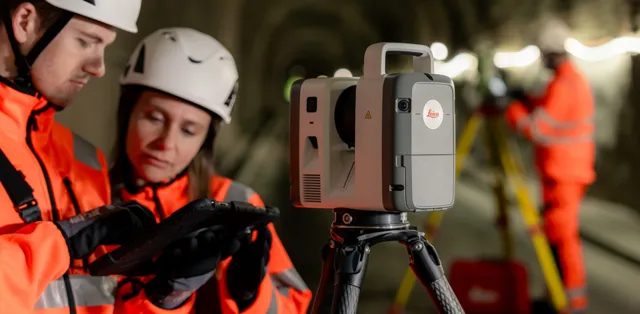
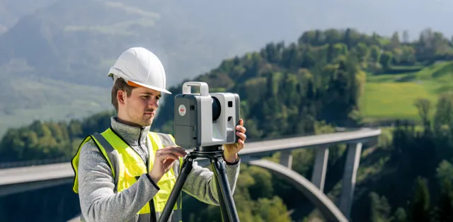
Infrastructure
Document roads, bridges, tunnels, rail corridors, and large-scale assets with reliable 3D reality capture. The Leica RTC Series helps infrastructure teams capture accurate site conditions in demanding environments, supporting better planning, progress verification, asset documentation, and project coordination from field to office.
Leica Geosystems
Leica Geosystems Saudi Arabia – Precision Meets Innovation
Introduction
Leica Geosystems Saudi Arabia delivers unmatched precision, durability, and advanced geospatial performance for professionals across construction, infrastructure, mining, and agriculture. For over 200 years, Leica has pioneered surveying instruments, GNSS/GPS systems, laser scanners, and software platforms that empower projects worldwide.
Trusted Worldwide, Available Locally in Saudi Arabia
Founded in Switzerland, Leica Geosystems has built a legacy of engineering excellence. Now available in Saudi Arabia through authorized dealers, Leica Geosystems Saudi Arabia products are adapted for the region’s challenging environments—providing local support, training, and calibrated precision.
Innovation in Every Leica Geosystems Product
Ranging from sophisticated total stations and GNSS receivers to mobile mapping and high-definition laser scanners, Leica Geosystems Saudi Arabia offers real-time accuracy and seamless digital workflows that boost project efficiency and reduce field downtime.
Key Achievements & Milestones
-
Over 200 years of geomatics innovation
-
Inventor of the world’s first digital level and early laser distance meters
-
Reality capture systems deployed in 100+ countries
-
Trusted in major infrastructure, metro, and oil & gas surveying
-
Adopted by engineers, surveyors, and government agencies worldwide
Why Choose Leica Geosystems in Saudi Arabia?
-
Localized support: Technical assistance, training, and product availability through authorized dealers
-
Unmatched accuracy: Instruments deliver centimeter-level precision and durability
-
Comprehensive portfolio: Full range from DISTO distance meters to robotic total stations and reality capture systems
-
Smart integration: Compatible with Hexagon, Autodesk, and other industry-leading software platforms
Leica Product Range in KSA
-
Leica Total Stations – Manual and robotic total stations for construction and high-precision surveying.
-
Leica Mobile Mapping Systems – Pegasus TRK Neo, Pegasus:Backpack, BLK2GO for vehicle, wearable, and handheld 3D capture
-
Leica GPS & GNSS Equipment – GS18 I GNSS RTK rover, iCON GPS smart antennas offering tilt-compensated precision positioning
-
Ground Penetrating Radar (GPR) – Leica GPR solutions for accurate subsurface mapping
-
Leica Laser Scanners – ScanStation P‑Series, RTC360, BLK360, and BLK2FLY for HD 3D scanning and digital twin workflows
-
Leica DISTO & Leica Levels – Leica DISTO™ meter series and LINO/Rugby laser levels for point‑to‑point measurements and leveling
Leica Cyclone Software Portfolio
-
Cyclone REGISTER 360 PLUS – Guided workflows to register and visualize point cloud datasets with automation for efficient office workflows
-
Cyclone 3DR – End-to-end solution to analyze and model point clouds into actionable 3D deliverables
-
Cyclone Enterprise – On‑premise project and data management platform for centralized reality capture workflows
-
Cyclone Cloud – Subscription-based SaaS portal offering centralized license management and secure cloud-hosted service access
Get in Touch - Contact Us
Discover how Leica Geosystems Saudi Arabia solutions can elevate your next project. Reach out to your authorized local distributor to request demos, pricing, and expert consultation tailored to your requirements.
Official Website: www.leica-geosystems.com
Leica Geosystems is a world leader in precision surveying and geospatial solutions with over 200 years of expertise. From total stations and GNSS/GPS receivers to 3D laser scanning systems, Leica products deliver exceptional accuracy and reliability for construction, infrastructure, and mapping projects in Saudi Arabia and worldwide.