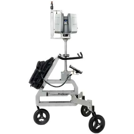
Increase the productivity of your laser scanning by using this mobile reality capture platform
With Leica ProScan you can scan indoors and outdoors without the need to register your scans. This system offers maximum flexibility and can be connected to a variety of Leica laser scanners and TPS systems – increasing the productivity of your 3D capturing tasks and Leica equipment.
By utilising the ProScan platform, your traditional terrestrial laser scanner will turn into a kinematic 3D measurement system.
Significantly reduces your data capturing time on site
Intuitive to handle handling and easy to use
Straight forward computation of point clouds
Fully transportable and flexible
Leverage your existing TPS systems
The ProScan trolley was specifically developed for kinematic data capturing workflows. During the initialisation phase (alignment) it serves as a base station. In the data capturing phase it becomes a convenient measuring platform giving you freedom to move quickly and freely.
Optimal for indoor and outdoor applications
The fully integrated GNSS module allows you to move freely and provides a direct geo-referencing for all the points in the resulting point cloud. For indoor scanning you can mark points on a straight line and simply follow the line. The system automatically registers the points utilising tracking technology.
The ultimate kinematic scanning experience
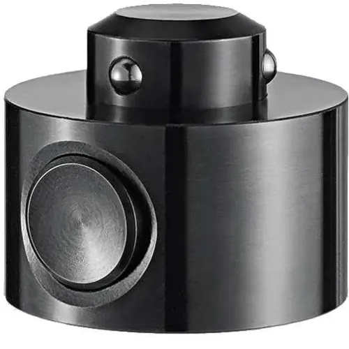
Get your TPS to follows the platform wherever you go so that you can fully concentrate on the object to be scanned – indoor, outdoor, tunnels – you name it. Tracking the platform with TPS guarantees unconstraint moving, highest flexibility and the best accuracy possible thanks to the innovative tracking.
Leica Geosystems
Leica Geosystems Saudi Arabia – Precision Meets Innovation
Introduction
Leica Geosystems Saudi Arabia delivers unmatched precision, durability, and advanced geospatial performance for professionals across construction, infrastructure, mining, and agriculture. For over 200 years, Leica has pioneered surveying instruments, GNSS/GPS systems, laser scanners, and software platforms that empower projects worldwide.
Trusted Worldwide, Available Locally in Saudi Arabia
Founded in Switzerland, Leica Geosystems has built a legacy of engineering excellence. Now available in Saudi Arabia through authorized dealers, Leica Geosystems Saudi Arabia products are adapted for the region’s challenging environments—providing local support, training, and calibrated precision.
Innovation in Every Leica Geosystems Product
Ranging from sophisticated total stations and GNSS receivers to mobile mapping and high-definition laser scanners, Leica Geosystems Saudi Arabia offers real-time accuracy and seamless digital workflows that boost project efficiency and reduce field downtime.
Key Achievements & Milestones
Over 200 years of geomatics innovation
Inventor of the world’s first digital level and early laser distance meters
Reality capture systems deployed in 100+ countries
Trusted in major infrastructure, metro, and oil & gas surveying
Adopted by engineers, surveyors, and government agencies worldwide
Why Choose Leica Geosystems in Saudi Arabia?
Localized support: Technical assistance, training, and product availability through authorized dealers
Unmatched accuracy: Instruments deliver centimeter-level precision and durability
Comprehensive portfolio: Full range from DISTO distance meters to robotic total stations and reality capture systems
Smart integration: Compatible with Hexagon, Autodesk, and other industry-leading software platforms
Leica Product Range in KSA
Leica Total Stations – Manual and robotic total stations for construction and high-precision surveying.
Leica Mobile Mapping Systems – Pegasus TRK Neo, Pegasus:Backpack, BLK2GO for vehicle, wearable, and handheld 3D capture
Discover how Leica Geosystems Saudi Arabia solutions can elevate your next project. Reach out to your authorized local distributor to request demos, pricing, and expert consultation tailored to your requirements.
Leica Geosystems is a world leader in precision surveying and geospatial solutions with over 200 years of expertise. From total stations and GNSS/GPS receivers to 3D laser scanning systems, Leica products deliver exceptional accuracy and reliability for construction, infrastructure, and mapping projects in Saudi Arabia and worldwide.