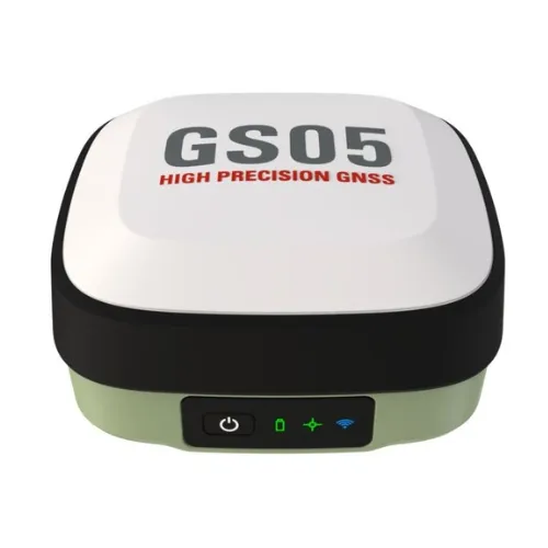
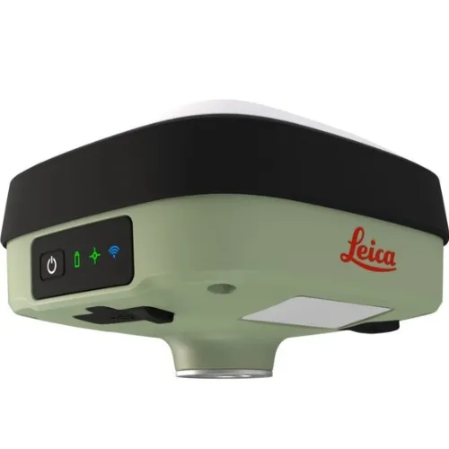
Leica GS05 GNSS RTK Rover

Contact Details

Tilt all day. The lightest GNSS smart antenna to trust.

The GS05 is a lightweight and compact GNSS Smart Antenna that can perform tilt-compensated measurements up to 30°. With this release, Leica Geosystems aims to empower businesses with precise, efficient and trustworthy professional surveying tools. A lightweight, compact GNSS smart antenna with tilt compensation, the Leica GS05 lets you measure all day with ease. Forget the bubble and measure more points, more efficiently than ever before.


SKU: 2206015-1 Categories: ,

Description

LIGHTWEIGHT

Small enough to fit in the palm of your hand and barely noticeable on top of your pole, the GS05 packs a lot of tech into just 0.75 kilograms. With 4G, UHF radio, a 10-hour internal battery, tilt compensation, and IP-rated durability, you’ll be amazed at what this lightweight powerhouse is capable of.

TILT-COMPENSATING

The GS05 features Leica Geosystems’ proven tilt compensation, which is calibration-free and immune to magnetic disturbances. Forget the bubble and focus on the task at hand, saving time and effort. Measure points without breaking stride and stake points quicker and simpler than ever.
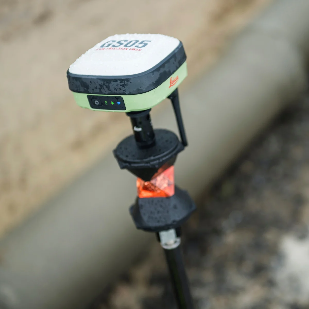
SMARTPOLE

Thanks to its light weight, the GS05 is perfect for combining GNSS and total station operation as a SmartPole. Simply place the GS05 on top of a 360° prism and work more efficiently than ever.desc

TILT-COMPENSATING

As you’d expect, the GS05 is built on Leica Geosystems’ reputation for quality. It seamlessly integrates with Leica Captivate field software, Captivate tablets and controllers, Leica Infinity, GeoCloud Drive, and beyond. Maintenance, service, and support are all available through Leica Geosystems’ Active Customer Care.

Datasheet

GNSS TECHNOLOGY & SERVICES
Self-learning GNSS Leica RTKplus Adaptive on-the-fly satellite selection
HxGN SmartNet Global HxGN SmartNet NRTK GS05 Network RTK with Sensor ID authentication
Leica SmartCheck Continuous check of RTK solution Reliability 99.95%
Signal tracking GPS | GLONASS
Galileo | BeiDou
QZSS
SBAS
L1, L2C | L1, L2C
E1, E5b | B1I, B2I
L1, L2C
Enabled through future firmware updates
Number of channels 184
Tilt compensation1 Increased measurement productivity and traceability Calibration-free, Immune to magnetic disturbances, up to 30° tilt
MEASUREMENT PERFORMANCE & ACCURACY
Time for RTK initialisation Typically 6 s
Real-time kinematic Single baseline
Network RTK
Hz 10 mm + 1 ppm | V 20 mm + 1 ppm
Hz 10 mm + 0.5 ppm | V 20 mm + 0.5 ppm
Real-time kinematic tilt compensated Not for static control points Additional Hz uncertainty less than 1.5 cm down to 30° tilt
Post processing Static (phase) with long observations
Static and rapid static (phase)
Hz 3 mm + 0.5 ppm | V 6 mm + 0.5 ppm
Hz 5 mm + 0.5 ppm | V 10 mm + 0.5 ppm
Code differential DGNSS Hz 25 cm | V 50 cm
COMMUNICATIONS
Communication ports USB | Bluetooth® | WLAN USB-C | Bluetooth® v5.2 (BLE & BR/EDR), class 1 & 2 | 802.11 b/g/n
Communication protocols RTK data protocols
NMEA output
Network RTK
Leica, Leica 4G, CMR, CMR+, RTCM 2.2, 2.3, 3.0, 3.1, 3.2 MSM3
NMEA 0183 v4.00 & v4.10 and Leica proprietary
VRS, FKP, iMAX, MAC (RTCM SC 104)
Built-in LTE modem4 LTE frequency bands5 1, 2, 3, 4, 5, 8, 12, 13, 18, 19, 20, 25, 26, 27, 28, 66, 85 |
1, 2, 3, 4, 5, 7, 8, 20, 28, 34, 38, 39, 40, 41, 66
Built-in UHF modem6 Receive & transmit UHF radio modem UHF: 413 - 473 MHz
GENERAL
Field controller and software Leica Captivate software Leica CS20 field controller, Leica CS30, CC180 & CC200 tablets
User interface Buttons and LEDs On / Off button, 3 status LEDs
Data recording Storage
Data type and recording rate
Available internal memory up to 4 GB
Leica GNSS raw data and RINEX data at up to 10 Hz
Power management Internal power supply
External power supply
Operating time7
Internal Li-Ion battery (6.0 Ah / 3.6 V)
USB-C 5V chargeable
Typical time up to 10 hours
Weight and dimensions Weight
Dimensions
0.75 kg / 2.82 kg standard RTK rover setup on pole (using CS30)
118.9 mm x 118.9 mm x 75.5 mm
Environmental Temperature


Drop
Proof against water, sand and dust

Vibration
Humidity
Bump
-30 to +55°C operating with internal power
-40 to +65°C operating with external power
-40 to +80°C storage
Withstands topple over from a 2 m survey pole onto hard surfaces
IP66 | IP68 (IEC60529 | MIL STD 810H 506.6 Proc II | MIL STD 810H 512.6 Proc I | MIL STD 810H 510.7 Proc II)
Withstands strong vibration (ISO9022-36-08-2; ISO 9022-3:2022(E))
95% (ISO9022-12-04-2; ISO 9022-2: 2015/Amd1:2023(E) | MIL STD 810H 507.6)
ISO 9022-31-08-1; ISO 9022-3: 2022(E)

Brand

Leica Geosystems

Leica Geosystems Saudi Arabia – Precision Meets Innovation

Introduction

Leica Geosystems Saudi Arabia delivers unmatched precision, durability, and advanced geospatial performance for professionals across construction, infrastructure, mining, and agriculture. For over 200 years, Leica has pioneered surveying instruments, GNSS/GPS systems, laser scanners, and software platforms that empower projects worldwide.

Trusted Worldwide, Available Locally in Saudi Arabia

Founded in Switzerland, Leica Geosystems has built a legacy of engineering excellence. Now available in Saudi Arabia through authorized dealers, Leica Geosystems Saudi Arabia products are adapted for the region’s challenging environments—providing local support, training, and calibrated precision.

Innovation in Every Leica Geosystems Product

Ranging from sophisticated total stations and GNSS receivers to mobile mapping and high-definition laser scanners, Leica Geosystems Saudi Arabia offers real-time accuracy and seamless digital workflows that boost project efficiency and reduce field downtime.

Key Achievements & Milestones

  • Over 200 years of geomatics innovation

  • Inventor of the world’s first digital level and early laser distance meters

  • Reality capture systems deployed in 100+ countries

  • Trusted in major infrastructure, metro, and oil & gas surveying

  • Adopted by engineers, surveyors, and government agencies worldwide

Why Choose Leica Geosystems in Saudi Arabia?

  • Localized support: Technical assistance, training, and product availability through authorized dealers

  • Unmatched accuracy: Instruments deliver centimeter-level precision and durability

  • Comprehensive portfolio: Full range from DISTO distance meters to robotic total stations and reality capture systems

  • Smart integration: Compatible with Hexagon, Autodesk, and other industry-leading software platforms

Leica Product Range in KSA

  • Total Stations – Manual and robotic total stations for construction and high-precision surveying.

  • Mobile Mapping Systems – Pegasus TRK Neo, Pegasus:Backpack, BLK2GO for vehicle, wearable, and handheld 3D capture

  • GPS & GNSS Equipment – GS18 I GNSS RTK rover, iCON GPS smart antennas offering tilt-compensated precision positioning

  • Ground Penetrating Radar (GPR) – Leica GPR solutions for accurate subsurface mapping

  • Laser Scanners – ScanStation P‑Series, RTC360, BLK360, and BLK2FLY for HD 3D scanning and digital twin workflows

  • DISTO Laser Distance Meters & Levels – Leica DISTO™ meter series and LINO/Rugby laser levels for point‑to‑point measurements and leveling

Leica Cyclone Software Portfolio

  • Cyclone REGISTER 360 PLUS – Guided workflows to register and visualize point cloud datasets with automation for efficient office workflows

  • Cyclone 3DR – End-to-end solution to analyze and model point clouds into actionable 3D deliverables

  • Cyclone Enterprise – On‑premise project and data management platform for centralized reality capture workflows

  • Cyclone Cloud – Subscription-based SaaS portal offering centralized license management and secure cloud-hosted service access

Get in Touch - Contact Us

Discover how Leica Geosystems Saudi Arabia solutions can elevate your next project. Reach out to your authorized local distributor to request demos, pricing, and expert consultation tailored to your requirements.

Official Website: www.leica-geosystems.com

Leica Geosystems is a world leader in precision surveying and geospatial solutions with over 200 years of expertise. From total stations and GNSS/GPS receivers to 3D laser scanning systems, Leica products deliver exceptional accuracy and reliability for construction, infrastructure, and mapping projects in Saudi Arabia and worldwide.

Reviews

There are no reviews yet.

Only logged in customers who have purchased this product may leave a review.

Title

Go to Top