Leica GNSS & GPS Systems
Selected GNSS RTK bundles are currently featured in our Ramadan promotion – VIEW OFFER
Leica GNSS GPS systems are advanced surveying solutions designed for professionals who require reliable, high-precision positioning across land surveying, construction, engineering, and geospatial applications. These systems deliver consistent accuracy using multi-constellation satellite tracking and intelligent GNSS technology, ensuring stable performance in all field conditions.
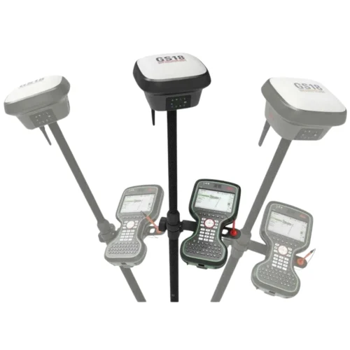
Leica GNSS surveying systems track all major satellite constellations including GPS, GLONASS, Galileo, and BeiDou, providing strong signal availability and fast position fixes even in challenging environments such as urban areas, construction sites, and remote locations. This multi-constellation capability ensures dependable RTK performance and accurate results throughout the project lifecycle.
Built for professional use, Leica RTK GNSS systems support high-accuracy surveying, construction layout, boundary measurements, topographic mapping, and as-built documentation. Advanced GNSS receivers, robust antennas, and intelligent sensors allow surveyors to work efficiently while maintaining confidence in measurement quality and repeatability.
Leica GNSS receivers are engineered for durability, ease of use, and seamless field operation. Combined with powerful field software and flexible hardware configurations, these GNSS GPS systems help reduce field time, minimize errors, and streamline data collection for both small-scale and large-scale projects.
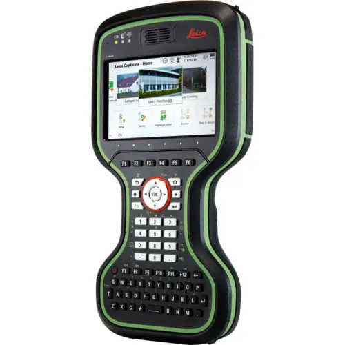
Leica GNSS GPS systems integrate seamlessly with professional field controllers, GNSS planning tools, and office software, enabling smooth data transfer and complete workflow continuity. From data capture in the field to processing and analysis in the office, Leica GNSS solutions are designed to support efficient decision-making and long-term project success.
This category brings together a comprehensive range of Leica GNSS GPS solutions designed to meet different accuracy requirements, project environments, and operational workflows. Each solution is engineered to support specific surveying and positioning needs, allowing professionals to select the right GNSS system based on project scope and application demands.
Leica GNSS GPS systems are trusted worldwide for their accuracy, reliability, and innovation, making them a preferred choice for surveyors and geospatial professionals seeking future-ready GNSS technology.
The cost of a professional GNSS GPS system depends on accuracy requirements, RTK capability, software configuration, and support services. Professional GNSS solutions are typically provided on an enquiry basis.
Pricing depends on GNSS receiver technology, positioning accuracy, RTK performance, software integration, and local support services.
Yes, professional GNSS GPS systems are available with local technical support, calibration, training, and after-sales services.
Selection depends on project scope, accuracy requirements, site conditions, and workflow compatibility.
Yes, modern GNSS GPS systems support RTK workflows for high-accuracy surveying and construction applications.