Leica GNSS Controllers – Professional Field Controllers for GNSS Surveying
Leica GNSS Controllers are professional field controllers designed to manage GNSS surveying workflows with speed, reliability, and precision. Built for demanding field conditions, Leica GNSS Controllers enable surveyors and engineering teams to efficiently control GNSS receivers, collect data, and perform surveying tasks across construction, infrastructure, and land development projects in Saudi Arabia.
Leica GNSS Controllers are engineered to support professional surveying workflows with reliable field control, intuitive operation, and efficient GNSS data management in real-world site environments.
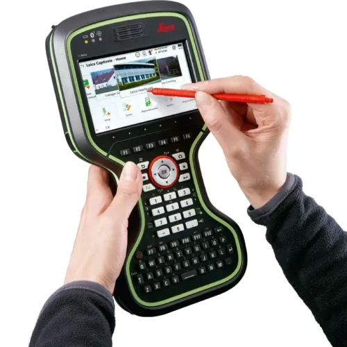
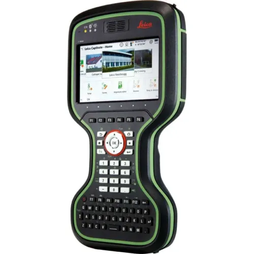
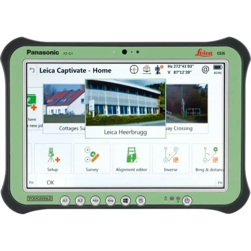
Rugged GNSS Controllers for Intensive Field Use
The Leica GNSS controller range includes rugged handheld controllers and high-performance field tablets engineered for long operating hours and intensive field use. With responsive touchscreens, durable construction, and optimized field ergonomics, Leica GNSS Controllers support smooth data capture, stakeout, and real-time positioning workflows in both urban and remote environments.
Designed to integrate seamlessly with Leica GNSS systems and field software, Leica GNSS Controllers provide a stable and intuitive interface for professional surveying operations while minimizing workflow interruptions and improving on-site productivity.
Why Choose Leica GNSS Controllers
- Rugged design for demanding field environments
- Optimized interface for professional GNSS surveying workflows
- Reliable performance for long field operations
- Seamless integration with Leica GNSS systems and field software
- Designed for professional surveying and construction use
Leica GNSS Controllers for Surveying and Construction
Leica GNSS Controllers are widely used for land surveying, construction stakeout, infrastructure development, as-built documentation, and engineering projects. These professional GNSS field controllers support efficient GNSS data collection and site operations across a wide range of surveying and construction applications.
Frequently Asked Questions
What is a GNSS controller used for?
Yes. Leica GNSS Controllers are designed to integrate seamlessly with Leica GNSS receivers and Leica field software, providing a stable and efficient surveying workflow.
What is the difference between a handheld controller and a GNSS field tablet?
Handheld GNSS controllers are compact and rugged for intensive field use, while GNSS field tablets offer larger displays and higher processing power for complex surveying and construction workflows.
Which industries use Leica GNSS Controllers?
Leica GNSS Controllers are used in surveying, construction, civil engineering, infrastructure development, and geospatial mapping projects across Saudi Arabia.