The user-friendly option for large-volume manual laser scanning
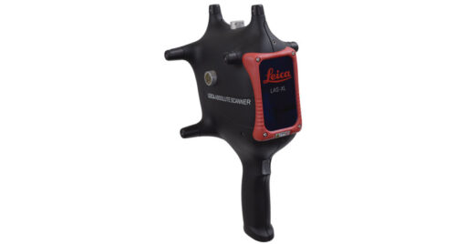
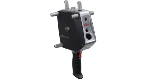
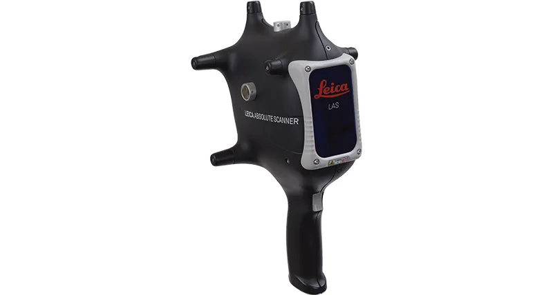
Bringing complete usability to shop-floor laser scanning, the Leica Absolute Scanner LAS is an affordable and easy-to-use way to add 3D digitisation to your metrology toolset.
Collecting accurate point-cloud data in measurement volumes of up to 60 metres, LAS-20-8 combines the six degrees of freedom (6DoF) measurement capabilities of the Leica Absolute Tracker AT960 coordinate measuring machine (CMM) with a lightweight and ergonomically-designed handheld laser scanner unit to provide a complete and user-friendly portable 3D scanning solution.
Optimised for manual inspection applications and offering excellent performance in non-contact freeform surface inspection, the LAS-20-8 handheld laser scanner is packed with operator-friendly features.
LAS automatically adjusts the laser intensity to adapt to changes in material or ambient light, so you can generate detailed dimensional data on even on shiny metallic or dark objects without spending time on surface preparation. Designed for quick changes between inspection techniques, the LAS scanner is automatically recognised by the laser tracker for seamless shifts between reflector, probe and scanner measurements, making it the perfect complement to the Leica T-Probe. You can also use the main button to select a customisable pre-set measurement profile, allowing you to use the optimum setup for each section of the part without needing to make adjustments in the software.
The scanner unit features a built-in guidelight and three line-of-sight indicators to ensure correct positioning for the best possible scan results. Visual, acoustic and haptic indicators enable you to see, hear and feel feedback from the scanner to give you complete confidence in your operations. IP50 rated and with a battery power option, LAS is the handheld laser scanning solution that can be taken anywhere.