Leica BLK3D

Contact Details

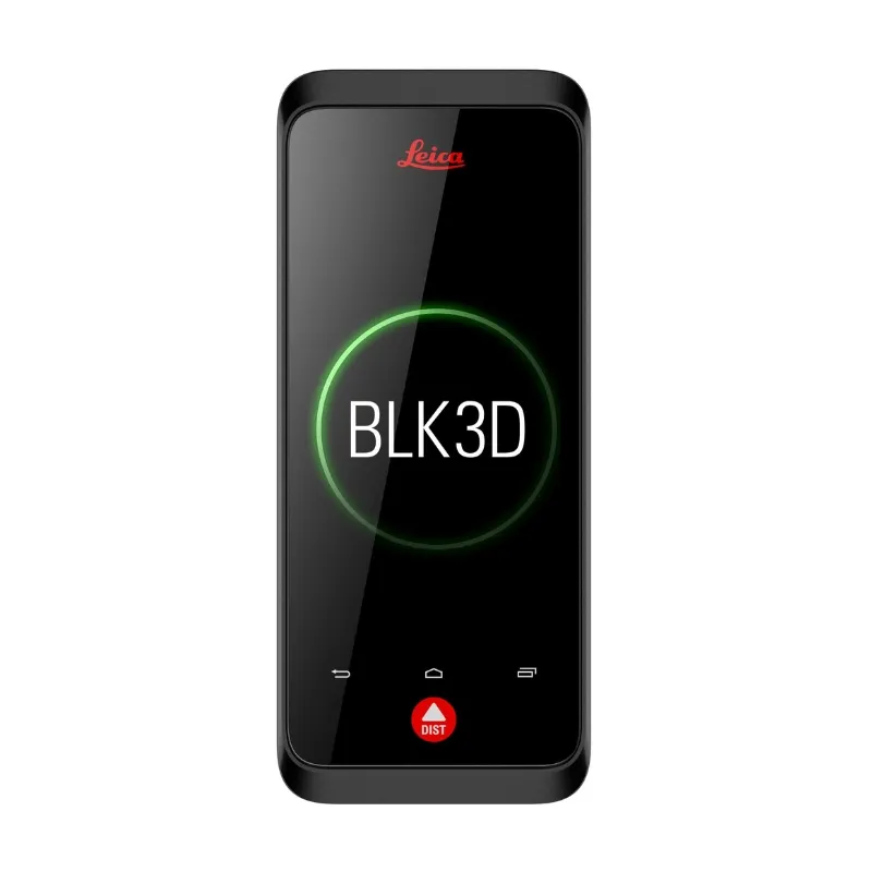
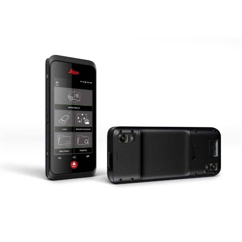
Capture Measurements Instantly with High Accuracy

The BLK3D revolutionizes measurement-taking by allowing you to extract precise dimensions directly from any image captured with the device. This cutting-edge solution simplifies documentation, enabling professionals to record as-built conditions and track project progress efficiently.

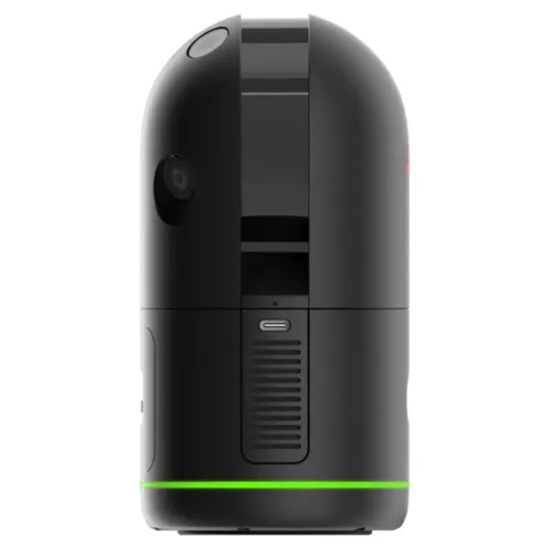
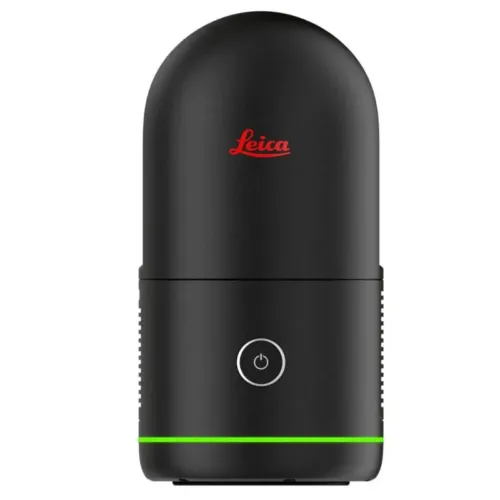
A Smart and Intuitive Photogrammetry Tool

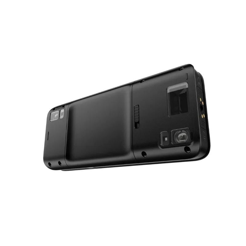
Designed for ease of use, the BLK3D combines advanced photogrammetry technology with a smartphone-like form factor. Equipped with intelligent edge detection algorithms, it enables accurate measurements within 2D images. The high-resolution touchscreen interface enhances usability, providing a seamless experience for professionals who demand precision.

Advanced Functionality for Various Applications

Built to support diverse workflows, the BLK3D empowers professionals to make faster, data-driven decisions. Whether it’s measuring inaccessible areas, creating detailed floor plans, estimating building installations, or documenting construction progress, this device streamlines tasks with efficiency. Its ability to generate measurable as-built documentation ensures reliability in architectural, engineering, and construction projects.

Seamless Data Storage, Access, and Sharing

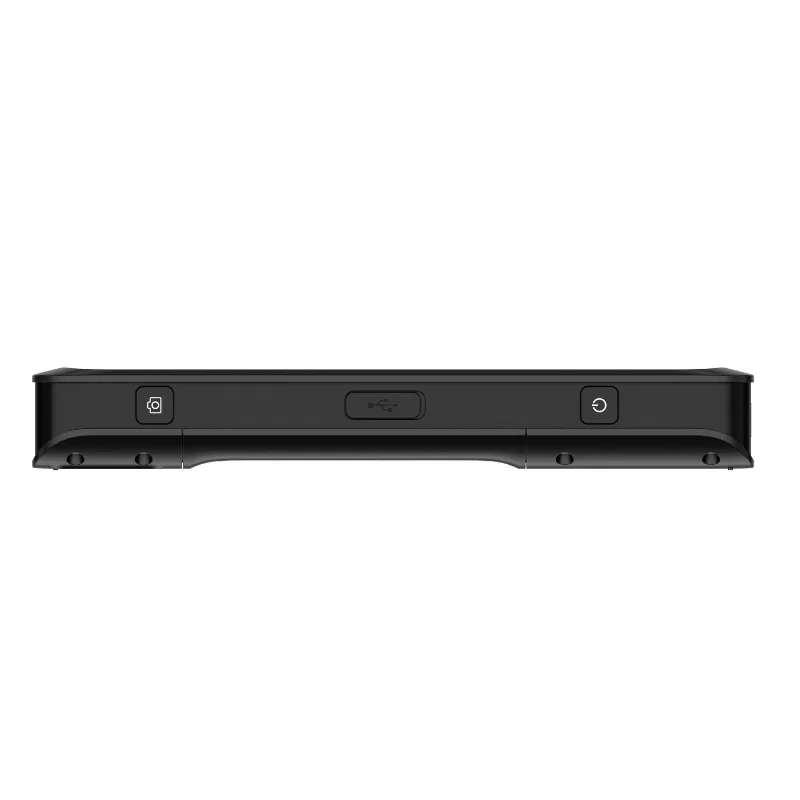
With versatile storage and transfer options, the BLK3D ensures that your data is always accessible. Store images directly on the device or transfer them effortlessly using USB-C or WLAN for integration with your computer. Organize projects efficiently by tagging images with searchable keywords, allowing for quick retrieval. Share measured images in multiple formats to enhance collaboration and workflow efficiency.

SKU: Leica BLK3D Category:

Description

Leica BLK3D

THE POWER OF PHOTOGRAMMETRY

Harness the Power of Photogrammetry

Now seamlessly integrated into your RTC360 and BLK360 data, photogrammetry empowers you to capture precise, measurable image data. Enhance your workflow with high-accuracy measurements, improved documentation, and streamlined project execution.

Leica BLK3D

Execute Cyclone FIELD 360 directly on the BLK3D and gain full control over your scans with precision and efficiency.

Capture Small and Inaccessible Spaces with Precision

Easily document and measure tight, confined, or hard-to-reach areas with advanced photogrammetry and scanning technology.

Eliminate Scan Shadows for Complete Data Capture

Accurately collect data in shadowed areas behind objects or beyond the scanner’s line of sight, ensuring comprehensive and precise documentation.

Capture data from concealed spaces, including the interiors of electrical panels, cabinets, and complex plumbing systems, ensuring thorough and accurate documentation.

Leave No Detail Behind

Save time, reduce costs, and minimize waste by capturing critical details on-site, ensuring nothing is overlooked on the first visit.

Plumbing

Document concealed plumbing infrastructure, even in areas hidden behind drop ceilings, ensuring accurate and comprehensive data capture.

Electrical

Obtain measurable data from inside electrical boxes, transfer switches, relays, and panels, enabling precise documentation for wire diagrams and future reference.

HVAC

Identify and document hidden decay in piping and electrical floor transitions, ensuring proactive maintenance and accurate system assessments.

Architectural Elements

Capture detailed cross-sectional data for precise documentation of architectural features and intricate design elements.

Place annotations directly in your 3D images to leave important notes.

Embed measurable images seamlessly into your 3D point clouds for enhanced visualization, analysis, and accurate documentation.

Annotate directly within your 3D images, adding notes for enhanced collaboration, documentation, and streamlined project workflows.

Specifications

BLK3D Specifications
Dimensions (H x W x D) 180.6 x 77.6 x 27.1 mm (7.11 x 3.06 x 1.07 in)
Weight (with rechargeable battery) 480 g (17 oz)
Temperature Range Storage: -25 to 60 °C (-13 to 140 °F)
Operation: -10 to 50 °C (14 to 122 °F)
Charging: 0 to 40 °C (32 to 104 °F)
Tripod Adapter Supports 1/4-20 UNC screw adapters
Article No. 869073
Technology
Operating System Android 7.1.2 (Nougat)
Processor (with integrated GPU) Snapdragon 820E QuadCore (2.35 GHz)
RAM Memory 4 GB
Real-time Processor STM32F446
Screen 5.0” IPS, HD 720x1280 LCD capacitive multi-touch screen, chemically strengthened, brightness: 450 cd/m²
Stereo Camera Pixels: 2 x 10 MP (15.8 cm diagonal baseline), Field of view: 80°, Focal length: 4.0 mm (22 mm in 35 mm equiv. in 1:1), Aperture: F3.0
EDM Camera Pixels: 2 MP, Field of view: 14°
I/O USB Type-C 1.0 for data transfer and charging (water-resistant), integrated speaker and microphone
Keyboard Three physical buttons (Power, Laser/Photo capture, Photo capture), four touch buttons (Back, Home, Recents, Laser/Photo capture)
Additional Sensors Compass, 3D accelerometer, 3D gyroscope
Laser Class 2
Laser Type 655 nm, 0.95 mW
Storage
Internal Storage 64 GB (equals 14,000 single-shot or 5,000 multi-shot 3D images)
Communication
Bluetooth® Smart Bluetooth® v4.1 and v2.1
Radiated power: 1.78 mW (BLE)
Radiated power: 10.00 mW (BT classic)
Frequency: 2402-2480 MHz
Wireless LAN Standard: 802.11 b/g/n
Radiated power: 6.31 mW
Frequency: 2412-2472 to 2412-2462 MHz
GPS A-GPS and GLONASS
Power Management
Battery Rechargeable battery pack Li-ion, (3.80 V, 3880 mAh, 14.7 Wh)
Power Management AC adapter (input: 100-240 V AC), External charger (input: 100-240 V AC) (optional)
Charge Time < 3.5 h (with AC adapter), < 5 h (with optional external charger)
Operating Time Typical capture: 4h / 220 multi-shot captures
Continuous capture: 2.5 h / 1000 single-shot captures
Laser measurements: 6.5 h / 9500 laser measurements
Auto power off after 3 h in sleep mode
Laser Distance Measurement
Accuracy (Favorable Conditions) ± 1.0 mm (0.04 in)
Accuracy (Unfavorable Conditions) ± 2.0 mm (0.08 in)
Range (Favorable Conditions) 250 m (820 ft)
Range (Unfavorable Conditions) 120 m (394 ft)
Smallest Unit Displayed 0.1 mm (1/32 in)
X-Range Power Technology™ Yes
Ø Laser Point at Distances 6 / 30 / 60 mm (10 / 50 / 100 m)
Tilt Measurement
Measuring Tolerance to Laser Beam ± 0.2°
Measuring Tolerance to Housing ± 0.2°
Range 360°
P2P Measurement with DST 360 (Optional)
Working Range Vertical Sensor -64° to > 90°
Accuracy Vertical Sensor Up To ± 0.1°
Working Range Horizontal Sensor 360°
Accuracy Horizontal Sensor Up To ± 0.1°
Tolerance P2P Function at Distances ± 2 mm / 2 m, ± 5 mm / 5 m, ± 10 mm / 10 m
Levelling Range ± 5°
Software Options Overview
BLK3D Mobile (Included) Reality Capture, Laser, Organiser, 3D Image export to PDF and JPG
Sketch & Document Option (Optional) Sketch Plan, P2P Measure, Smart Room, Plan export to PDF, JPG, DXF, and DWG (2D/3D/raw)
Autodesk BIM 360 Option (Optional) Work with Autodesk BIM 360 Docs projects
BLK3D Desktop Base (Optional) Organiser, Measure, Working with Plans
3D Model Option (Optional) 3D Modelling on 3D Images, including export to DXF and DWG (3D)
Publisher Option (Optional) Publish 3D Images to BLK3D Web
Autodesk BIM 360 Option (Optional) Work with Autodesk BIM 360 Docs projects
Minimum System Requirements Windows® 8.1, 10 with 64-bit; 6 GB RAM

1) Wi-Fi® off, Bluetooth® off, flash off, screen brightness 50%.

2) Applies to 100 % target reflectivity (white painted wall), low background illumination, 25 ºC.

3) Applies to 10 to 100 % target reflectivity, high background illumination, – 10 ºC to + 50 ºC.

4) Tolerances apply to ranges from 0.05 m to 10 m with a confidence level of 95%. The maximum tolerance may deteriorate to 0.1 mm/m between 10 m to 30 m, to 0.20 mm/m between 30 m to 100 m and to 0.30 mm/m for distances above 100 m.

5) After user calibration. Additional angle related deviation of ±0.0.1° per degree up to ±45° in each quadrant.

6) Valid Autodesk BIM 360 subscription required.

7) Tolerances apply to 2D measurements up to 3m in length (<20° depth).

BLK3D VIDEO

For privacy reasons YouTube needs your permission to be loaded. For more details, please see our Privacy Policy.
I Accept

Brand

Leica Geosystems

Leica Geosystems Saudi Arabia – Precision Meets Innovation

Introduction

Leica Geosystems Saudi Arabia delivers unmatched precision, durability, and advanced geospatial performance for professionals across construction, infrastructure, mining, and agriculture. For over 200 years, Leica has pioneered surveying instruments, GNSS/GPS systems, laser scanners, and software platforms that empower projects worldwide.

Trusted Worldwide, Available Locally in Saudi Arabia

Founded in Switzerland, Leica Geosystems has built a legacy of engineering excellence. Now available in Saudi Arabia through authorized dealers, Leica Geosystems Saudi Arabia products are adapted for the region’s challenging environments—providing local support, training, and calibrated precision.

Innovation in Every Leica Geosystems Product

Ranging from sophisticated total stations and GNSS receivers to mobile mapping and high-definition laser scanners, Leica Geosystems Saudi Arabia offers real-time accuracy and seamless digital workflows that boost project efficiency and reduce field downtime.

Key Achievements & Milestones

  • Over 200 years of geomatics innovation

  • Inventor of the world’s first digital level and early laser distance meters

  • Reality capture systems deployed in 100+ countries

  • Trusted in major infrastructure, metro, and oil & gas surveying

  • Adopted by engineers, surveyors, and government agencies worldwide

Why Choose Leica Geosystems in Saudi Arabia?

  • Localized support: Technical assistance, training, and product availability through authorized dealers

  • Unmatched accuracy: Instruments deliver centimeter-level precision and durability

  • Comprehensive portfolio: Full range from DISTO distance meters to robotic total stations and reality capture systems

  • Smart integration: Compatible with Hexagon, Autodesk, and other industry-leading software platforms

Leica Product Range in KSA

  • Total Stations – Manual and robotic total stations for construction and high-precision surveying.

  • Mobile Mapping Systems – Pegasus TRK Neo, Pegasus:Backpack, BLK2GO for vehicle, wearable, and handheld 3D capture

  • GPS & GNSS Equipment – GS18 I GNSS RTK rover, iCON GPS smart antennas offering tilt-compensated precision positioning

  • Ground Penetrating Radar (GPR) – Leica GPR solutions for accurate subsurface mapping

  • Laser Scanners – ScanStation P‑Series, RTC360, BLK360, and BLK2FLY for HD 3D scanning and digital twin workflows

  • DISTO Laser Distance Meters & Levels – Leica DISTO™ meter series and LINO/Rugby laser levels for point‑to‑point measurements and leveling

Leica Cyclone Software Portfolio

  • Cyclone REGISTER 360 PLUS – Guided workflows to register and visualize point cloud datasets with automation for efficient office workflows

  • Cyclone 3DR – End-to-end solution to analyze and model point clouds into actionable 3D deliverables

  • Cyclone Enterprise – On‑premise project and data management platform for centralized reality capture workflows

  • Cyclone Cloud – Subscription-based SaaS portal offering centralized license management and secure cloud-hosted service access

Get in Touch - Contact Us

Discover how Leica Geosystems Saudi Arabia solutions can elevate your next project. Reach out to your authorized local distributor to request demos, pricing, and expert consultation tailored to your requirements.

Official Website: www.leica-geosystems.com

Leica Geosystems is a world leader in precision surveying and geospatial solutions with over 200 years of expertise. From total stations and GNSS/GPS receivers to 3D laser scanning systems, Leica products deliver exceptional accuracy and reliability for construction, infrastructure, and mapping projects in Saudi Arabia and worldwide.

Reviews

There are no reviews yet.

Only logged in customers who have purchased this product may leave a review.

Title

Go to Top