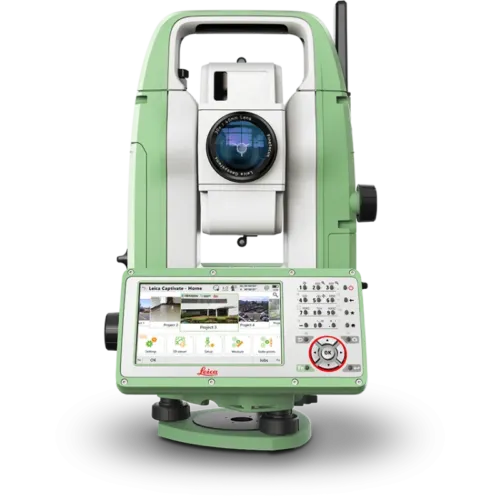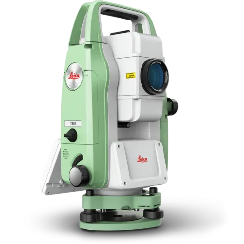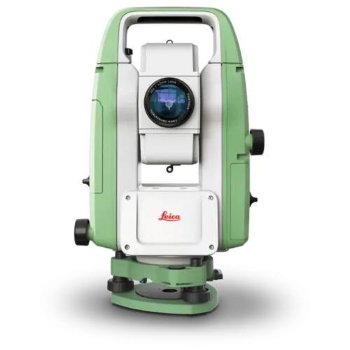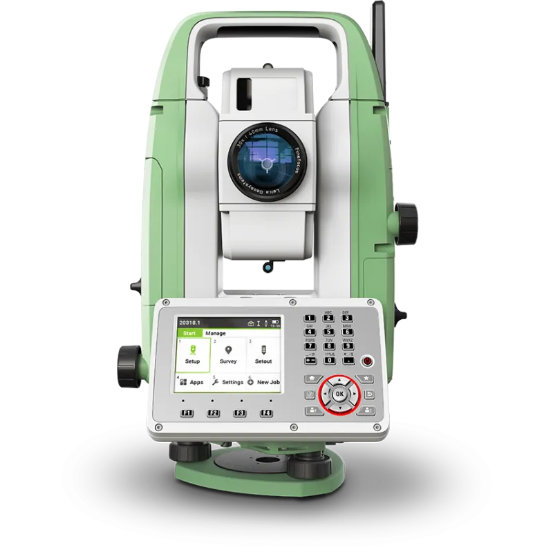
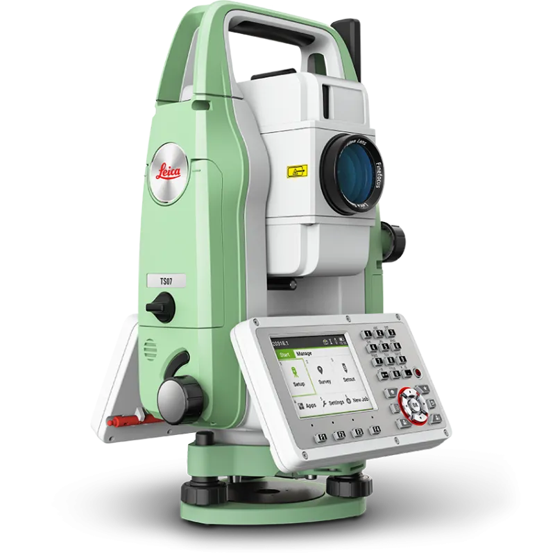
The Leica FlexLine TS07 high-quality, manual total station is based on a proven product concept that has been revolutionising the world of measurement and survey for nearly 200 years. The Leica TS07 is equipped with a comprehensive application-based software package – Leica FlexField software – that enables most survey and stakeout tasks to be carried out easily and efficiently. The new FlexLine TS07 works reliably and delivers accurate results even in the harshest environments.
• Work faster: measure more points per day due to faster measurement and stakeout procedures (endless drives, trigger key, drives on both sides, pinpoint EDM and more), supported by our comprehensive and user-friendly Leica FlexField software.
• Use it trouble-free: increase productivity and minimise downtime by relying on instruments that simply work and come with a global service and support network.
• Choose products that are built to last: FlexLine operates with the same high level of quality even after years of use under harsh conditions (like mud, dust, blowing rain, extreme heat and cold).
• Control your investment: reliability, speed and accuracy ensure a lower investment over the product lifetime and a higher resell value.
• Save time with AutoHeight: measure, read and set the instrument height automatically with this revolutionary feature in the FlexLine TS07 (optional). Errors are minimised and the setup process onsite is faster.
Leica FlexLine TS07 Manual Total Station
Contact Details
| Leica FlexLine TS07 | ||
| ANGULAR MEASUREMENT | ||
| Accuracy Hz and V | Absolute, continuous, diametrical1 | 1’’ / 2’’ / 3’’ / 5’’ / 7“ |
|
 |
|
| DISTANCE MEASUREMENT | ||
| Range |
|
|
| Non-Prism / Any surface | ||
| R500 | |
|
| R1000 |  |
|
| Accuracy / Measurement time |
Single prism
|
|
Non-Prism / Any surface
|
|
|
| Laser dot size |
|
|
| Telescope |
|
|
| GENERAL | ||
| Display and keyboard | 3.5“ (inch), 320 x 240 px QVGA, colour, touch, 28 keys5b | |
| 2nd keyboard | |
|
| Key illumination | |
|
| Operation |
|
|
| Power management | Exchangeable Lithium-Ion battery | |
| Operating time with GEB361 | up to 30h | |
| Operating time with GEB331 | up to 15h | |
| Battery charging time with | ||
| GKL341 charger for GEB361 / GEB331 | 3h 30min / 3h | |
| GKL311 charger for GEB361 / GEB331 | 6h 30min / 3h 30min | |
| Data storage |
|
|
| Processor |
|
|
| Interfaces | RS2327, USB device | |
| Bluetooth®8, WLAN9 | |
|
| Mobile Data sidecover: LTE-Modem for internet access | |
|
| Guide Light (EGL) |
|
(R1000) |
| Laser plummet (Laserclass 2) |
Accuracy
|
|
| AutoHeight module for automatic instrument height measurement (Laserclass 2) | Accuracy
|
|
| Weight | 4.3 - 4.5kg | |
| Environmental specifications | Working temperature range: –20°C to +50°C | |
| Arctic version: –35°C to +50°C | |
|
| Dust / Water (IEC 60529) / Humidity: IP66 / 95%, non-condensing | |
|
| Military Standard 810G, Method 506.5 | |
|
Leica Geosystems
Leica Geosystems Saudi Arabia – Precision Meets Innovation
Introduction
Leica Geosystems Saudi Arabia delivers unmatched precision, durability, and advanced geospatial performance for professionals across construction, infrastructure, mining, and agriculture. For over 200 years, Leica has pioneered surveying instruments, GNSS/GPS systems, laser scanners, and software platforms that empower projects worldwide.
Trusted Worldwide, Available Locally in Saudi Arabia
Founded in Switzerland, Leica Geosystems has built a legacy of engineering excellence. Now available in Saudi Arabia through authorized dealers, Leica Geosystems Saudi Arabia products are adapted for the region’s challenging environments—providing local support, training, and calibrated precision.
Innovation in Every Leica Geosystems Product
Ranging from sophisticated total stations and GNSS receivers to mobile mapping and high-definition laser scanners, Leica Geosystems Saudi Arabia offers real-time accuracy and seamless digital workflows that boost project efficiency and reduce field downtime.
Key Achievements & Milestones
-
Over 200 years of geomatics innovation
-
Inventor of the world’s first digital level and early laser distance meters
-
Reality capture systems deployed in 100+ countries
-
Trusted in major infrastructure, metro, and oil & gas surveying
-
Adopted by engineers, surveyors, and government agencies worldwide
Why Choose Leica Geosystems in Saudi Arabia?
-
Localized support: Technical assistance, training, and product availability through authorized dealers
-
Unmatched accuracy: Instruments deliver centimeter-level precision and durability
-
Comprehensive portfolio: Full range from DISTO distance meters to robotic total stations and reality capture systems
-
Smart integration: Compatible with Hexagon, Autodesk, and other industry-leading software platforms
Leica Product Range in KSA
-
Leica Total Stations – Manual and robotic total stations for construction and high-precision surveying.
-
Leica Mobile Mapping Systems – Pegasus TRK Neo, Pegasus:Backpack, BLK2GO for vehicle, wearable, and handheld 3D capture
-
Leica GPS & GNSS Equipment – GS18 I GNSS RTK rover, iCON GPS smart antennas offering tilt-compensated precision positioning
-
Ground Penetrating Radar (GPR) – Leica GPR solutions for accurate subsurface mapping
-
Leica Laser Scanners – ScanStation P‑Series, RTC360, BLK360, and BLK2FLY for HD 3D scanning and digital twin workflows
-
Leica DISTO & Leica Levels – Leica DISTO™ meter series and LINO/Rugby laser levels for point‑to‑point measurements and leveling
Leica Cyclone Software Portfolio
-
Cyclone REGISTER 360 PLUS – Guided workflows to register and visualize point cloud datasets with automation for efficient office workflows
-
Cyclone 3DR – End-to-end solution to analyze and model point clouds into actionable 3D deliverables
-
Cyclone Enterprise – On‑premise project and data management platform for centralized reality capture workflows
-
Cyclone Cloud – Subscription-based SaaS portal offering centralized license management and secure cloud-hosted service access
Get in Touch - Contact Us
Discover how Leica Geosystems Saudi Arabia solutions can elevate your next project. Reach out to your authorized local distributor to request demos, pricing, and expert consultation tailored to your requirements.
Official Website: www.leica-geosystems.com
Leica Geosystems is a world leader in precision surveying and geospatial solutions with over 200 years of expertise. From total stations and GNSS/GPS receivers to 3D laser scanning systems, Leica products deliver exceptional accuracy and reliability for construction, infrastructure, and mapping projects in Saudi Arabia and worldwide.