Leica TDRA6000 Laser Station

Contact Details

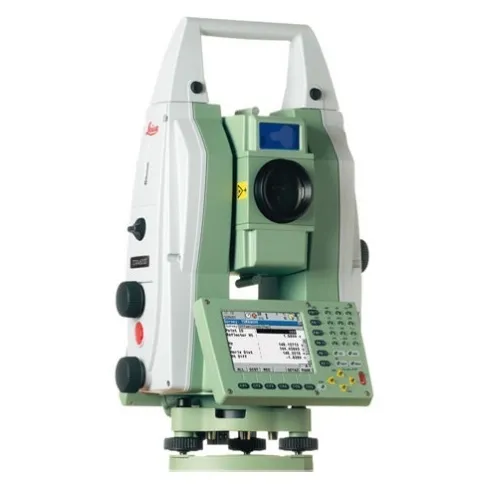
The new Leica TDRA6000 introduces new and improved technology. With an all new direct drive technology, reflectorless measurements and a typical 3D point accuracy of 0.25 mm at 35 meters, this new generation of Laser Station incorporates Leica Geosystems’ long experience developing industrial laser stations.

The new Leica TDRA6000 is the most accurate total station ever designed for industrial use. This new Leica Geosystems laser station has the ability to automatically target both CCR and tape targets and can even measure without targets maintaining a typical reflectorless accuracy of 1 mm. Optimized for use within 300 meters and combined with the Leica Geosystems PowerSearch module, the new Leica TDRA6000’s tracking performance is simply unbeatable.
An all new Leica Geosystems proprietary direct drive technology has been designed from the ground up for this new sensor. Based on Piezo technology, these new direct drives enable high speed motorization and acceleration, at up to 4x the previous generation, but still allow sub micron level fine positioning. This technology has very low power consumption, requires almost no maintenance and is near silent.

Combined with the right software package like DCP05 or Microlog, the Leica TDRA6000 is a top level solution for industrial metrology.

SKU: Leica TDRA6000 Category:

Description

Leica Geosystems introduced the world to Industrial Total Stations in 1983 with the legendary TC2002. In 1995 we introduced the TPS5000 series as the world’s first fully automated tracking Industrial Total Station. For decades, Leica Geosystems has supplied thousands of Industrial Theodolites and Total Stations worldwide – many in the toughest industrial environments imaginable,
indoors and outdoors. Their ease of use and one-man operation capability make them the obvious choice for a large variety of metrology tasks in aerospace and shipbuilding as well as general precision applications. We have spent the last 25 years perfecting the Total Station for use in industrial environments, and the latest Leica Geosystems Laser Station incorporates everything that we have learned along the way.

A new high speed absolute angle encoder paired with our 4th generation Automatic Target Recognition (ATR) technology give the Leica TDRA6000 Laser Station the best tracking performance in its class. This new quadruple angle detection system is accurate to 0.5 Arc Seconds (1σ). The ATR and encoder feedback loop has been optimized for use with 1.5” corner cube reflectors and is specially tuned for use in a 600m volume.

The PinPoint Reflectorless Distance Meter allows non-contact measurements within the full 600 m volume, and has a very small visible beam that allows precision measurements on difficult surfaces. This new EDM is based on our proven System Analyzer technology that takes advantage of both phase and time-of-flight information. The System Analyzer accuracy is further enhanced (specifically on corner cube reflectors) by passing the laser beam through a new anamorphic lens. This lens reshapes the beam with an optimized profile and footprint allowing the inhomogeneous peripheral light to be cut off from the laser beam completely.

Brand

Leica Geosystems

Leica Geosystems Saudi Arabia – Precision Meets Innovation

Introduction

Leica Geosystems Saudi Arabia delivers unmatched precision, durability, and advanced geospatial performance for professionals across construction, infrastructure, mining, and agriculture. For over 200 years, Leica has pioneered surveying instruments, GNSS/GPS systems, laser scanners, and software platforms that empower projects worldwide.

Trusted Worldwide, Available Locally in Saudi Arabia

Founded in Switzerland, Leica Geosystems has built a legacy of engineering excellence. Now available in Saudi Arabia through authorized dealers, Leica Geosystems Saudi Arabia products are adapted for the region’s challenging environments—providing local support, training, and calibrated precision.

Innovation in Every Leica Geosystems Product

Ranging from sophisticated total stations and GNSS receivers to mobile mapping and high-definition laser scanners, Leica Geosystems Saudi Arabia offers real-time accuracy and seamless digital workflows that boost project efficiency and reduce field downtime.

Key Achievements & Milestones

  • Over 200 years of geomatics innovation

  • Inventor of the world’s first digital level and early laser distance meters

  • Reality capture systems deployed in 100+ countries

  • Trusted in major infrastructure, metro, and oil & gas surveying

  • Adopted by engineers, surveyors, and government agencies worldwide

Why Choose Leica Geosystems in Saudi Arabia?

  • Localized support: Technical assistance, training, and product availability through authorized dealers

  • Unmatched accuracy: Instruments deliver centimeter-level precision and durability

  • Comprehensive portfolio: Full range from DISTO distance meters to robotic total stations and reality capture systems

  • Smart integration: Compatible with Hexagon, Autodesk, and other industry-leading software platforms

Leica Product Range in KSA

  • Total Stations – Manual and robotic total stations for construction and high-precision surveying.

  • Mobile Mapping Systems – Pegasus TRK Neo, Pegasus:Backpack, BLK2GO for vehicle, wearable, and handheld 3D capture

  • GPS & GNSS Equipment – GS18 I GNSS RTK rover, iCON GPS smart antennas offering tilt-compensated precision positioning

  • Ground Penetrating Radar (GPR) – Leica GPR solutions for accurate subsurface mapping

  • Laser Scanners – ScanStation P‑Series, RTC360, BLK360, and BLK2FLY for HD 3D scanning and digital twin workflows

  • DISTO Laser Distance Meters & Levels – Leica DISTO™ meter series and LINO/Rugby laser levels for point‑to‑point measurements and leveling

Leica Cyclone Software Portfolio

  • Cyclone REGISTER 360 PLUS – Guided workflows to register and visualize point cloud datasets with automation for efficient office workflows

  • Cyclone 3DR – End-to-end solution to analyze and model point clouds into actionable 3D deliverables

  • Cyclone Enterprise – On‑premise project and data management platform for centralized reality capture workflows

  • Cyclone Cloud – Subscription-based SaaS portal offering centralized license management and secure cloud-hosted service access

Get in Touch - Contact Us

Discover how Leica Geosystems Saudi Arabia solutions can elevate your next project. Reach out to your authorized local distributor to request demos, pricing, and expert consultation tailored to your requirements.

Official Website: www.leica-geosystems.com

Leica Geosystems is a world leader in precision surveying and geospatial solutions with over 200 years of expertise. From total stations and GNSS/GPS receivers to 3D laser scanning systems, Leica products deliver exceptional accuracy and reliability for construction, infrastructure, and mapping projects in Saudi Arabia and worldwide.

Reviews

There are no reviews yet.

Be the first to review “Leica TDRA6000 Laser Station”

Title

Go to Top