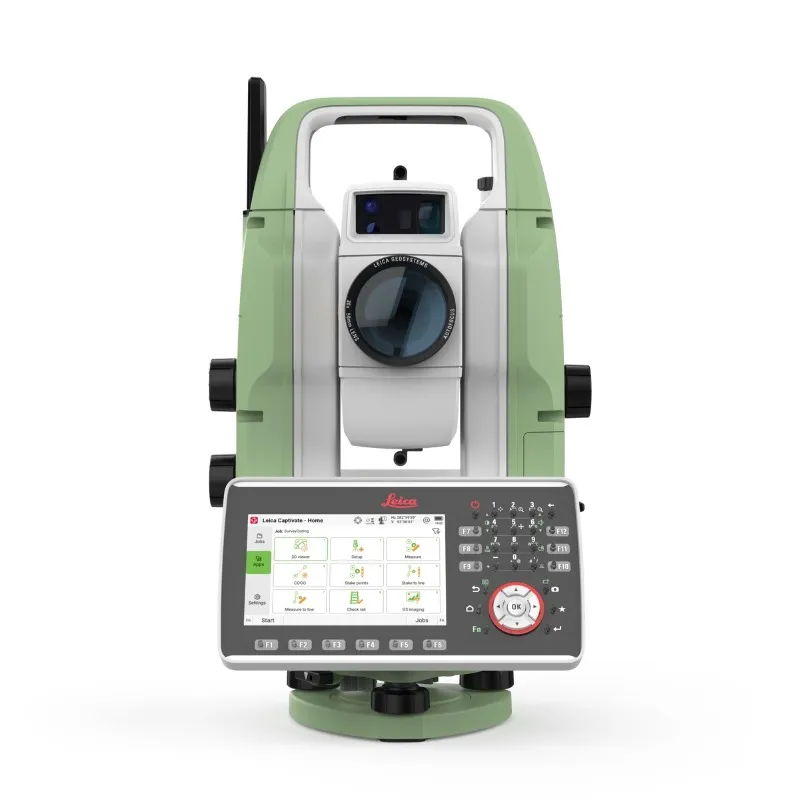
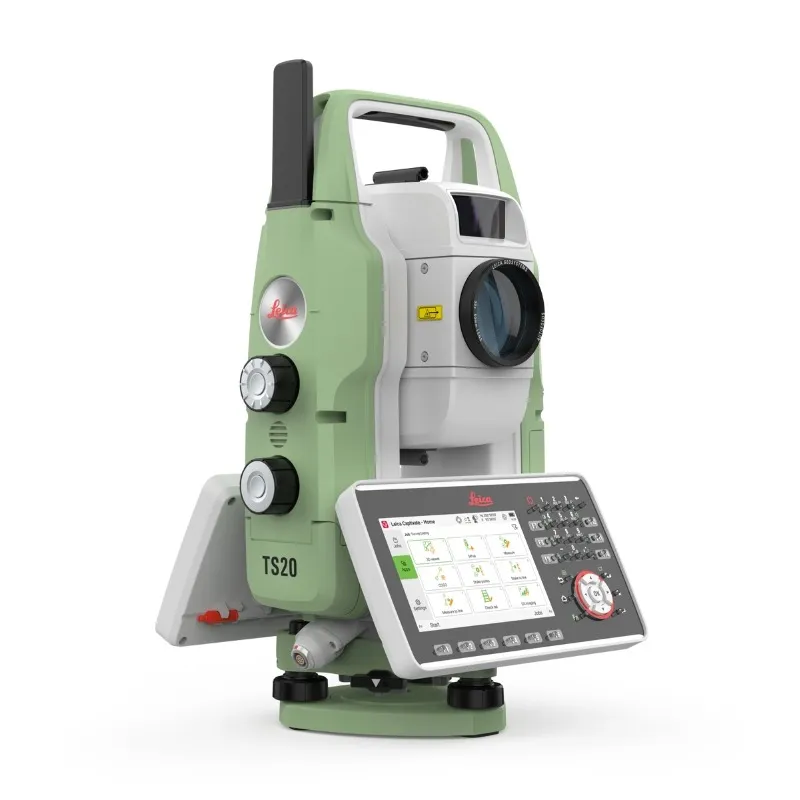
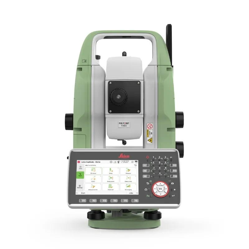
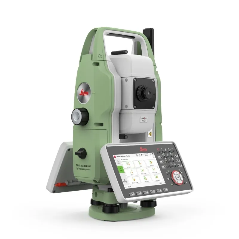
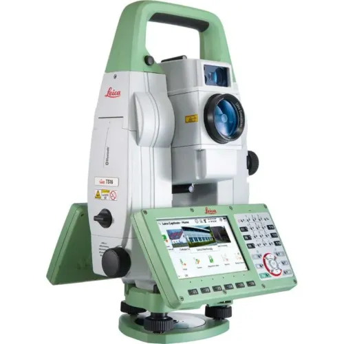
Leica TS20 Robotic Total Station sets a new standard in precision surveying by combining edge AI technology, next-generation EDM performance, and a faster Leica Captivate platform. Built for demanding field environments, it delivers unmatched speed, accuracy, and intelligent automation.
– Edge AI with built-in NPU powers AI-Detect for automatic prism recognition and AI-driven Search & ATR, ensuring rapid and reliable target acquisition. – AI-Follow ready – future firmware update will enable fully automated prism tracking for maximum productivity. – Next-generation EDM provides high-frequency measurements and superior prism lock, even in fog, rain, or low-visibility conditions. – Enhanced Captivate performance offers faster processing and smoother workflows across all tasks. – Rugged and maintenance-free with IP66 protection and brushless BLDC motors for long-term durability. – Seamless connectivity and security through mobile data, Wi-Fi, and Bluetooth, plus GeoCloud Protect to safeguard your equipment. – One-person workflow – fully compatible with the Leica AP20 AutoPole for faster, smarter field operations.
Prepare for exceptional surveying performance with a total station that sets a new benchmark for productivity and leads the way in the future of robotic technology.
The Leica TS20 is a true productivity powerhouse, built to handle everything from cadastral surveys to complex construction projects with ease. Equipped with advanced automation, robust IP66 protection, integrated connectivity, cloud-based services, and fast, maintenance-free motors, it delivers consistent performance and reliability even in the toughest site conditions.
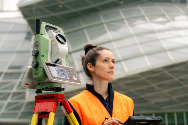
From establishing control networks to measuring points and staking out designs, the TS20 provides a next-generation total station experience that enables surveyors to work faster, minimize errors, and maintain complete confidence in every task. Get ready to take your surveying to the next level and embrace the future of robotic technology.
Advanced Automation
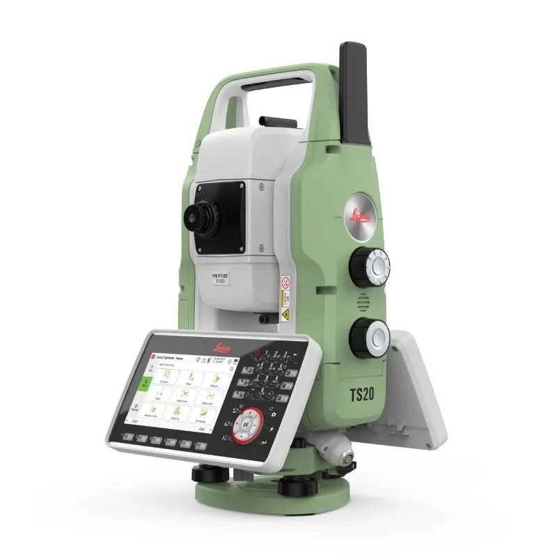
The TS20 introduces next-level intelligence with its built-in NPU, bringing powerful in-field processing directly to your total station. It automatically recognizes prism types and enhances measuring efficiency through AI-driven search and precise target aiming — even when working with reflective tapes.
Leica AP20 optimised
The TS20 and AP20 form a unique productivity pair, creating a smart prism pole solution designed for maximum efficiency. This combination delivers the strongest prism lock, effortless height adjustments, and flexible tilted measuring, bringing together speed and precision for truly seamless workflows.
All-weather ready
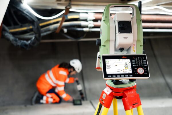
Rain or shine, the TS20 is built to keep working. With IP66-rated protection against dust and water, combined with AI-powered target aiming trained to perform in the harshest conditions, it delivers precise measurements no matter the weather.
Surveying services
Stay seamlessly connected with GeoCloud Drive’s cloud-based data exchange, ensuring all your information is stored and synchronized in real time. GeoCloud Protect adds an extra layer of security with easy tracking and remote locking, so you always know the location of your TS20 — and only your team can access it.
Connected
Strong connectivity drives success. The TS20 offers versatile communication options, including integrated mobile data, WLAN, Ethernet, and long-range Bluetooth, enabling secure remote access and efficient data management wherever the job takes you.
Excellence you expect
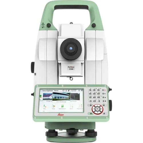
Turn exceptional performance into your everyday standard. With high-speed motors, precise PinPoint EDM, AutoHeight, and more, the TS20 enhances and builds upon the proven excellence that defines Leica’s robotic total stations.
Be ready with the optimal workflow
PREPARE
Use Leica Infinity to fully prepare your TS20 for the field. Import design files and data, set up and modify jobs, define coordinate systems, and manage all essential project information in advance. With GeoCloud Drive, seamlessly send everything to Leica Captivate, so your team is ready to work the moment they arrive on site.
MEASURE AND STAKE
In the field, collect, visualise, and verify data effortlessly using the powerful Leica Captivate software with its immersive 3D capabilities. Pair it with the AP20 to measure and stake out more efficiently, reducing the number of total station setups and speeding up your entire workflow.
TRANSFER DATA
Send your collected data straight to GeoCloud Drive. It’s securely stored in the cloud and immediately available for office teams to review or begin processing eliminating delays and preventing data gaps.
PROCESS AND DELIVER
Manage and process your datasets in Leica Infinity, combining TS20 results with data from other survey instruments. Create clear survey deliverables with CAD drafting, add notes, export to BIM and CAD applications, send updated data back to the field, and more all within a streamlined workflow.
For privacy reasons YouTube needs your permission to be loaded. For more details, please see our Privacy Policy.
Measure points faster and with greater accuracy in every condition
The Leica TS20 sets a new benchmark for productivity by excelling in the two areas that matter most: speed and precision.
Surveying often requires measuring and staking out a large number of points each day while keeping errors to a minimum to save both time and costs.
Speed is achieved through a combination of AI-powered target search, automatic target recognition, and reliable locking, supported by fast brushless motors and advanced EDM technology. Whether working with prisms or reflective tapes, the TS20 keeps pace with your workflow. Its IP66 protection ensures performance remains consistent, even in challenging weather conditions.
Accuracy is enhanced with AI-Detect, which identifies prism types automatically so that measurements are always recorded with the correct settings. The upcoming AI-Follow feature, launching in 2026, will allow the TS20 to maintain lock on the AP20 prism even when the line of sight is briefly obstructed.
Together, these capabilities increase the number of points measured while minimizing errors. Less rework and fewer corrections make the TS20 a true standard of efficiency for any project, from cadastral surveys to complex construction tasks such as railways, tunnels, bridges, buildings, and highways.
The Leica TS20 combines power, efficiency, and intelligent design to help you perform at your best today while staying ready for tomorrow’s projects. With faster motors, long-range EDM, advanced optics, and built-in mobile and Ethernet connectivity, it delivers a new level of productivity without compromising quality.
While packed with innovation, the TS20 retains the familiar user experience professionals rely on. Its fast processor keeps Leica Captivate responsive, and the intuitive multi-touch screen with zoom and pan makes onboard operation smooth and efficient. Integrated connectivity enables seamless adoption of cloud-based data and sensor services whenever you are ready.
As the only robotic total station equipped with a neural processing unit (NPU), the TS20’s AI automation will continue to advance through software updates. This ensures reliable prism detection and target locking, even in demanding environments and adverse weather conditions.
By combining Leica’s proven precision and reliability with future-focused technology, the TS20 delivers both immediate performance gains and lasting value for years to come.
Leica Geosystems Saudi Arabia – Precision Meets Innovation
Introduction
Leica Geosystems Saudi Arabia delivers unmatched precision, durability, and advanced geospatial performance for professionals across construction, infrastructure, mining, and agriculture. For over 200 years, Leica has pioneered surveying instruments, GNSS/GPS systems, laser scanners, and software platforms that empower projects worldwide.
Trusted Worldwide, Available Locally in Saudi Arabia
Founded in Switzerland, Leica Geosystems has built a legacy of engineering excellence. Now available in Saudi Arabia through authorized dealers, Leica Geosystems Saudi Arabia products are adapted for the region’s challenging environments—providing local support, training, and calibrated precision.
Innovation in Every Leica Geosystems Product
Ranging from sophisticated total stations and GNSS receivers to mobile mapping and high-definition laser scanners, Leica Geosystems Saudi Arabia offers real-time accuracy and seamless digital workflows that boost project efficiency and reduce field downtime.
Key Achievements & Milestones
Over 200 years of geomatics innovation
Inventor of the world’s first digital level and early laser distance meters
Reality capture systems deployed in 100+ countries
Trusted in major infrastructure, metro, and oil & gas surveying
Adopted by engineers, surveyors, and government agencies worldwide
Why Choose Leica Geosystems in Saudi Arabia?
Localized support: Technical assistance, training, and product availability through authorized dealers
Unmatched accuracy: Instruments deliver centimeter-level precision and durability
Comprehensive portfolio: Full range from DISTO distance meters to robotic total stations and reality capture systems
Smart integration: Compatible with Hexagon, Autodesk, and other industry-leading software platforms
Leica Product Range in KSA
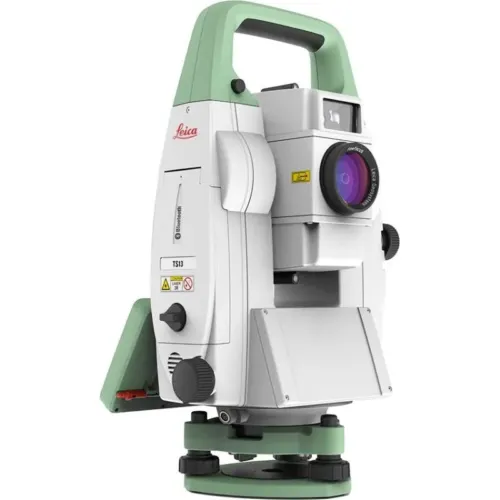
Leica Total Stations – Manual and robotic total stations for construction and high-precision surveying.
Leica Mobile Mapping Systems – Pegasus TRK Neo, Pegasus:Backpack, BLK2GO for vehicle, wearable, and handheld 3D capture
Discover how Leica Geosystems Saudi Arabia solutions can elevate your next project. Reach out to your authorized local distributor to request demos, pricing, and expert consultation tailored to your requirements.
Leica Geosystems is a world leader in precision surveying and geospatial solutions with over 200 years of expertise. From total stations and GNSS/GPS receivers to 3D laser scanning systems, Leica products deliver exceptional accuracy and reliability for construction, infrastructure, and mapping projects in Saudi Arabia and worldwide.