Leica Viva GS16 GNSS Smart Antenna

Contact Details

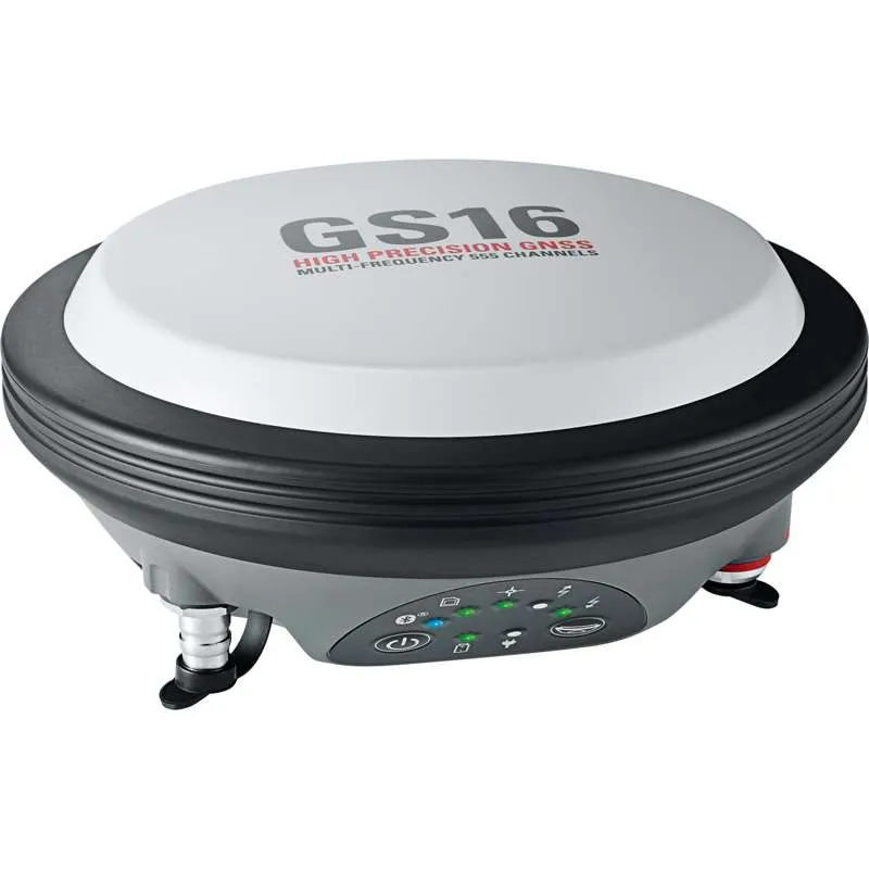
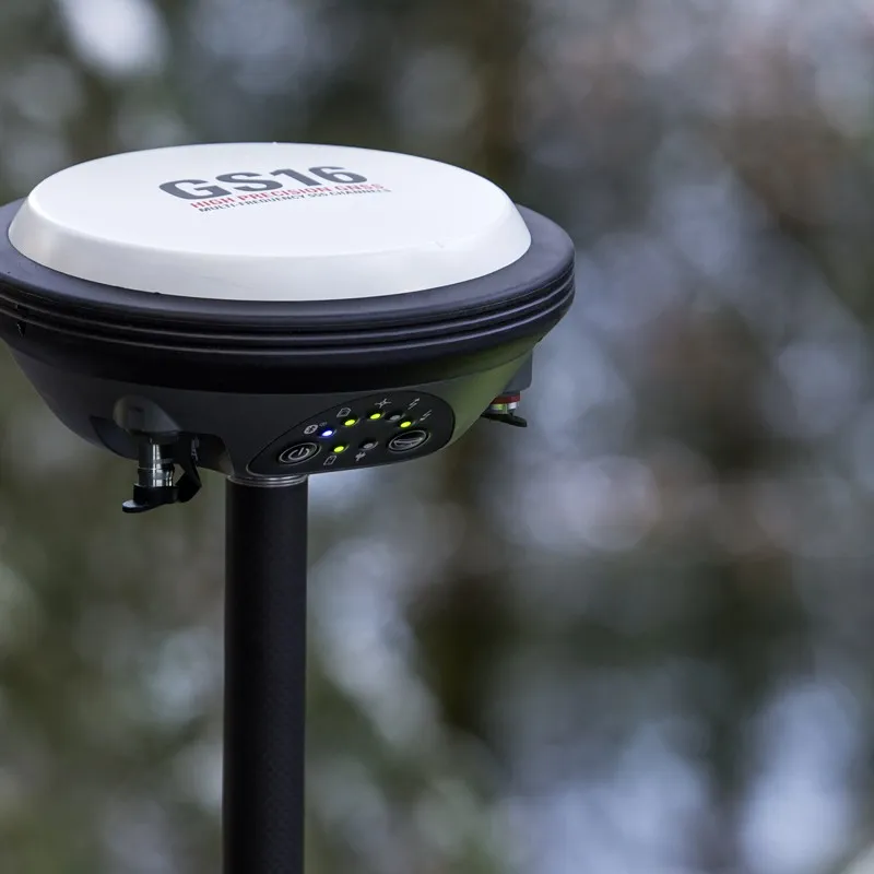
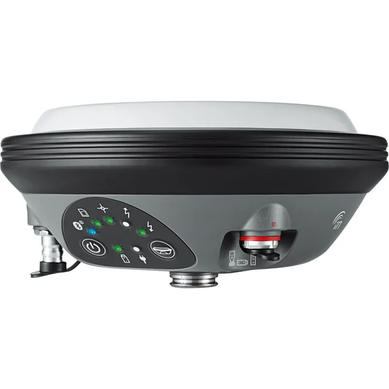
The Leica Viva GS16 is the most powerful and compact, self-learning GNSS smart antenna. Operating with the principal RTK technology, the Viva GS16 meets the uppermost standards in measurement superiority with SmartLink and RTKplus. The increasing number of signals from an expanding satellite constellation requires a GNSS receiver to be quicker and smarter. RTKplus intelligently adjusts to altering conditions by choosing the optimum signals to provide the most accurate positions. Work more efficiently and in more demanding environments than ever before.

Enjoy continuous precise positioning even if your local correction service is not available due to obstacles or shortage of cellular coverage with the global SmartLink service.

Engaging software
The Leica Viva GS16 GNSS smart antenna comes with the ground-breaking Captivate software, turning complicated data into the most realistic and workable 3D models. With easy-to-use applications and recognised touch technology, all forms of design and measured data can be viewed in all dimensions. Leica Captivate spans applications and industries with hardly any more than a swipe, regardless of whether you work with total stations, GNSS or both.

Infinite possibilities
While Captivate captures and models data in the field, Leica Infinity software processes the information back in the office. A smooth data transfer ensures the project stays on track. Captivate and Infinity work in conjunction to join previous survey data and edit projects faster and more efficiently.

Powerful handheld devices
The Leica CS35 tablet and CS20 controller provide the essential control, convenience and absolute mobility. Touch-screen technology allows for comfortable and fast data processing while an impressive 3D view transforms your experience.


Share data among instruments
Leica Infinity imports data from your GNSS, total station and level instruments for one complete and precise result. Processing has never been made easier when all your instruments work in together to produce accurate and actionable information.

SKU: Leica Viva GS16 Category:

Description

RTKplus

  • 555 channels for more signals, faster acquisition and improved sensitivity
  • Intelligent management of multi-frequency, multi-constellation signals
  • Intelligent selection to automatically reject reflected or noisy signals


SMARTCHECK

  • Unique RTK technology provides continuous checks to guarantee correct results
  • Initialisation within seconds
  • Complete reliability


SMARTLINK

  • Achieve centimetre accurate positioning worldwide – perfect when working in remote areas around the globe
  • No RTK base station or RTK network required, correction data is continuously transmitted by satellite delivering global coverage
  • Bridging RTK outages for uninterrupted centimetre Positioning


BUILT FOR THE MOST DEMANDING ENVIRONMENTS

  • IP68 protection
  • Built for extreme temperatures of -40°C to +65°C
  • Fulfils toughest standards throughout the complete product lifetime


ERGONOMICS

  • Integrated mobile phone and UHF radio RTK devices
  • Compact housing
  • Lightweight


ONLINE SERVICES

  • SmartNet Satellite Positioning – your No.1 partner for network RTK
  • Leica Active Assist – the next level in support
  • Leica Exchange – transfer data easily, quickly and safely

Leica Viva GS16 Datasheet

GNSS TECHNOLOGY
Self-learning GNSS Leica RTKplus
SmartLink (worldwide correction service)
SmartLink fill (worldwide correction service)
Adaptive on-the-fly satellite selection
Remote precise point positioning (3 cm 2D)1
Initial convergence to full accuracy 20 - 40 min, Re-convergence < 1 min
Bridging of RTK outages up to 10 min (3 cm 2D)1
Leica SmartCheck Continuous check of RTK solution Reliability 99.99%
Signal tracking GPS (L1, L2, L2C, L5), Glonass (L1, L2), BeiDou (B1, B2, B32), Galileo (E1, E5a, E5b, Alt-BOC, E62), QZSS3, SBAS (WAAS, EGNOS, MSAS, GAGAN), L-band
Number of channels 555 (more signals, fast acquisition, high sensitivity)
MEASUREMENT PERFORMANCE & ACCURACY
Time for initialisation Typically 4 s
Real-time kinematic
(Compliant to ISO17123-8 standard)
Single baseline
Network RTK
Hz 8 mm + 1 ppm / V 15 mm + 1 ppm
Hz 8 mm + 0.5 ppm / V 15 mm + 0.5 ppm
Post processing Static (phase) with long observations
Static and rapid static (phase)
Hz 3 mm + 0.1 ppm / V 3.5 mm + 0.4 ppm
Hz 3 mm + 0.5 ppm / V 5 mm + 0.5 ppm
Code differential DGPS / RTCM Typically 25 cm
COMMUNICATIONS
Communication ports Lemo
Bluetooth®
USB and RS232 serial
Bluetooth® v2.00 + EDR, class 2
Communication protocols RTK data protocols
NMEA output
Network RTK
Leica, Leica 4G, CMR, CMR+, RTCM 2.2, 2.3, 3.0, 3.1, 3.2 MSM
NMEA 0183 V 4.00 and Leica proprietary
VRS, FKP, iMAX, MAC (RTCM SC 104)
Built-in data links 3.75G GSM / UMTS / CDMA phone modem
Radio modem
Fully integrated, internal antenna
Fully integrated, receive and transmit, external antenna
403 - 470 MHz, 1 W output power, up to 28800 bps over air
External data links GSM / GPRS / UMTS / CDMA and UHF / VHF modem
GENERAL
Field controller and software Leica Captivate software Leica CS20 field controller, Leica CS35 tablet
User interface Buttons and LEDs
Web server
On / Off and Function button, 7 status LEDs
Full status information and configuration options
Data recording Storage
Data type and recording rate
Removable microSD card, 8 GB
Leica GNSS raw data and RINEX data at up to 20 Hz
Power management Internal power supply
External power supply
Operation time4
Exchangeable Li-Ion battery (2.6 Ah / 7.4 V)
Nominal 12 V DC, range 10.5 - 28 V DC
7 h receiving (Rx) data with internal radio, 5 h transmitting (Tx) data with internal
radio, 6 h Rx / Tx data with internal phone modem
Weight and dimensions Weight
Diameter x Height
0.93 kg / 2.90 kg standard RTK rover setup on pole
190 mm x 90 mm
Environmental Temperature -40 to 65°C operating, -40 to 80°C storage
Drop Withstands topple over from a 2 m survey pole onto hard surfaces
Proof against water, sand and dust IP68 (IEC60529 / MIL STD 810G 506.5 I / MIL STD 810G 510.5 I / MIL STD 810G 512.5 I)
Vibration Withstands strong vibration (ISO9022-36-08 / MIL STD 810G 514.6 Cat.24)
Humidity 100% (ISO9022-13-06 / ISO9022-12-04 / MIL STD 810G 507.5 I)
Functional shock 40 g / 15 to 23 msec (MIL STD 810G 516.6 I)

Brand

Leica Geosystems

Leica Geosystems Saudi Arabia – Precision Meets Innovation

Introduction

Leica Geosystems Saudi Arabia delivers unmatched precision, durability, and advanced geospatial performance for professionals across construction, infrastructure, mining, and agriculture. For over 200 years, Leica has pioneered surveying instruments, GNSS/GPS systems, laser scanners, and software platforms that empower projects worldwide.

Trusted Worldwide, Available Locally in Saudi Arabia

Founded in Switzerland, Leica Geosystems has built a legacy of engineering excellence. Now available in Saudi Arabia through authorized dealers, Leica Geosystems Saudi Arabia products are adapted for the region’s challenging environments—providing local support, training, and calibrated precision.

Innovation in Every Leica Geosystems Product

Ranging from sophisticated total stations and GNSS receivers to mobile mapping and high-definition laser scanners, Leica Geosystems Saudi Arabia offers real-time accuracy and seamless digital workflows that boost project efficiency and reduce field downtime.

Key Achievements & Milestones

  • Over 200 years of geomatics innovation

  • Inventor of the world’s first digital level and early laser distance meters

  • Reality capture systems deployed in 100+ countries

  • Trusted in major infrastructure, metro, and oil & gas surveying

  • Adopted by engineers, surveyors, and government agencies worldwide

Why Choose Leica Geosystems in Saudi Arabia?

  • Localized support: Technical assistance, training, and product availability through authorized dealers

  • Unmatched accuracy: Instruments deliver centimeter-level precision and durability

  • Comprehensive portfolio: Full range from DISTO distance meters to robotic total stations and reality capture systems

  • Smart integration: Compatible with Hexagon, Autodesk, and other industry-leading software platforms

Leica Product Range in KSA

  • Total Stations – Manual and robotic total stations for construction and high-precision surveying.

  • Mobile Mapping Systems – Pegasus TRK Neo, Pegasus:Backpack, BLK2GO for vehicle, wearable, and handheld 3D capture

  • GPS & GNSS Equipment – GS18 I GNSS RTK rover, iCON GPS smart antennas offering tilt-compensated precision positioning

  • Ground Penetrating Radar (GPR) – Leica GPR solutions for accurate subsurface mapping

  • Laser Scanners – ScanStation P‑Series, RTC360, BLK360, and BLK2FLY for HD 3D scanning and digital twin workflows

  • DISTO Laser Distance Meters & Levels – Leica DISTO™ meter series and LINO/Rugby laser levels for point‑to‑point measurements and leveling

Leica Cyclone Software Portfolio

  • Cyclone REGISTER 360 PLUS – Guided workflows to register and visualize point cloud datasets with automation for efficient office workflows

  • Cyclone 3DR – End-to-end solution to analyze and model point clouds into actionable 3D deliverables

  • Cyclone Enterprise – On‑premise project and data management platform for centralized reality capture workflows

  • Cyclone Cloud – Subscription-based SaaS portal offering centralized license management and secure cloud-hosted service access

Get in Touch - Contact Us

Discover how Leica Geosystems Saudi Arabia solutions can elevate your next project. Reach out to your authorized local distributor to request demos, pricing, and expert consultation tailored to your requirements.

Official Website: www.leica-geosystems.com

Leica Geosystems is a world leader in precision surveying and geospatial solutions with over 200 years of expertise. From total stations and GNSS/GPS receivers to 3D laser scanning systems, Leica products deliver exceptional accuracy and reliability for construction, infrastructure, and mapping projects in Saudi Arabia and worldwide.

Reviews

There are no reviews yet.

Only logged in customers who have purchased this product may leave a review.

Title

Go to Top