Leica BLK2GO

Contact Details

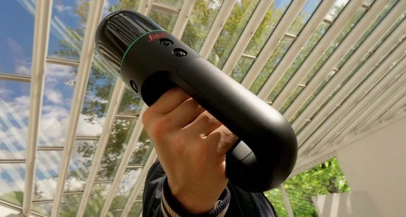
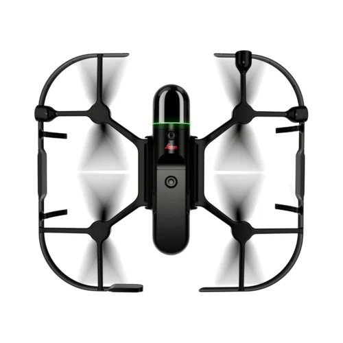
Leica BLK2GO is a compact handheld 3D laser scanner that captures spaces in real time as you walk. Designed for mobile reality capture, it delivers high-speed, accurate point clouds for architecture, construction, and facility documentation in Saudi Arabia.

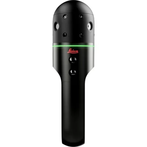
The Leica BLK2GO redefines 3D scanning by allowing professionals to capture reality while in motion. This handheld mobile laser scanner uses SLAM (Simultaneous Localization and Mapping) technology to record spatial data in real time—making it ideal for fast, efficient indoor and outdoor scans without the need for tripods or targets.

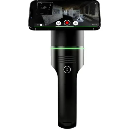
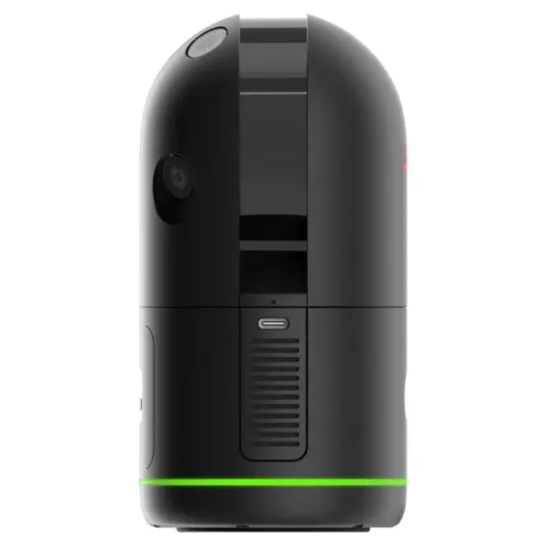
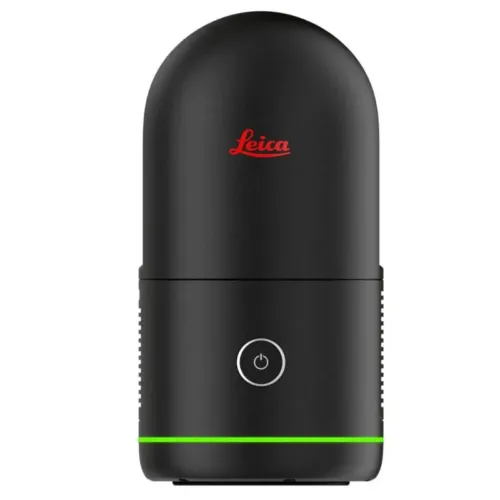
With just one button, the BLK2GO captures high-density point clouds and panoramic imagery while you walk. Its compact design, robust sensor fusion, and advanced LiDAR make it perfect for BIM documentation, construction progress monitoring, facility management, and as-built verification.

Trusted across Saudi Arabia by architects, engineers, and scanning professionals working in tight spaces and complex structures, the BLK2GO streamlines data collection and integrates seamlessly with Leica Cyclone software and cloud-based workflows.

Backed by SITML, the authorized Leica Geosystems distributor and service center in KSA, the BLK2GO offers unmatched mobility, speed, and performance in the field.

SKU: Leica BLK2GO Category:

Description

The BLK2GO is a lightweight, wireless handheld scanner built for rapid mobile reality capture, allowing you to scan spaces effortlessly as you walk—anytime, anywhere.

The BLK2GO handheld imaging laser scanner captures dimensionally accurate point clouds and high-resolution imagery as you move through a space. Powered by SLAM (Simultaneous Localization and Mapping) technology, it maps your path in real time—creating a 3D digital recreation of environments with speed and precision.

For privacy reasons YouTube needs your permission to be loaded. For more details, please see our Privacy Policy.
I Accept

FAST

Capture reality in real time as you walk. The BLK2GO scans continuously—no stops, no interruptions—so you can digitize entire spaces on the move.

AGILE

Navigate tight spaces with ease. Scan under obstacles, through doorways, around corners, and even up or down stairwells. With built-in SLAM technology, the BLK2GO always knows its position in space for accurate 3D mapping.

SEAMLESS CAPTURE

Think of it as a torch for 3D reality. The BLK2GO automatically creates colorized point clouds and captures imagery while you’re in motion, from the start of your scan session to the end—fully integrated and ready for processing.

UNBOUND

Leave the tripod behind. With onboard storage, wireless data capture, and rechargeable battery power, the BLK2GO offers total freedom for continuous mobile scanning.


Technical Specifications

Dual-Axis LiDAR Dome

Features the world’s smallest dual-axis LiDAR sensor, enclosed in a durable dome. It captures up to 420,000 points per second with best-in-class accuracy using two continuously rotating axes.

Multi-Camera Vision System

Includes a 12MP detail camera for crisp, high-contrast imagery, plus three panoramic cameras for SLAM-based navigation, point cloud coloring, and 360° panoramic image capture.

GRANDSLAM

The GRANDSLAM system fuses high-speed LiDAR, panoramic vision, and an inertial measurement unit (IMU) to enable fully self-navigating, handheld 3D scanning—no GPS required.

Lightweight Design

Constructed from matte-finish aluminum, the BLK2GO weighs just 775 grams (1.7 lbs) with battery, offering superb portability and scanning agility.

Smart Handle

Equipped with WLAN connectivity, USB-C fast transfer, onboard data storage for up to 6 hours of scans, and a rechargeable battery offering 45 minutes of continuous scanning. Built-in edge computing powers real-time performance.

Advanced Light Guide

An intuitive LED light guide wraps around the scanner, offering real-time feedback on system status, scanning progress, and data quality—making the BLK2GO accessible for users at any experience level.

Brand

Leica Geosystems

Leica Geosystems Saudi Arabia – Precision Meets Innovation

Introduction

Leica Geosystems Saudi Arabia delivers unmatched precision, durability, and advanced geospatial performance for professionals across construction, infrastructure, mining, and agriculture. For over 200 years, Leica has pioneered surveying instruments, GNSS/GPS systems, laser scanners, and software platforms that empower projects worldwide.

Trusted Worldwide, Available Locally in Saudi Arabia

Founded in Switzerland, Leica Geosystems has built a legacy of engineering excellence. Now available in Saudi Arabia through authorized dealers, Leica Geosystems Saudi Arabia products are adapted for the region’s challenging environments—providing local support, training, and calibrated precision.

Innovation in Every Leica Geosystems Product

Ranging from sophisticated total stations and GNSS receivers to mobile mapping and high-definition laser scanners, Leica Geosystems Saudi Arabia offers real-time accuracy and seamless digital workflows that boost project efficiency and reduce field downtime.

Key Achievements & Milestones

  • Over 200 years of geomatics innovation

  • Inventor of the world’s first digital level and early laser distance meters

  • Reality capture systems deployed in 100+ countries

  • Trusted in major infrastructure, metro, and oil & gas surveying

  • Adopted by engineers, surveyors, and government agencies worldwide

Why Choose Leica Geosystems in Saudi Arabia?

  • Localized support: Technical assistance, training, and product availability through authorized dealers

  • Unmatched accuracy: Instruments deliver centimeter-level precision and durability

  • Comprehensive portfolio: Full range from DISTO distance meters to robotic total stations and reality capture systems

  • Smart integration: Compatible with Hexagon, Autodesk, and other industry-leading software platforms

Leica Product Range in KSA

  • Total Stations – Manual and robotic total stations for construction and high-precision surveying.

  • Mobile Mapping Systems – Pegasus TRK Neo, Pegasus:Backpack, BLK2GO for vehicle, wearable, and handheld 3D capture

  • GPS & GNSS Equipment – GS18 I GNSS RTK rover, iCON GPS smart antennas offering tilt-compensated precision positioning

  • Ground Penetrating Radar (GPR) – Leica GPR solutions for accurate subsurface mapping

  • Laser Scanners – ScanStation P‑Series, RTC360, BLK360, and BLK2FLY for HD 3D scanning and digital twin workflows

  • DISTO Laser Distance Meters & Levels – Leica DISTO™ meter series and LINO/Rugby laser levels for point‑to‑point measurements and leveling

Leica Cyclone Software Portfolio

  • Cyclone REGISTER 360 PLUS – Guided workflows to register and visualize point cloud datasets with automation for efficient office workflows

  • Cyclone 3DR – End-to-end solution to analyze and model point clouds into actionable 3D deliverables

  • Cyclone Enterprise – On‑premise project and data management platform for centralized reality capture workflows

  • Cyclone Cloud – Subscription-based SaaS portal offering centralized license management and secure cloud-hosted service access

Get in Touch - Contact Us

Discover how Leica Geosystems Saudi Arabia solutions can elevate your next project. Reach out to your authorized local distributor to request demos, pricing, and expert consultation tailored to your requirements.

Official Website: www.leica-geosystems.com

Leica Geosystems is a world leader in precision surveying and geospatial solutions with over 200 years of expertise. From total stations and GNSS/GPS receivers to 3D laser scanning systems, Leica products deliver exceptional accuracy and reliability for construction, infrastructure, and mapping projects in Saudi Arabia and worldwide.

Reviews

There are no reviews yet.

Only logged in customers who have purchased this product may leave a review.

Title

Go to Top