Leica BLK2GO PULSE

Contact Details

The Leica BLK2GO Pulse is a handheld SLAM-based 3D scanner that delivers real-time, colored point clouds as you walk. Designed for fast, mobile scanning with immediate visual feedback—ideal for construction, reality capture, and BIM in Saudi Arabia.

The Leica BLK2GO Pulse is the next-generation handheld laser scanner, delivering real-time, full-color 3D point clouds while you move through complex environments. With advanced SLAM algorithms and live feedback on its built-in screen, it provides an unmatched scanning experience—combining speed, simplicity, and precision.

Engineered for construction professionals, BIM managers, architects, and facilities teams across Saudi Arabia, the BLK2GO Pulse enables rapid scanning of interiors, corridors, stairwells, and congested spaces with no setup time. See what you scan instantly, reduce errors on-site, and streamline your reality capture workflow.

Integrates seamlessly with Leica Cyclone software, cloud platforms, and visualization tools. Supported by SITML, the official Leica distributor and service partner in KSA, the BLK2GO Pulse offers cutting-edge mobile mapping with professional-grade accuracy.

SKU: Leica BLK2GO PULSE Category:

Description

Capture reality instantly—your viewpoint, your data, seamlessly integrated from scan to delivery.

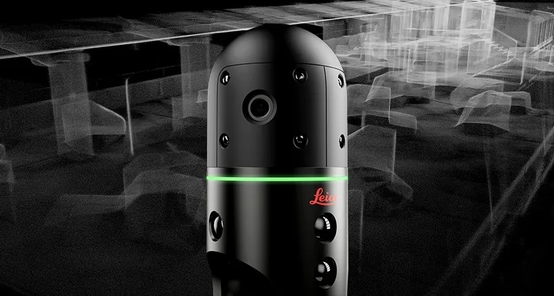
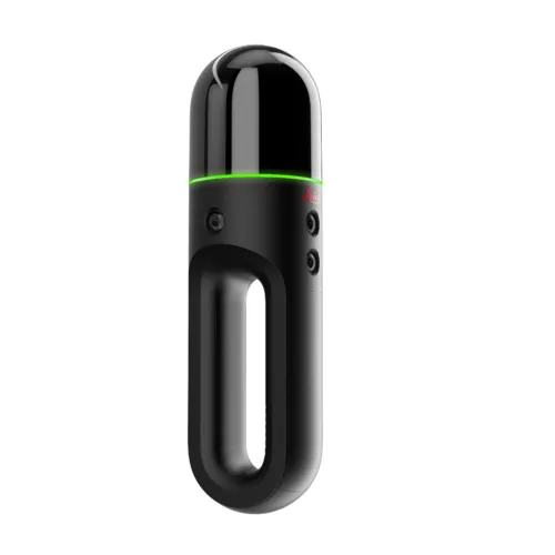
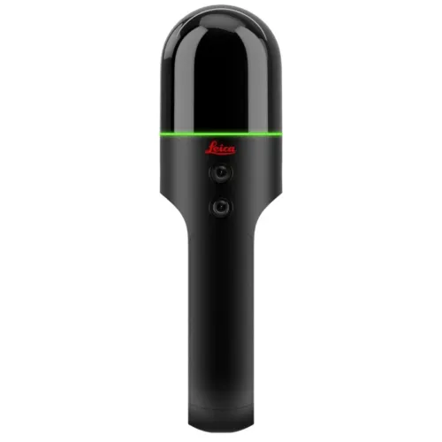
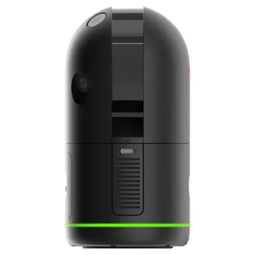
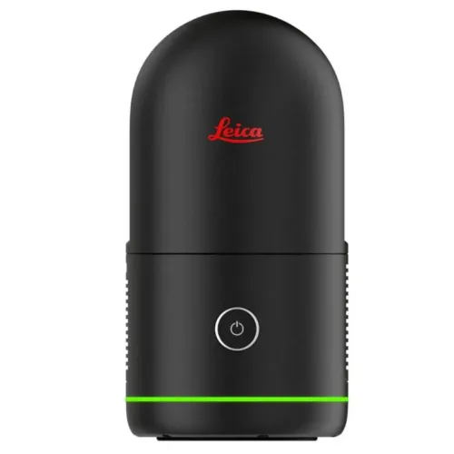
The Leica BLK2GO PULSE is a revolutionary first-person handheld laser scanner that captures real-world environments exactly as you experience them. Designed for instant 3D reality capture from your perspective, it streams colorised point clouds in real time to your smartphone—no post-processing required.

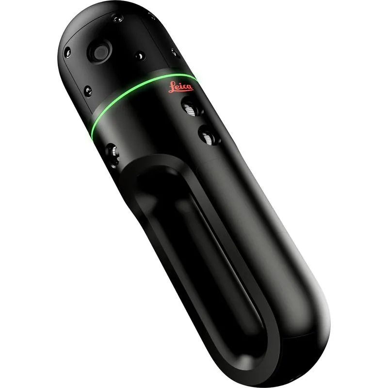
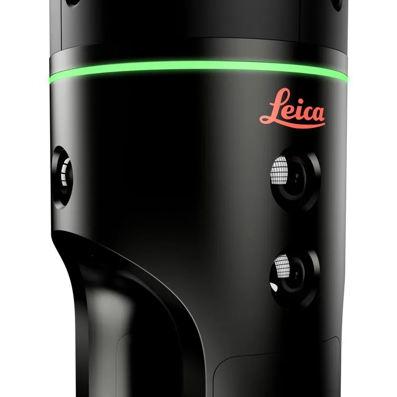
Leveraging GrandSLAM technology and dual solid-state Time-of-Flight (ToF) LiDAR sensors, the BLK2GO PULSE, in combination with the BLK Live app, offers a fully mobile, intuitive, and end-to-end scanning solution.


Key Features

  • First-Person 3D Scanning
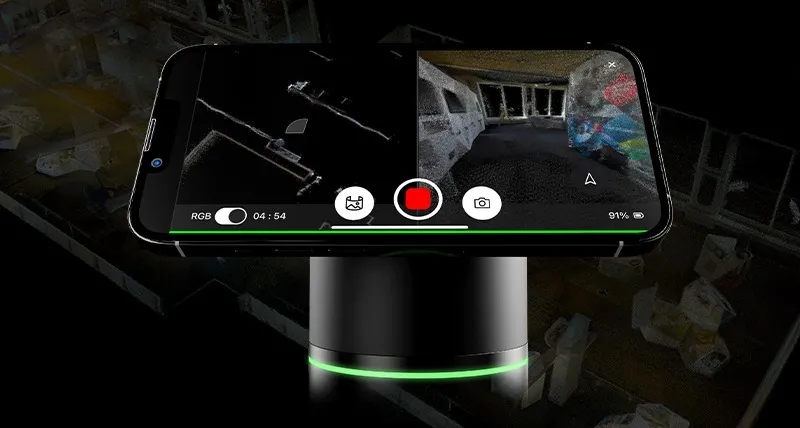
    View what the scanner sees as you move. Real-time colourised point clouds appear directly on your smartphone, enabling immersive, in-the-moment scanning from your exact viewpoint.

  • Immediate Data Access
    Instantly view, share, and manage point cloud data and imagery in the field—just like sending a photo or video.

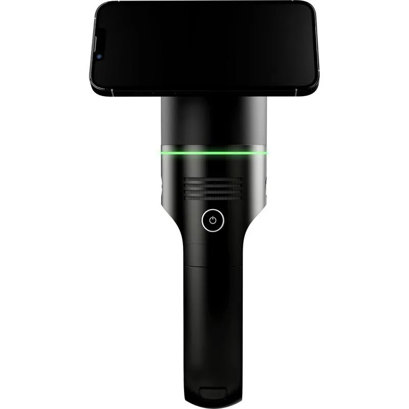
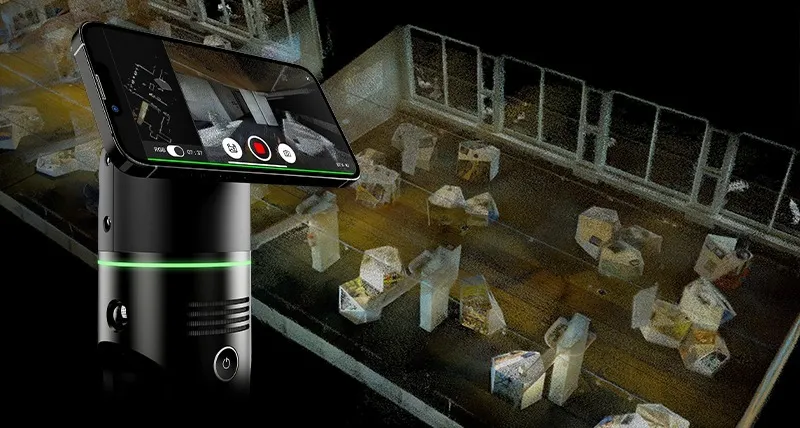
  • BLK Live App for iOS & Android
    Mount your smartphone to the scanner with Quad Lock and access a complete, on-the-go scanning workflow. Toggle between first-person 3D and top-down 2D views, or use both simultaneously for maximum clarity.

  • Smart Scanning Guidance
    On-screen alerts help you maintain best scanning practices, ensuring high-quality data capture every time.

  • Cloud Integration with Reality Cloud Studio
    Seamlessly upload captured data to Reality Cloud Studio powered by HxDR—Hexagon’s cloud platform for automated meshing, collaboration, visualization, and secure sharing.


What Is a First-Person Scanner?

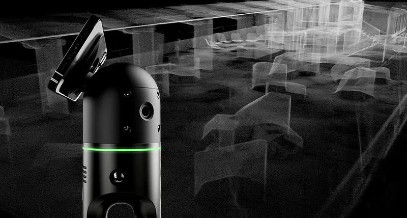
A first-person scanner aligns its field of view with your own, showing a real-time stream of 3D scan data as you move. The BLK2GO PULSE takes this intuitive workflow further with its unique PULSE technology—an advanced fusion of GrandSLAM and dual ToF LiDAR sensors, developed in collaboration with Sony. The result: uniform, colorised point clouds captured in real time, with no need for post-processing.

For privacy reasons YouTube needs your permission to be loaded. For more details, please see our Privacy Policy.
I Accept

The Leica BLK2GO PULSE is purpose-built for indoor reality capture, allowing you to create 3D digital twins, 2D floorplans, and elevations with speed and simplicity. It’s the ideal solution for any project requiring fast, accurate spatial data and real-time visualisation.


Real-Time Scanning from Your Perspective

With the BLK2GO PULSE, what you see is what you scan. As you move through a space, the scanner streams colorised 3D point cloud data directly to your smartphone, giving you a first-person view of the scan in progress. Just point the device where you need to scan, and start capturing.


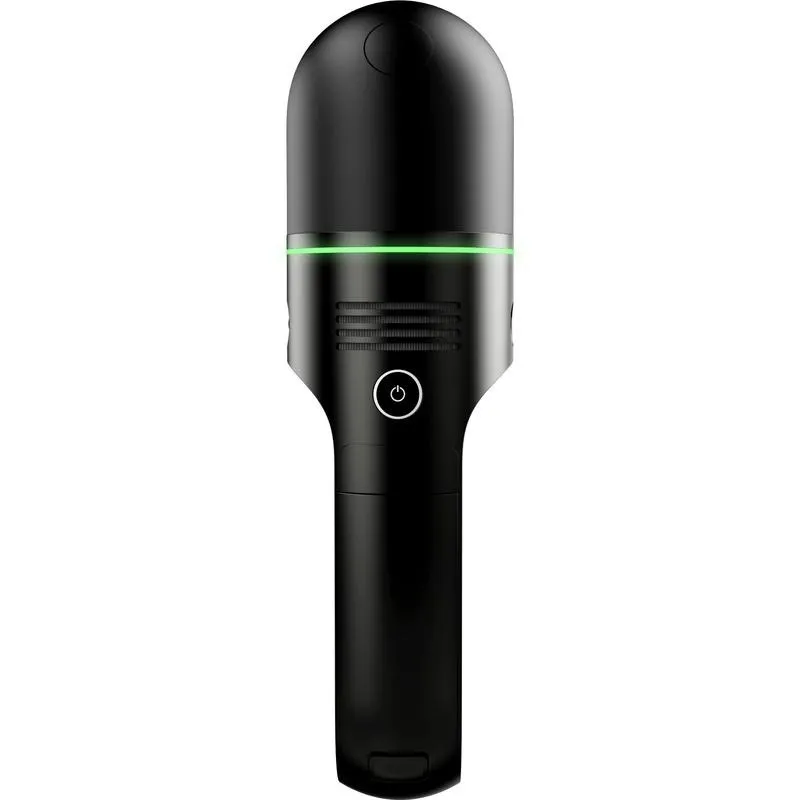
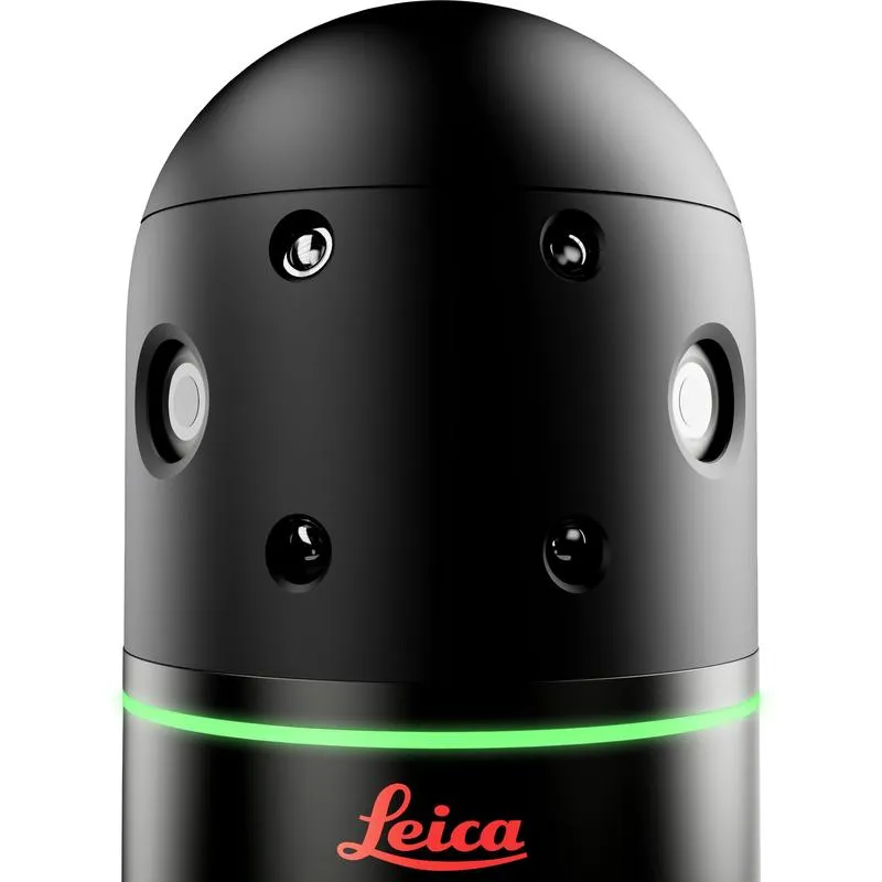
Solid-State Time-of-Flight Technology

Equipped with dual solid-state ToF LiDAR sensors, the BLK2GO PULSE emits thousands of laser pulses per second to capture highly uniform point clouds in real time. This cutting-edge technology ensures precise, consistent results with every scan.


Seamless and Intuitive Workflow

Designed for on-the-go scanning, the BLK2GO PULSE works in sync with the BLK Live app, delivering a smartphone-based user experience that feels as natural as recording a video. Whether you’re navigating tight interiors or capturing room layouts, scanning is fast, intuitive, and dynamic.


Instant Access to Your Data

All captured data is immediately ready for use—no post-processing required. Share and export files on-site, or upload directly to Reality Cloud Studio, powered by HxDR, for cloud-based storage, automated registration, 3D meshing, and secure collaboration.


The BLK Live App: Your Reality in Real Time

The BLK Live companion app offers full control and visual feedback throughout your scan. From a first-person point of view, monitor the scan in real time, view and manage colorised point clouds, and seamlessly export or upload your data for downstream use.

Brand

Leica Geosystems

Leica Geosystems Saudi Arabia – Precision Meets Innovation

Introduction

Leica Geosystems Saudi Arabia delivers unmatched precision, durability, and advanced geospatial performance for professionals across construction, infrastructure, mining, and agriculture. For over 200 years, Leica has pioneered surveying instruments, GNSS/GPS systems, laser scanners, and software platforms that empower projects worldwide.

Trusted Worldwide, Available Locally in Saudi Arabia

Founded in Switzerland, Leica Geosystems has built a legacy of engineering excellence. Now available in Saudi Arabia through authorized dealers, Leica Geosystems Saudi Arabia products are adapted for the region’s challenging environments—providing local support, training, and calibrated precision.

Innovation in Every Leica Geosystems Product

Ranging from sophisticated total stations and GNSS receivers to mobile mapping and high-definition laser scanners, Leica Geosystems Saudi Arabia offers real-time accuracy and seamless digital workflows that boost project efficiency and reduce field downtime.

Key Achievements & Milestones

  • Over 200 years of geomatics innovation

  • Inventor of the world’s first digital level and early laser distance meters

  • Reality capture systems deployed in 100+ countries

  • Trusted in major infrastructure, metro, and oil & gas surveying

  • Adopted by engineers, surveyors, and government agencies worldwide

Why Choose Leica Geosystems in Saudi Arabia?

  • Localized support: Technical assistance, training, and product availability through authorized dealers

  • Unmatched accuracy: Instruments deliver centimeter-level precision and durability

  • Comprehensive portfolio: Full range from DISTO distance meters to robotic total stations and reality capture systems

  • Smart integration: Compatible with Hexagon, Autodesk, and other industry-leading software platforms

Leica Product Range in KSA

  • Total Stations – Manual and robotic total stations for construction and high-precision surveying.

  • Mobile Mapping Systems – Pegasus TRK Neo, Pegasus:Backpack, BLK2GO for vehicle, wearable, and handheld 3D capture

  • GPS & GNSS Equipment – GS18 I GNSS RTK rover, iCON GPS smart antennas offering tilt-compensated precision positioning

  • Ground Penetrating Radar (GPR) – Leica GPR solutions for accurate subsurface mapping

  • Laser Scanners – ScanStation P‑Series, RTC360, BLK360, and BLK2FLY for HD 3D scanning and digital twin workflows

  • DISTO Laser Distance Meters & Levels – Leica DISTO™ meter series and LINO/Rugby laser levels for point‑to‑point measurements and leveling

Leica Cyclone Software Portfolio

  • Cyclone REGISTER 360 PLUS – Guided workflows to register and visualize point cloud datasets with automation for efficient office workflows

  • Cyclone 3DR – End-to-end solution to analyze and model point clouds into actionable 3D deliverables

  • Cyclone Enterprise – On‑premise project and data management platform for centralized reality capture workflows

  • Cyclone Cloud – Subscription-based SaaS portal offering centralized license management and secure cloud-hosted service access

Get in Touch - Contact Us

Discover how Leica Geosystems Saudi Arabia solutions can elevate your next project. Reach out to your authorized local distributor to request demos, pricing, and expert consultation tailored to your requirements.

Official Website: www.leica-geosystems.com

Leica Geosystems is a world leader in precision surveying and geospatial solutions with over 200 years of expertise. From total stations and GNSS/GPS receivers to 3D laser scanning systems, Leica products deliver exceptional accuracy and reliability for construction, infrastructure, and mapping projects in Saudi Arabia and worldwide.

Reviews

There are no reviews yet.

Only logged in customers who have purchased this product may leave a review.

Title

Go to Top