Leica JetStream

Contact Details

Centralised point cloud project storage and access with ultra-high-speed rendering.

Leica JetStream provides state-of-the-art point cloud project performance and big data management for Leica CloudWorx users. JetStream overcomes the biggest challenges in productivity, ease-of use and scalability of ever increasingly large laser scan point cloud data inside of CAD systems.

JetStream’s technology innovations deliver a completely new experience for point clouds in CAD. The instant open, all-the-points, all-the-time, paradigm is a revolutionary leap forward in performance. It drives better comprehension, increased productivity and removes the frustration and confusion of previously available solutions.

JetStream’s streamlined project management completely insulates the CAD user from needing laser scanning expert knowledge. JetStream‘s centralised project storage simplifies and streamlines a team-work approach for unlimited sized workgroups.

Features and Benefits

  • File sizes 5x to 10x smaller than traditional storage
  • Instant loading and rendering of any sized project
  • Pan and Zoom show, all-the-points, all-the-time
  • Optimised bandwidth ensure fast network access
  • “Ease-of-use” design simplifies using point clouds
  • Centralised data storage and access removes duplication of data, simplifies back-ups and management, saves time and money
SKU: Leica-JetStream Categories: ,

Description

Ultra-high-speed rendering, an entirely new experience for CloudWorx users

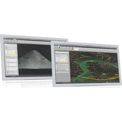
For starters, users will simply be amazed with the new ultra-high-speed rendering experience inside their favourite CloudWorx/CAD platform. Starting with loading and fully rendering and point cloud instantly, regardless of the size of the dataset, even billions of points load in an instant.

During every zoom or pan or clip action, the user experiences the reality of having all-the-points, all-the-time. This not only removes the frustration often experienced with waiting while the screen slowly fills with points, it greatly improves the comprehension of the scene and massively improves the user productivity.

Big data management that delivers on every front

The JetStream ProjectVault is designed from the ground up for user productivity. First having a centralised data storage location delivers obvious benefits in data management supporting access to a wide range of simultaneous client users with no need of wasteful, expensive and error peroneal data duplication.

Secondly, the greatly simplified project data structure improves and simplifies project access for every user every day with a new, single entry point for every project it reduces and searching or learning curve, user can just dive right in.

The new data compression capabilities of JetStream ProjectVault minimise the required storage space by a factor of 10x in some cases, lowering cost and reducing network traffic and bandwidth requirements significantly.

Finally, the centralised data storage approach also provides a long list of additional benefits such as data security, where user access can be easily controlled and the benefits to the IT organisation with simplified data back-up and management.

Brand

Leica Geosystems

Leica Geosystems Saudi Arabia – Precision Meets Innovation

Introduction

Leica Geosystems Saudi Arabia delivers unmatched precision, durability, and advanced geospatial performance for professionals across construction, infrastructure, mining, and agriculture. For over 200 years, Leica has pioneered surveying instruments, GNSS/GPS systems, laser scanners, and software platforms that empower projects worldwide.

Trusted Worldwide, Available Locally in Saudi Arabia

Founded in Switzerland, Leica Geosystems has built a legacy of engineering excellence. Now available in Saudi Arabia through authorized dealers, Leica Geosystems Saudi Arabia products are adapted for the region’s challenging environments—providing local support, training, and calibrated precision.

Innovation in Every Leica Geosystems Product

Ranging from sophisticated total stations and GNSS receivers to mobile mapping and high-definition laser scanners, Leica Geosystems Saudi Arabia offers real-time accuracy and seamless digital workflows that boost project efficiency and reduce field downtime.

Key Achievements & Milestones

  • Over 200 years of geomatics innovation

  • Inventor of the world’s first digital level and early laser distance meters

  • Reality capture systems deployed in 100+ countries

  • Trusted in major infrastructure, metro, and oil & gas surveying

  • Adopted by engineers, surveyors, and government agencies worldwide

Why Choose Leica Geosystems in Saudi Arabia?

  • Localized support: Technical assistance, training, and product availability through authorized dealers

  • Unmatched accuracy: Instruments deliver centimeter-level precision and durability

  • Comprehensive portfolio: Full range from DISTO distance meters to robotic total stations and reality capture systems

  • Smart integration: Compatible with Hexagon, Autodesk, and other industry-leading software platforms

Leica Product Range in KSA

  • Total Stations – Manual and robotic total stations for construction and high-precision surveying.

  • Mobile Mapping Systems – Pegasus TRK Neo, Pegasus:Backpack, BLK2GO for vehicle, wearable, and handheld 3D capture

  • GPS & GNSS Equipment – GS18 I GNSS RTK rover, iCON GPS smart antennas offering tilt-compensated precision positioning

  • Ground Penetrating Radar (GPR) – Leica GPR solutions for accurate subsurface mapping

  • Laser Scanners – ScanStation P‑Series, RTC360, BLK360, and BLK2FLY for HD 3D scanning and digital twin workflows

  • DISTO Laser Distance Meters & Levels – Leica DISTO™ meter series and LINO/Rugby laser levels for point‑to‑point measurements and leveling

Leica Cyclone Software Portfolio

  • Cyclone REGISTER 360 PLUS – Guided workflows to register and visualize point cloud datasets with automation for efficient office workflows

  • Cyclone 3DR – End-to-end solution to analyze and model point clouds into actionable 3D deliverables

  • Cyclone Enterprise – On‑premise project and data management platform for centralized reality capture workflows

  • Cyclone Cloud – Subscription-based SaaS portal offering centralized license management and secure cloud-hosted service access

Get in Touch - Contact Us

Discover how Leica Geosystems Saudi Arabia solutions can elevate your next project. Reach out to your authorized local distributor to request demos, pricing, and expert consultation tailored to your requirements.

Official Website: www.leica-geosystems.com

Leica Geosystems is a world leader in precision surveying and geospatial solutions with over 200 years of expertise. From total stations and GNSS/GPS receivers to 3D laser scanning systems, Leica products deliver exceptional accuracy and reliability for construction, infrastructure, and mapping projects in Saudi Arabia and worldwide.

Reviews

There are no reviews yet.

Only logged in customers who have purchased this product may leave a review.

Title

Go to Top