Leica TruView Cloud

Contact Details

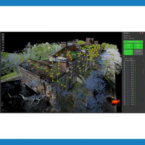
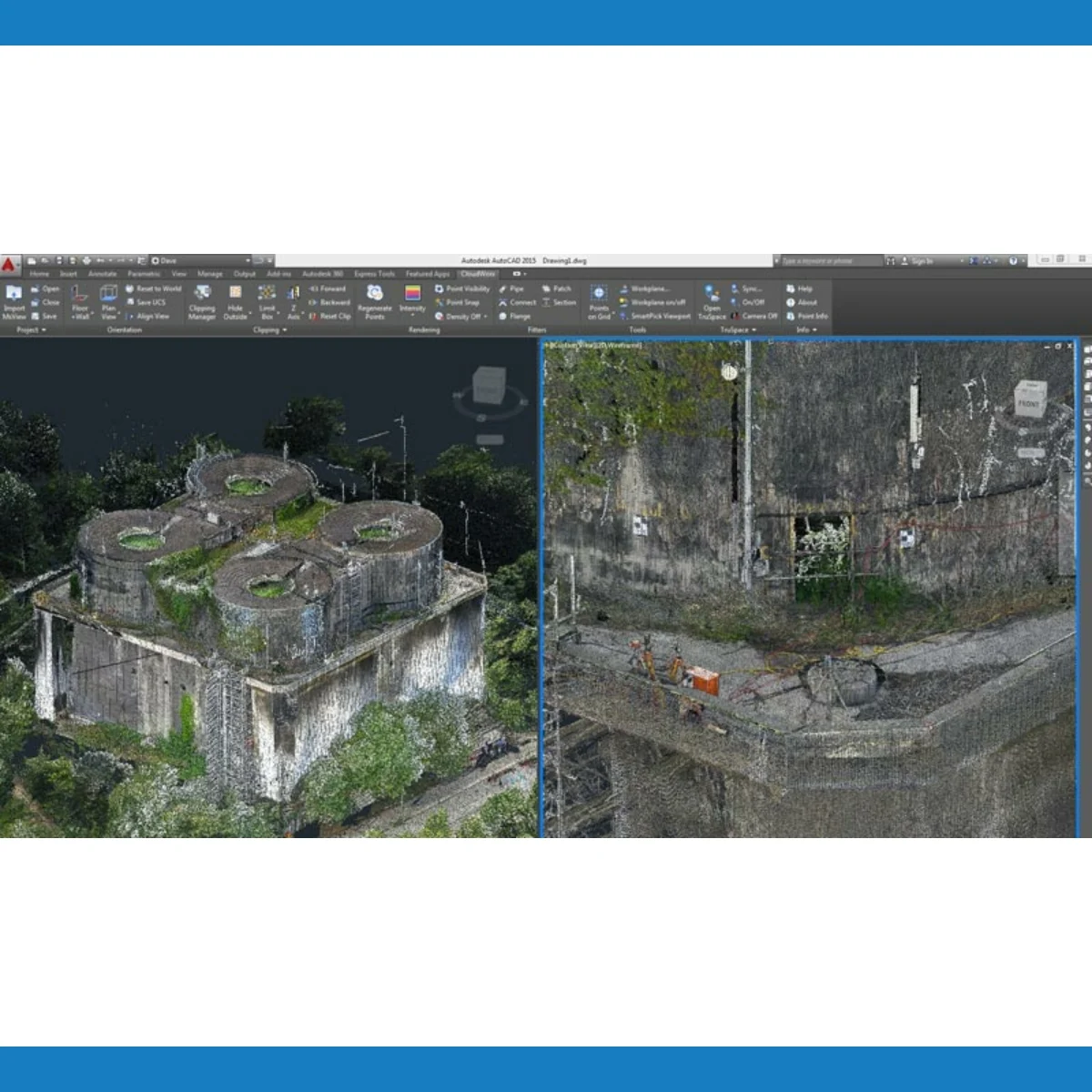
Digital reality data anywhere, anytime, any device

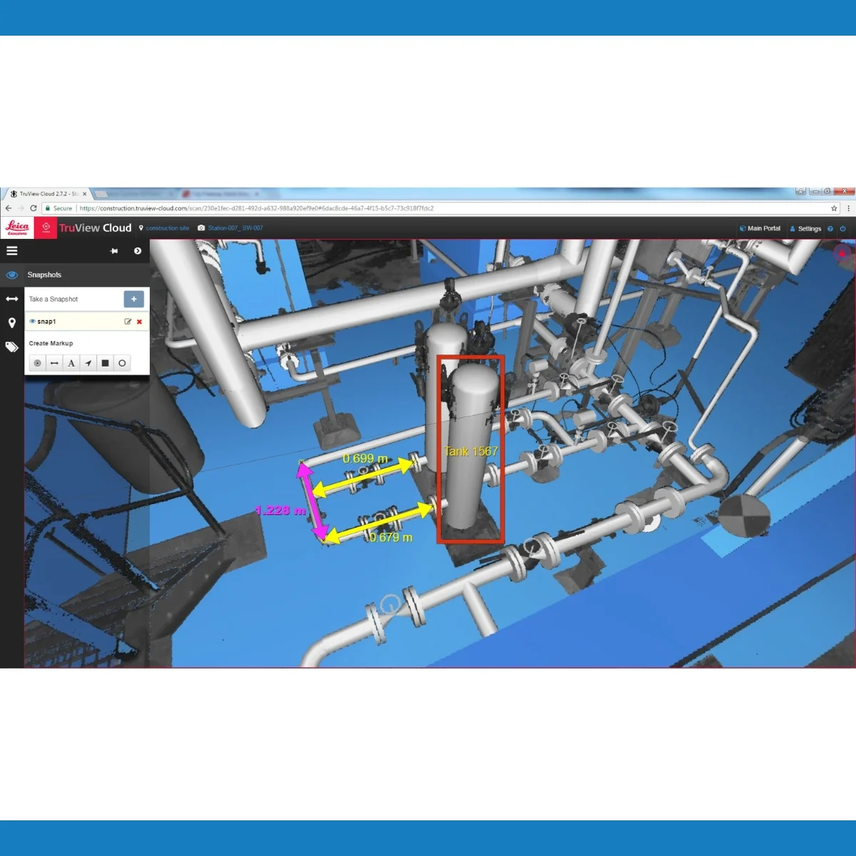
TruView is the industry leader for easily and intuitively sharing point cloud data, design models, mark-ups and more. TruView Cloud is available via Leica Geosystems’ Cyclone Cloud portal for cloud-based software services. TruView Cloud removes the hurdles of deploying a TruView server solution on a local server or external cloud service. Instead, access the same enterprise-level project collaboration solution in a Leica Geosystems-trusted and managed cloud environment. Bring unparalleled speed, scale and simplicity to your TruView workflows.

TruView Cloud is the perfect software to view, measure and annotate your digital reality data and it is now available anywhere, anytime and on any device. The intuitiveness of TruView has been married with an equally intuitive way to access your data. Simply log in to your Cyclone Cloud account, deploy the product and start sharing immediately. With excellent dependability and advanced admin and user controls, never worry about who has, or does not have access to your data.

SKU: Leica TruView Cloud Category:

Description

Speed

TruView Cloud is quick and easy to deploy and scale. From first login and license activation to fully-functioning deployment takes just minutes. No IT hassles. Share data quickly and instantly syncronise markups and more for rapid communication and collaboration to meet demanding project timelines.

Scale

TruView Cloud is an enterprise-level solution that can scale infinitely and instantly based on the volumes you and your clients need—publish all your data, whether it’s a handful of scans, or thousands. Unlimited, separate portals can be configured through the TruView Cloud portal. Assign different communities of unlimited users to each portal and assign access on a user-by-user basis.

Simplicity

TruView Cloud has removed the IT hurdles so firms of any size and capacity can set up and maintain an enterprise-level solution. Users do not have to install any app or program. Simply visit the URL you designate and access your TruView digital reality data from a laptop, desktop computer, or any smartphone or tablet. Easily collaborate with stakeholders and project-manage subcontractors by accepting data from a wide range of sensors, viewing both point clouds and models. Just point and click to unlock rich information.

Brand

Leica Geosystems

Leica Geosystems Saudi Arabia – Precision Meets Innovation

Introduction

Leica Geosystems Saudi Arabia delivers unmatched precision, durability, and advanced geospatial performance for professionals across construction, infrastructure, mining, and agriculture. For over 200 years, Leica has pioneered surveying instruments, GNSS/GPS systems, laser scanners, and software platforms that empower projects worldwide.

Trusted Worldwide, Available Locally in Saudi Arabia

Founded in Switzerland, Leica Geosystems has built a legacy of engineering excellence. Now available in Saudi Arabia through authorized dealers, Leica Geosystems Saudi Arabia products are adapted for the region’s challenging environments—providing local support, training, and calibrated precision.

Innovation in Every Leica Geosystems Product

Ranging from sophisticated total stations and GNSS receivers to mobile mapping and high-definition laser scanners, Leica Geosystems Saudi Arabia offers real-time accuracy and seamless digital workflows that boost project efficiency and reduce field downtime.

Key Achievements & Milestones

  • Over 200 years of geomatics innovation

  • Inventor of the world’s first digital level and early laser distance meters

  • Reality capture systems deployed in 100+ countries

  • Trusted in major infrastructure, metro, and oil & gas surveying

  • Adopted by engineers, surveyors, and government agencies worldwide

Why Choose Leica Geosystems in Saudi Arabia?

  • Localized support: Technical assistance, training, and product availability through authorized dealers

  • Unmatched accuracy: Instruments deliver centimeter-level precision and durability

  • Comprehensive portfolio: Full range from DISTO distance meters to robotic total stations and reality capture systems

  • Smart integration: Compatible with Hexagon, Autodesk, and other industry-leading software platforms

Leica Product Range in KSA

  • Total Stations – Manual and robotic total stations for construction and high-precision surveying.

  • Mobile Mapping Systems – Pegasus TRK Neo, Pegasus:Backpack, BLK2GO for vehicle, wearable, and handheld 3D capture

  • GPS & GNSS Equipment – GS18 I GNSS RTK rover, iCON GPS smart antennas offering tilt-compensated precision positioning

  • Ground Penetrating Radar (GPR) – Leica GPR solutions for accurate subsurface mapping

  • Laser Scanners – ScanStation P‑Series, RTC360, BLK360, and BLK2FLY for HD 3D scanning and digital twin workflows

  • DISTO Laser Distance Meters & Levels – Leica DISTO™ meter series and LINO/Rugby laser levels for point‑to‑point measurements and leveling

Leica Cyclone Software Portfolio

  • Cyclone REGISTER 360 PLUS – Guided workflows to register and visualize point cloud datasets with automation for efficient office workflows

  • Cyclone 3DR – End-to-end solution to analyze and model point clouds into actionable 3D deliverables

  • Cyclone Enterprise – On‑premise project and data management platform for centralized reality capture workflows

  • Cyclone Cloud – Subscription-based SaaS portal offering centralized license management and secure cloud-hosted service access

Get in Touch - Contact Us

Discover how Leica Geosystems Saudi Arabia solutions can elevate your next project. Reach out to your authorized local distributor to request demos, pricing, and expert consultation tailored to your requirements.

Official Website: www.leica-geosystems.com

Leica Geosystems is a world leader in precision surveying and geospatial solutions with over 200 years of expertise. From total stations and GNSS/GPS receivers to 3D laser scanning systems, Leica products deliver exceptional accuracy and reliability for construction, infrastructure, and mapping projects in Saudi Arabia and worldwide.

Go to Top