Leica Viva CS15 Total Station Controller

Contact Details

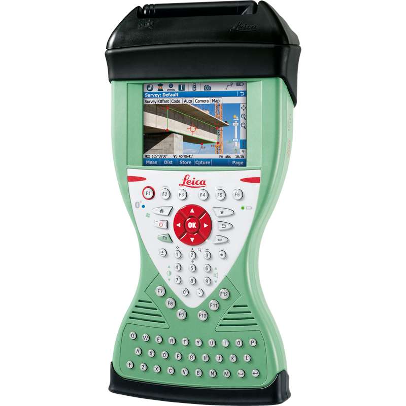
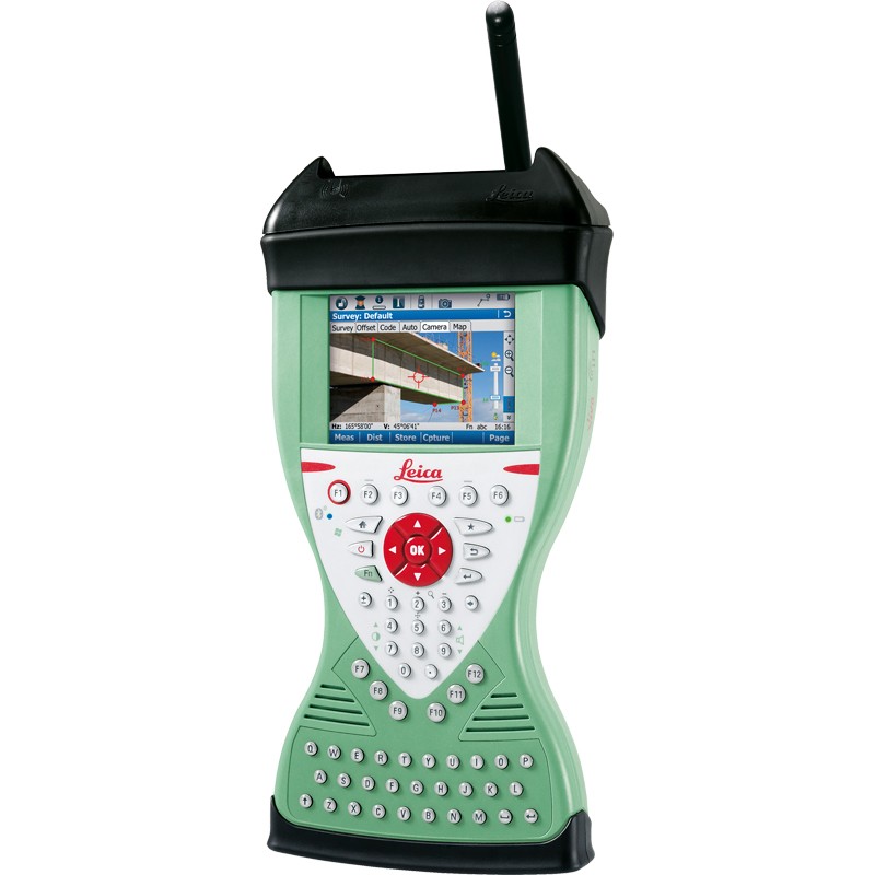
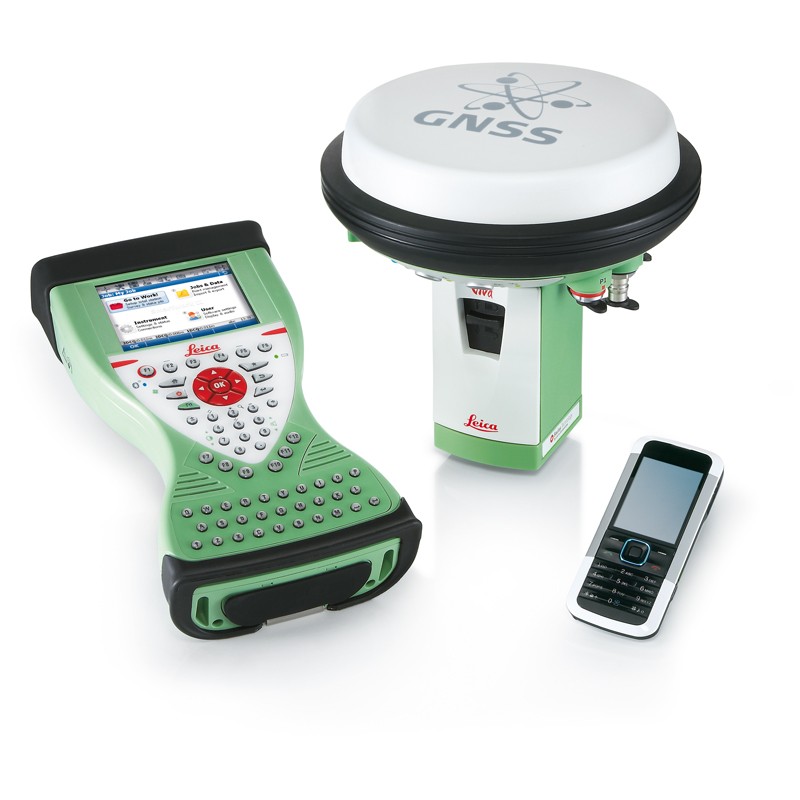
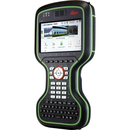
The Leica Viva CS15 controller is an effective wireless field controller which comes with capable and easy to understand software to increase both work production and quality with your robotic Total Station.

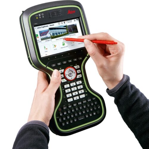
Suited for extreme environments, the Leica CS15 controller has an IP67 rating and is protected against dust, water and drops of just over a metre. Its operating temperature ranges between -30 to 60° C and is ergonomically designed to be comfortable in the hand. It is equipped with a fully illuminated QWERTY 65 key keypad and includes a 2 megapixel camera which can take pictures in the hand or when mounted on a pole. The CS15 also has the added benefit of displaying information using its fully illuminated VGA landscape colour touch screen.

The Leica CS15 comes with Bluetooth® wireless connectivity, WLAN, 1 GB non-volatile flash storage and USB connector, 2.4GHz radio with internal antenna and 3.5G modem. Perfect suited for use with all Leica Viva series Total Stations with a fitted radio handle.

SKU: CS15TS Category:

Description

This controller package comes installed with Leica SmartWorx Full

The Leica CS15 at a glance:

  • Leica Viva CS15 Field Controller
  • Operating System: Windows CE 6.0
  • SmartWorx Viva FULL
  • Standard software included: Internet Explorer Mobile, Word Mobile, Windows Media Player, Camera software.
  • Built in 3.5G internet modem
  • WLAN
  • Bluetooth connectivity
  • SD card, CF card & USB compatible
  • 2MP Camera
  • Audio speaker
  • Weight: 0.56Kg
  • Size: 200mm/120mm/45mm
  • Removable GEB212 rechargeable battery
    • 2 hours charging time
    • 10 hours operating time

Brand

Leica Geosystems

Leica Geosystems Saudi Arabia – Precision Meets Innovation

Introduction

Leica Geosystems Saudi Arabia delivers unmatched precision, durability, and advanced geospatial performance for professionals across construction, infrastructure, mining, and agriculture. For over 200 years, Leica has pioneered surveying instruments, GNSS/GPS systems, laser scanners, and software platforms that empower projects worldwide.

Trusted Worldwide, Available Locally in Saudi Arabia

Founded in Switzerland, Leica Geosystems has built a legacy of engineering excellence. Now available in Saudi Arabia through authorized dealers, Leica Geosystems Saudi Arabia products are adapted for the region’s challenging environments—providing local support, training, and calibrated precision.

Innovation in Every Leica Geosystems Product

Ranging from sophisticated total stations and GNSS receivers to mobile mapping and high-definition laser scanners, Leica Geosystems Saudi Arabia offers real-time accuracy and seamless digital workflows that boost project efficiency and reduce field downtime.

Key Achievements & Milestones

  • Over 200 years of geomatics innovation

  • Inventor of the world’s first digital level and early laser distance meters

  • Reality capture systems deployed in 100+ countries

  • Trusted in major infrastructure, metro, and oil & gas surveying

  • Adopted by engineers, surveyors, and government agencies worldwide

Why Choose Leica Geosystems in Saudi Arabia?

  • Localized support: Technical assistance, training, and product availability through authorized dealers

  • Unmatched accuracy: Instruments deliver centimeter-level precision and durability

  • Comprehensive portfolio: Full range from DISTO distance meters to robotic total stations and reality capture systems

  • Smart integration: Compatible with Hexagon, Autodesk, and other industry-leading software platforms

Leica Product Range in KSA

  • Total Stations – Manual and robotic total stations for construction and high-precision surveying.

  • Mobile Mapping Systems – Pegasus TRK Neo, Pegasus:Backpack, BLK2GO for vehicle, wearable, and handheld 3D capture

  • GPS & GNSS Equipment – GS18 I GNSS RTK rover, iCON GPS smart antennas offering tilt-compensated precision positioning

  • Ground Penetrating Radar (GPR) – Leica GPR solutions for accurate subsurface mapping

  • Laser Scanners – ScanStation P‑Series, RTC360, BLK360, and BLK2FLY for HD 3D scanning and digital twin workflows

  • DISTO Laser Distance Meters & Levels – Leica DISTO™ meter series and LINO/Rugby laser levels for point‑to‑point measurements and leveling

Leica Cyclone Software Portfolio

  • Cyclone REGISTER 360 PLUS – Guided workflows to register and visualize point cloud datasets with automation for efficient office workflows

  • Cyclone 3DR – End-to-end solution to analyze and model point clouds into actionable 3D deliverables

  • Cyclone Enterprise – On‑premise project and data management platform for centralized reality capture workflows

  • Cyclone Cloud – Subscription-based SaaS portal offering centralized license management and secure cloud-hosted service access

Get in Touch - Contact Us

Discover how Leica Geosystems Saudi Arabia solutions can elevate your next project. Reach out to your authorized local distributor to request demos, pricing, and expert consultation tailored to your requirements.

Official Website: www.leica-geosystems.com

Leica Geosystems is a world leader in precision surveying and geospatial solutions with over 200 years of expertise. From total stations and GNSS/GPS receivers to 3D laser scanning systems, Leica products deliver exceptional accuracy and reliability for construction, infrastructure, and mapping projects in Saudi Arabia and worldwide.

Reviews

There are no reviews yet.

Be the first to review “Leica Viva CS15 Total Station Controller”

Title

Go to Top