- Premium hardware GRP 1000
- High-performance software Amberg Survey Basic
- Optional: Amberg Track Geometry Record (TGR)
- Robust and guaranteed precision thanks to GRP Fidelity
- First-class customer support
Comprehensive, line-dedicated project data management as a basis for structured inventory surveys, data processing and data transfer.
Convenient project cockpit for preparation of efficient and easy practical fieldwork.
Powerful and integrated acquisition of as-built track coordinates and other track parameters such as gauge, superelevation, twist and versines.
Economic data evaluation thanks to automatic analysis and merging of several measurement sections.
Amberg Survey is an integral part of the application modules Slab Track, Tamping and Clearance.
-
 The configuration consists of
 -
 As-built track survey at its best. Extension of a revolutionary measuring principle
- Long-chord method with only one measurement trolley for as-built survey
- Combined survey of relative and absolute track geometry
- Unrivalled survey performance up to 5000 m/h
- Repeat accuracy ± 1 mm
- Up to 90% cost savings compared to traditional methods
- Unlimited use during day and night, rain and bright sunshine - no line of sight requirements
- Measurement of objects close to track
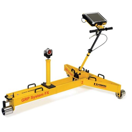
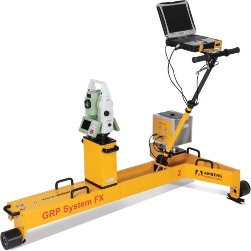
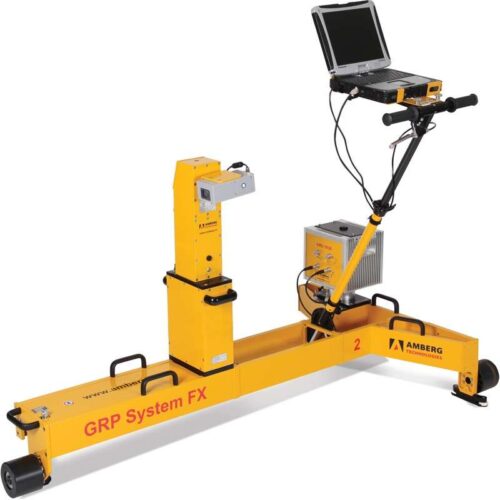
- Measuring trolley consisting of precision sensors for gauge, superelevation and distance and ruggedized notebook
- AMU 1030 (Amberg Measuring Unit) for unrivalled kinematic measurement precision
- Two different control point measuring devices:
- Total station (IMS 1000, fully automatic measurement)
- Profiler 110 FX (IMS 3000)
- Modular system upgrading possibilities
- Measuring performance up to 4000 m/h, typically 2500 m/h
- Absolute 3D control points given in global coordinate grid and used as transformation references
- Distance between CP measurements up to 500 m
- Fully compatible with other geodetic 3D survey data
- Measuring performance up to 4000 m/h, typically 2500 m/h
- Setup and survey of control points during initial track survey
- Track data available in local 3D coordinate grid
- Determination of local 3D coordinates for established control points
- Results can be used for local track design and track works as well as monitoring purposes
- Measuring performance up to 5000 m/h, typically 3500 m/h
- Stationing plates as references
- Measurement and calculation of track parameters horizontal versines (variable chord length), vertical versines (variable chord length), gauge, superelevation and twist
- Presentation and analysis of track data with sophisticated
- Track Geometry Record (TGR)