As-built track survey at its best.
Extension of a revolutionary measuring principle
- Long-chord method with only one measurement trolley for as-built survey
- Combined survey of relative and absolute track geometry
- Unrivalled survey performance up to 5000 m/h
- Repeat accuracy ± 1 mm
- Up to 90% cost savings compared to traditional methods
- Unlimited use during day and night, rain and bright sunshine – no line of sight requirements
- Measurement of objects close to track
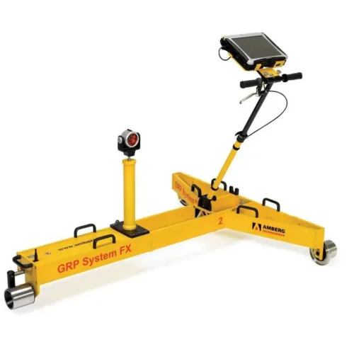
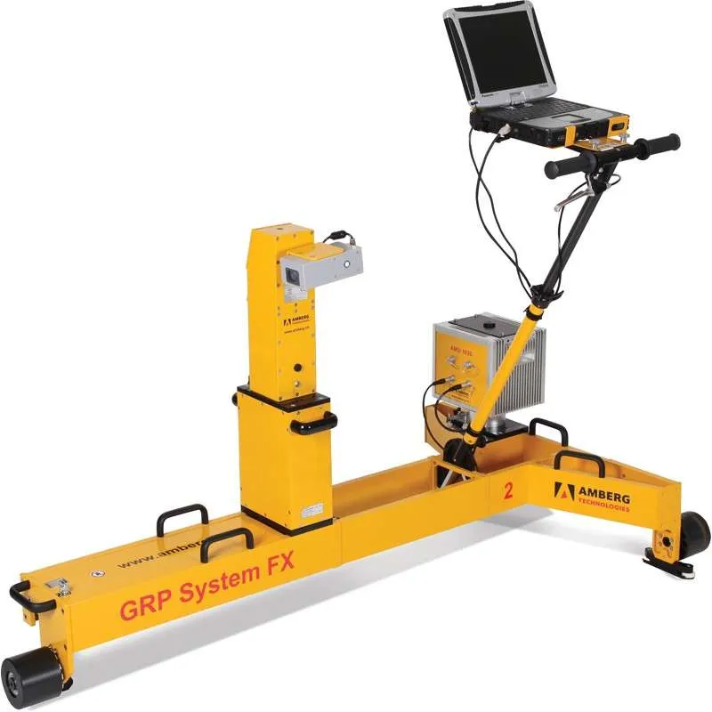
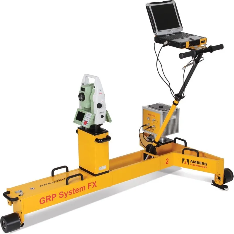
Modular system design
- Measuring trolley consisting of precision sensors for gauge, superelevation and distance and ruggedized notebook
- AMU 1030 (Amberg Measuring Unit) for unrivalled kinematic measurement precision
- Two different control point measuring devices:
- Total station (IMS 1000, fully automatic measurement)
- Profiler 110 FX (IMS 3000)
- Modular system upgrading possibilities
Global 3D topographic track survey
- Measuring performance up to 4000 m/h, typically 2500 m/h
- Absolute 3D control points given in global coordinate grid and used as transformation references
- Distance between CP measurements up to 500 m
- Fully compatible with other geodetic 3D survey data
Local 3D topographic track survey
- Measuring performance up to 4000 m/h, typically 2500 m/h
- Setup and survey of control points during initial track survey
- Track data available in local 3D coordinate grid
- Determination of local 3D coordinates for established control points
- Results can be used for local track design and track works as well as monitoring purposes
Relative track geometry survey
- Measuring performance up to 5000 m/h, typically 3500 m/h
- Stationing plates as references
- Measurement and calculation of track parameters horizontal versines (variable chord length), vertical versines (variable chord length), gauge, superelevation and twist
- Presentation and analysis of track data with sophisticated
- Track Geometry Record (TGR)