Complete railway infrastructure data in no time – simple and high performant
The new way of railway infrastructure scanning
- Well-tried GRP 5000 system enhanced with IMU technology
- Combined survey of relative and absolute track geometry
- Comprehensive scan data for clearance analysis and design purposes
- Highly accurate 3D point cloud of complete infrastructure
- Unrivalled survey performance up to 4,000 m/h
- No total station or GNSS signal required for absolute data
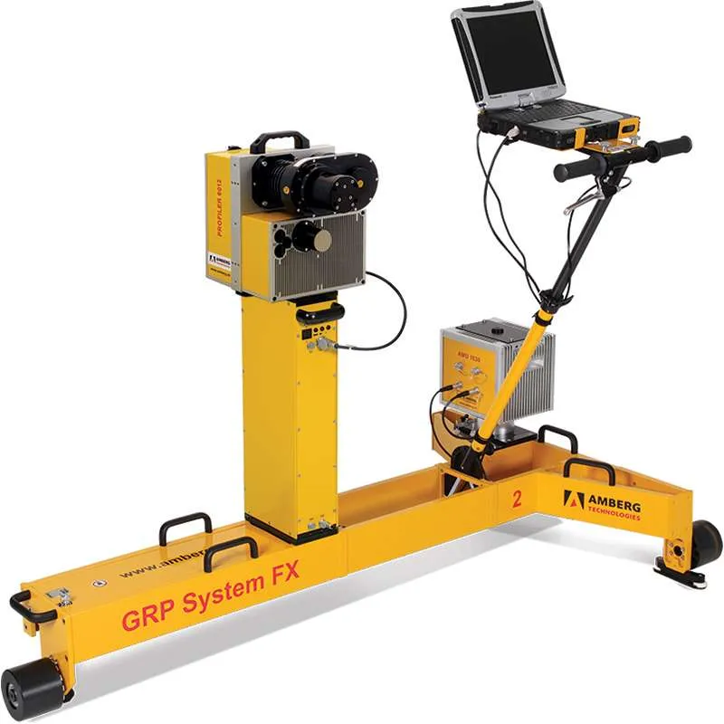
Modular system design
- Measuring trolley consisting of precision sensors for gauge, superelevation and distance as well as ruggedized notebook
- Laserscanner Amberg Profiler 6012 for acquisition of complete infrastructure
- AMU 1030 (Amberg Measuring Unit) for unrivalled kinematic measurement precision
- Modular system upgrading possibilities
Absolute as-built track and infrastructure survey with given 3D control points
- High performance for short and long track sections – up to 4,000 m/h
- Absolute 3D control points as transformation references
- Switching on / off control points for processing depending on quality
- Unlimited use during day and night – no line of sight requirements
Relative track geometry and infrastructure survey
- Pure relative survey of track geometry and objects around track
- Stationing plates as references
- Measurement and calculation of track parameters like horizontal / vertical versines, curvature / radius, gauge, superelevation and twist
- Usage of these parameters e.g. for dynamic clearance analysis